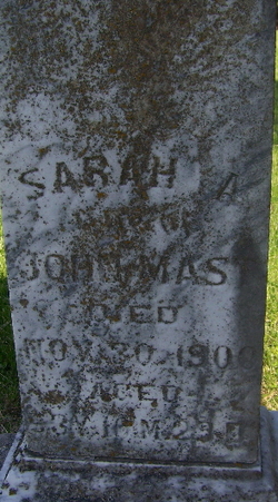
Sarah Adaline Brown Mast
| Birth | : | 1 Jan 1846 Missouri, USA |
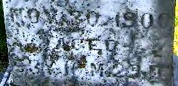
| Death | : | 30 Nov 1900 Skidmore, Nodaway County, Missouri, USA |
| Burial | : | Marvin Chapel Cemetery, Graceville, Jackson County, USA |
| Coordinate | : | 30.9616250, -85.5104840 |
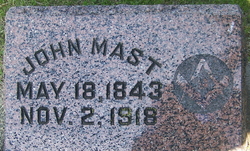
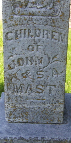
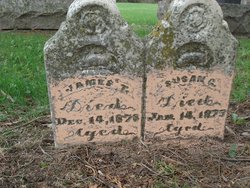
| Description | : | Sarah A. Brown Mast Sarah Adaline Brown Mast (obituary) Born in Missouri, in January, ?, Sarah A. Brown Mast was the wife of John Mast. (please SEE * SUGGESTIONS, OBITUARY, as pertaining to birth & death dates used for this memorial page) Sarah A. Brown married John Mast either of the dates of October 21 or 25, 1864, in Missouri. (records give two different dates for thier marriage) According to a 1900c, Nodaway Co., Mo., Sarah and her husband, John Mast, had 10 children, and with 4 children still living at the time of the taking of the census. The census also stated that... Read More |
frequently asked questions (FAQ):
-
Where is Sarah Adaline Brown Mast's memorial?
Sarah Adaline Brown Mast's memorial is located at: Marvin Chapel Cemetery, Graceville, Jackson County, USA.
-
When did Sarah Adaline Brown Mast death?
Sarah Adaline Brown Mast death on 30 Nov 1900 in Skidmore, Nodaway County, Missouri, USA
-
Where are the coordinates of the Sarah Adaline Brown Mast's memorial?
Latitude: 30.9616250
Longitude: -85.5104840
Family Members:
Parent
Spouse
Siblings
Children
Flowers:
Nearby Cemetories:
1. Marvin Chapel Cemetery
Graceville, Jackson County, USA
Coordinate: 30.9616250, -85.5104840
2. Graceville Community Cemetery
Graceville, Jackson County, USA
Coordinate: 30.9679590, -85.5144315
3. Collins Mill Cemetery
Graceville, Jackson County, USA
Coordinate: 30.9644600, -85.5290100
4. Mount Calvary Holiness Church of Christ Cemetery
Graceville, Jackson County, USA
Coordinate: 30.9567397, -85.4869610
5. Damascus Baptist Church Cemetery
Graceville, Jackson County, USA
Coordinate: 30.9381300, -85.5191710
6. Pleasant Grove Baptist Church Cemetery
New Hope, Holmes County, USA
Coordinate: 30.9761280, -85.5374370
7. Hinson Cemetery
Jackson County, USA
Coordinate: 30.9643993, -85.4736023
8. Crutchfield Cemetery
Jackson County, USA
Coordinate: 30.9963815, -85.4927275
9. Selma Cemetery
Holmes County, USA
Coordinate: 30.9638996, -85.5635986
10. Pilgrims Rest Church Cemetery
Slocomb, Geneva County, USA
Coordinate: 31.0116000, -85.5047000
11. Gainer Cemetery
Browntown, Jackson County, USA
Coordinate: 30.9873960, -85.4587840
12. New Hope Assembly of God Church Cemetery
Graceville, Jackson County, USA
Coordinate: 30.9130000, -85.4885030
13. Faith Assembly of God Cemetery
Graceville, Jackson County, USA
Coordinate: 30.9503000, -85.5724700
14. Antioch Cemetery
Geneva County, USA
Coordinate: 31.0116000, -85.5377000
15. Mount Calvary Baptist Church Cemetery
Slocomb, Geneva County, USA
Coordinate: 31.0249470, -85.5160600
16. Pleasant Grove United Methodist Church Cemetery
Fadette, Geneva County, USA
Coordinate: 31.0277000, -85.4899000
17. Bethel Baptist Church Cemetery
Holmes County, USA
Coordinate: 30.9400349, -85.5866165
18. Whitaker Cemetery
Geneva County, USA
Coordinate: 31.0038000, -85.5760000
19. Brown-Bush-Tindall Cemetery
Bonifay, Holmes County, USA
Coordinate: 30.9791700, -85.5936300
20. Beulah Cemetery
Graceville, Jackson County, USA
Coordinate: 30.8968350, -85.5572840
21. Galilee United Methodist Church Cemetery
Graceville, Jackson County, USA
Coordinate: 30.8842890, -85.5090680
22. Springhill United Methodist Church Cemetery
Campbellton, Jackson County, USA
Coordinate: 30.9000830, -85.4557850
23. Walker Cemetery
Noma, Holmes County, USA
Coordinate: 30.9911694, -85.5963881
24. Liberty Cemetery
Esto, Holmes County, USA
Coordinate: 30.9682900, -85.6055500

