

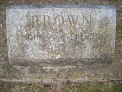
John Andrew Brown
| Birth | : | 23 Aug 1824 Tennessee, USA |
| Death | : | 6 Oct 1912 Nodaway County, Missouri, USA |
| Burial | : | Matakana Public Cemetery, Matakana, Auckland Council, New Zealand |
| Coordinate | : | -36.3488910, 174.7232640 |
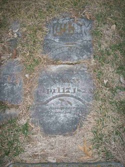
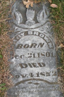
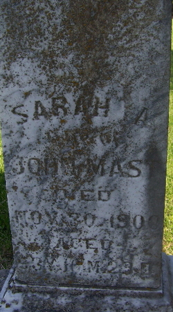
| Description | : | John Brown, farmer and stock raiser, was a native of Jackson county, Tennessee. He was born on the 23rd of August, 1824 and was the son of Andrew and Mary (Yount) Brown. He with his parents moved to Platte county, Missouri and settled on a farm in 1837 and in 1840 came to Nodaway county, locating in Hughes Township, where the elder Brown purchased a claim, and it was the first land broken in Nodaway county. Mr. Brown's father laid out Graham in 1855. He started out in life as a blacksmith, when at the age of 18 years, working... Read More |
frequently asked questions (FAQ):
-
Where is John Andrew Brown's memorial?
John Andrew Brown's memorial is located at: Matakana Public Cemetery, Matakana, Auckland Council, New Zealand.
-
When did John Andrew Brown death?
John Andrew Brown death on 6 Oct 1912 in Nodaway County, Missouri, USA
-
Where are the coordinates of the John Andrew Brown's memorial?
Latitude: -36.3488910
Longitude: 174.7232640
Family Members:
Parent
Spouse
Siblings
Children

Flowers:


Nearby Cemetories:
1. Matakana Public Cemetery
Matakana, Auckland Council, New Zealand
Coordinate: -36.3488910, 174.7232640
2. Whangateau Cemetery
Whangateau, Auckland Council, New Zealand
Coordinate: -36.3141600, 174.7710200
3. Warkworth Anglican Church Cemetery
Warkworth, Auckland Council, New Zealand
Coordinate: -36.4022100, 174.6628800
4. Warkworth Roman Catholic Cemetery
Warkworth, Auckland Council, New Zealand
Coordinate: -36.3895340, 174.6457850
5. Warkworth Cemetery
Warkworth, Auckland Council, New Zealand
Coordinate: -36.4128510, 174.6674360
6. Pakiri Cemetery
Pakiri, Auckland Council, New Zealand
Coordinate: -36.2594400, 174.7265300
7. Leigh Cemetery
Leigh, Auckland Council, New Zealand
Coordinate: -36.2902800, 174.8094100
8. Te Kapa Cemetery
Mahurangi, Auckland Council, New Zealand
Coordinate: -36.4511910, 174.7502920
9. Mahurangi Heads Presbyterian Church Cemetery
Mahurangi, Auckland Council, New Zealand
Coordinate: -36.4589100, 174.7317400
10. National Erebus Memorial
Parnell, Auckland Council, New Zealand
Coordinate: -36.4546695, 174.7720847
11. Boyds Hill Cemetery
Kawau Island, Auckland Council, New Zealand
Coordinate: -36.4312880, 174.8294080
12. Pukapuka Cemetery
Pohuehue, Auckland Council, New Zealand
Coordinate: -36.4858910, 174.6783405
13. Puhoi Cemetery
Puhoi, Auckland Council, New Zealand
Coordinate: -36.5052400, 174.6476300
14. Te Muri
Puhoi, Auckland Council, New Zealand
Coordinate: -36.5182030, 174.7204840
15. Wellsford Cemetery
Wellsford, Auckland Council, New Zealand
Coordinate: -36.2826700, 174.5106800
16. Hoteo North Cemetery
Hoteo North, Auckland Council, New Zealand
Coordinate: -36.3255803, 174.4957872
17. Te Arai Cemetery
Te Arai, Auckland Council, New Zealand
Coordinate: -36.1910790, 174.6010190
18. Tauhoa Cemetery
Tauhoa, Auckland Council, New Zealand
Coordinate: -36.3671330, 174.4449600
19. Port Albert Cemetery
Port Albert, Auckland Council, New Zealand
Coordinate: -36.2813200, 174.4483850
20. Komokoriki Cemetery
Manukau, Auckland Council, New Zealand
Coordinate: -36.5026370, 174.5033710
21. Glorit Cemetery
Glorit, Auckland Council, New Zealand
Coordinate: -36.4599760, 174.4448830
22. Minniesdale Chapel Cemetery
Wharehine, Auckland Council, New Zealand
Coordinate: -36.3139990, 174.3996600
23. Hakaru Cemetery
Hakaru, Kaipara District, New Zealand
Coordinate: -36.1491780, 174.5103440
24. Kaipara Flats Cemetery
Kaipara Flats, Auckland Council, New Zealand
Coordinate: -36.5017800, 174.4534100