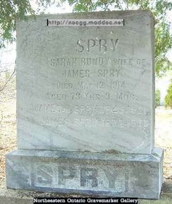
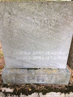
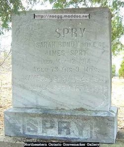
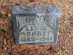
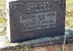
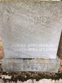
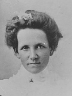
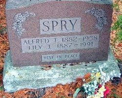
Sarah Boundy Spry
| Birth | : | 1 Oct 1841 Prince Edward Island, Canada |
| Death | : | 12 May 1914 Ontario, Canada |
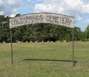
| Burial | : | Cold Springs Cemetery, Cold Springs, Manitoulin District, Canada |
| Coordinate | : | 45.8595060, -82.1087820 |
| Description | : | Sarah was the daughter of John Boundy and Emmaline Marshall. She was the first born of six children. Her father John, born in 1816, was baptized on the 28th of July 1816 in Morwenstow, Cornwall England. He married Emmaline on the 20th March 1841 in Morwenstow Cornwall England. Sarah was born on the 1st of October 1841 according to her baptismal record which lists the birth date. She was baptized on the 17th of February 1843 in Prince Edward Island , Canada. Her baptismal record records her birth date but does not list the location of birth. |
frequently asked questions (FAQ):
-
Where is Sarah Boundy Spry's memorial?
Sarah Boundy Spry's memorial is located at: Cold Springs Cemetery, Cold Springs, Manitoulin District, Canada.
-
When did Sarah Boundy Spry death?
Sarah Boundy Spry death on 12 May 1914 in Ontario, Canada
-
Where are the coordinates of the Sarah Boundy Spry's memorial?
Latitude: 45.8595060
Longitude: -82.1087820
Family Members:
Spouse
Children
Flowers:
Nearby Cemetories:
1. Cold Springs Cemetery
Cold Springs, Manitoulin District, Canada
Coordinate: 45.8595060, -82.1087820
2. M'Chigeeng Cemetery
West Bay, Manitoulin District, Canada
Coordinate: 45.8163400, -82.1601200
3. Green Bay United Church Cemetery
Manitoulin, Manitoulin District, Canada
Coordinate: 45.8603520, -82.0223110
4. Kagawong Cedars Cemetery
Kagawong, Manitoulin District, Canada
Coordinate: 45.9089600, -82.2568300
5. Big Lake Cemetery
Manitoulin, Manitoulin District, Canada
Coordinate: 45.7457500, -82.0575900
6. Mindemoya Cemetery
Mindemoya, Manitoulin District, Canada
Coordinate: 45.7473100, -82.1928000
7. Sucker Creek Cemetery
Sucker Creek, Manitoulin District, Canada
Coordinate: 45.9604060, -81.9764140
8. Elm View Cemetery
Howland, Manitoulin District, Canada
Coordinate: 45.9045270, -81.9204550
9. Sheguiandah Reserve Cemetery
Sheguiandah, Manitoulin District, Canada
Coordinate: 45.8809640, -81.9049780
10. Mountain View Cemetery
Little Current, Manitoulin District, Canada
Coordinate: 45.9604400, -81.9523100
11. Holy Trinity Anglican Cemetery
Little Current, Manitoulin District, Canada
Coordinate: 45.9677590, -81.9439240
12. St. Bernard's Catholic Cemetery
Little Current, Manitoulin District, Canada
Coordinate: 45.9789170, -81.9596700
13. Long Bay Cemetery
Long Bay, Manitoulin District, Canada
Coordinate: 45.8056680, -82.3795380
14. Grimesthorpe Cemetery
Grimsthorpe, Manitoulin District, Canada
Coordinate: 45.7098120, -82.3246620
15. Fairview Cemetery
Tehkummah, Manitoulin District, Canada
Coordinate: 45.6564280, -82.0034580
16. Providence Bay Cemetery
Providence Bay, Manitoulin District, Canada
Coordinate: 45.6728600, -82.2664600
17. St. Paul's Anglican Cemetery
Manitowaning, Manitoulin District, Canada
Coordinate: 45.7447912, -81.8061589
18. Hilly Grove Cemetery
Hilly Grove, Manitoulin District, Canada
Coordinate: 45.6789600, -81.8764700
19. Gordon Cemetery
Gordon, Manitoulin District, Canada
Coordinate: 45.8757300, -82.4724300
20. Buzwah Cemetery
Buzwah, Manitoulin District, Canada
Coordinate: 45.7660100, -81.7644500
21. Sagamok New Cemetery
Sagamok, Algoma District, Canada
Coordinate: 46.1582040, -82.1007238
22. Burpee Mills Cemetery
Burpee and Mills, Manitoulin District, Canada
Coordinate: 45.7685100, -82.5328800
23. Spanish River First Nations Cemetery
Massey, Sudbury District, Canada
Coordinate: 46.1701900, -82.1068600
24. Birch Island Cemetery
Birch Island, Manitoulin District, Canada
Coordinate: 46.0676300, -81.7714000

