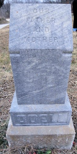
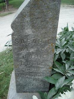
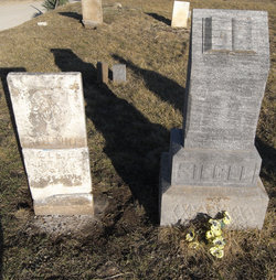
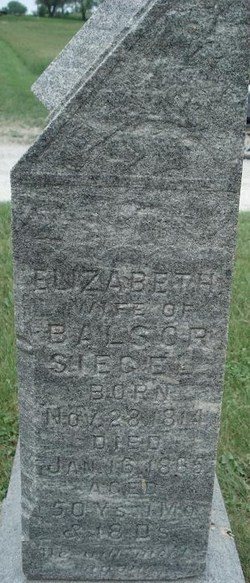
Sarah Catherine Siegel O'Dell
| Birth | : | 17 Jan 1848 Jefferson County, Tennessee, USA |
| Death | : | 19 Jan 1898 Ray County, Missouri, USA |
| Burial | : | Lawrence Chapel United Methodist Church Cemetery, Central, Pickens County, USA |
| Coordinate | : | 34.7447014, -82.8360977 |
| Description | : | Wife of John O'Dell |
frequently asked questions (FAQ):
-
Where is Sarah Catherine Siegel O'Dell's memorial?
Sarah Catherine Siegel O'Dell's memorial is located at: Lawrence Chapel United Methodist Church Cemetery, Central, Pickens County, USA.
-
When did Sarah Catherine Siegel O'Dell death?
Sarah Catherine Siegel O'Dell death on 19 Jan 1898 in Ray County, Missouri, USA
-
Where are the coordinates of the Sarah Catherine Siegel O'Dell's memorial?
Latitude: 34.7447014
Longitude: -82.8360977
Family Members:
Parent
Spouse
Siblings
Children
Flowers:
Nearby Cemetories:
1. Lawrence Chapel United Methodist Church Cemetery
Central, Pickens County, USA
Coordinate: 34.7447014, -82.8360977
2. Poplar Springs Baptist Church Cemetery
Central, Pickens County, USA
Coordinate: 34.7391014, -82.8273010
3. Pleasant Hill Baptist Church Cemetery
Central, Pickens County, USA
Coordinate: 34.7633018, -82.8324966
4. Pleasant Hill Baptist (Old)
Central, Pickens County, USA
Coordinate: 34.7606670, -82.8082870
5. Lawrence Family Cemetery
Clemson, Pickens County, USA
Coordinate: 34.7180830, -82.8470170
6. Welcome Baptist Church Cemetery
Central, Pickens County, USA
Coordinate: 34.7580500, -82.8037330
7. Dodd Family Cemetery
Westminster, Oconee County, USA
Coordinate: 34.7327499, -82.8743134
8. Old Kings Grove Baptist Church Cemetery
Central, Pickens County, USA
Coordinate: 34.7648330, -82.8737500
9. Robert Morgan-Cannon Family
Central, Pickens County, USA
Coordinate: 34.7820850, -82.8521350
10. Kings Grove Baptist Church Cemetery
Central, Pickens County, USA
Coordinate: 34.7829000, -82.8574000
11. Colhoun Family Cemetery
Clemson, Pickens County, USA
Coordinate: 34.7044000, -82.8562670
12. Josiah Reames Gravesite
Clemson, Pickens County, USA
Coordinate: 34.6999610, -82.8240690
13. Mount Zion Cemetery
Central, Pickens County, USA
Coordinate: 34.7188988, -82.7874985
14. Ballentine Cemetery
Pickens County, USA
Coordinate: 34.7415009, -82.7768021
15. Morgan Family Cemetery
Central, Pickens County, USA
Coordinate: 34.7825670, -82.8750170
16. Mount Tabor Baptist Church Cemetery
Clemson, Pickens County, USA
Coordinate: 34.7014008, -82.7996979
17. Church of God of Prophecy Cemetery
Six Mile, Pickens County, USA
Coordinate: 34.7962860, -82.8183080
18. Cary Cemetery
Oconee County, USA
Coordinate: 34.7700005, -82.8966980
19. Mount Nebo Baptist Church Cemetery #1
Seneca, Oconee County, USA
Coordinate: 34.7059450, -82.8860670
20. New Olive Grove Baptist Church Cemetery
Central, Pickens County, USA
Coordinate: 34.7327100, -82.7673160
21. Abel Baptist Church Cemetery
Clemson, Pickens County, USA
Coordinate: 34.6933250, -82.8032000
22. Camp Creek Baptist Church Cemetery
Six Mile, Pickens County, USA
Coordinate: 34.7880360, -82.7879620
23. Fort Hill Presbyterian Church Columbarium
Clemson, Pickens County, USA
Coordinate: 34.6857830, -82.8370670
24. Boggs Family Cemetery
Clemson, Pickens County, USA
Coordinate: 34.6876984, -82.8143005

