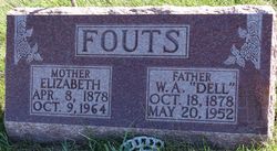
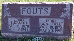
Sarah Elizabeth “Lizzie” Mosher Fouts
| Birth | : | 8 Apr 1878 Webster County, Iowa, USA |
| Death | : | 9 Oct 1964 Woodbine, Harrison County, Iowa, USA |
| Burial | : | All Saints Churchyard, Nynehead, Taunton Deane Borough, England |
| Coordinate | : | 50.9973924, -3.2298043 |
| Plot | : | New Section, Block 2, Row 6 |
| Description | : | HE DUNLAP REPORTER October 15, 1964 Funeral Serives Held Monday for Mrs. Dell Fouts Aged Lady Dies at Rose Vista Funeral services were held Monday October 12, 1964 at 2:00 p.m. at the Methodist Church in Dunlap, for Mrs. Dell Fouts, 86, with Elder Francis Harper Sr., officiating. Mrs. Robert Mitchell, at the organ, accompanied Mrs. Edgar Rannells and Mrs. Lowell Rang, who furnished the music. Pallbearers were Leonard Fouts, Richard Greenwood, Lyle Lahr, Bob Fouts, Lannis Hansen, and Richard Malone, all grandsons of Mrs. Fouts. Sarah Elizabeth Fouts, daughter of John Emory Mosher and Marcia Francella Hooker was born April 8, 1878, in Webster... Read More |
frequently asked questions (FAQ):
-
Where is Sarah Elizabeth “Lizzie” Mosher Fouts's memorial?
Sarah Elizabeth “Lizzie” Mosher Fouts's memorial is located at: All Saints Churchyard, Nynehead, Taunton Deane Borough, England.
-
When did Sarah Elizabeth “Lizzie” Mosher Fouts death?
Sarah Elizabeth “Lizzie” Mosher Fouts death on 9 Oct 1964 in Woodbine, Harrison County, Iowa, USA
-
Where are the coordinates of the Sarah Elizabeth “Lizzie” Mosher Fouts's memorial?
Latitude: 50.9973924
Longitude: -3.2298043
Family Members:
Spouse
Children
Flowers:
Nearby Cemetories:
1. All Saints Churchyard
Nynehead, Taunton Deane Borough, England
Coordinate: 50.9973924, -3.2298043
2. St John the Baptist Churchyard
Wellington, Taunton Deane Borough, England
Coordinate: 50.9811590, -3.2253540
3. Quaker Burial Ground at Wellington Meeting House
Wellington, Taunton Deane Borough, England
Coordinate: 50.9788260, -3.2263490
4. Saint Peter's Churchyard
Langford Budville, Taunton Deane Borough, England
Coordinate: 50.9988720, -3.2673740
5. Wellington Cemetery
Wellington, Taunton Deane Borough, England
Coordinate: 50.9733000, -3.2403000
6. St. Bartholomew's Churchyard
Oake, Taunton Deane Borough, England
Coordinate: 51.0196440, -3.2094170
7. All Saints Churchyard
Wellington, Taunton Deane Borough, England
Coordinate: 50.9727340, -3.2455050
8. Holy Cross at Hillfarrance
Wellington, Taunton Deane Borough, England
Coordinate: 51.0150260, -3.1884860
9. St Giles Churchyard
Bradford-on-Tone, Taunton Deane Borough, England
Coordinate: 51.0002460, -3.1799410
10. St Michael Churchyard
Milverton, Taunton Deane Borough, England
Coordinate: 51.0255170, -3.2537660
11. St. Mary The Virgin Churchyard
West Buckland, Taunton Deane Borough, England
Coordinate: 50.9778640, -3.1786260
12. St. Margaret's Churchyard
Thorne St Margaret, Taunton Deane Borough, England
Coordinate: 50.9821349, -3.2854411
13. St. John the Baptist Churchyard
Heathfield, Taunton Deane Borough, England
Coordinate: 51.0314500, -3.1990400
14. Friends' Burial Ground
Milverton, Taunton Deane Borough, England
Coordinate: 51.0267290, -3.2756778
15. Holy Cross Churchyard
Sampford Arundel, Taunton Deane Borough, England
Coordinate: 50.9624184, -3.2722576
16. Saint James Churchyard
Halse, Taunton Deane Borough, England
Coordinate: 51.0425680, -3.2285430
17. Saint James Churchyard
Fitzhead, Taunton Deane Borough, England
Coordinate: 51.0481000, -3.2571000
18. St Bartholomew's Churchyard
Bathealton, Taunton Deane Borough, England
Coordinate: 51.0086320, -3.3130130
19. St Nicholas' Church
Kittisford, Taunton Deane Borough, England
Coordinate: 50.9930799, -3.3149354
20. St. Peter's Churchyard
Wellington, Taunton Deane Borough, England
Coordinate: 50.9736319, -3.3136284
21. Chelmsine Chapel Cemetery
Pitminster, Taunton Deane Borough, England
Coordinate: 50.9594120, -3.1558180
22. All Saints Churchyard
Norton Fitzwarren, Taunton Deane Borough, England
Coordinate: 51.0279030, -3.1468510
23. Holy Trinity Churchyard
Ash Priors, Taunton Deane Borough, England
Coordinate: 51.0584700, -3.2118200
24. Taunton Deane Crematorium
Taunton, Taunton Deane Borough, England
Coordinate: 51.0099290, -3.1328370


