| Birth | : | Oct 1849 Carroll County, Missouri, USA |
| Death | : | 1936 Cascade, Cascade County, Montana, USA |
| Burial | : | Winchester Cemetery, Byron Center, Kent County, USA |
| Coordinate | : | 42.8246994, -85.6980972 |
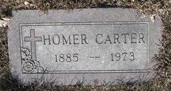
| Description | : | Additional information provided by Find A Grave contributor Joan (Wyatt) Bradley Born: Oct 1849 - Carroll County, Missouri Note: tombstone birth date appears to be 1858, an error based on family data and censuses...should be 1849. Sarah Ellen is in the 1850 Carroll MO census at age 1 with her parents, James W. & Eliza J. Boston |
frequently asked questions (FAQ):
-
Where is Sarah Ellen Boston Carter's memorial?
Sarah Ellen Boston Carter's memorial is located at: Winchester Cemetery, Byron Center, Kent County, USA.
-
When did Sarah Ellen Boston Carter death?
Sarah Ellen Boston Carter death on 1936 in Cascade, Cascade County, Montana, USA
-
Where are the coordinates of the Sarah Ellen Boston Carter's memorial?
Latitude: 42.8246994
Longitude: -85.6980972
Family Members:
Spouse
Children
Flowers:
Nearby Cemetories:
1. Winchester Cemetery
Byron Center, Kent County, USA
Coordinate: 42.8246994, -85.6980972
2. Kent Memorial Gardens
Byron Center, Kent County, USA
Coordinate: 42.8356018, -85.6883011
3. Weaver Cemetery
Byron Township, Kent County, USA
Coordinate: 42.8041992, -85.6828003
4. Sleepy Hollow Pet Cemetery and Crematory
Byron Center, Kent County, USA
Coordinate: 42.8477040, -85.7329940
5. Boynton Cemetery
Byron Center, Kent County, USA
Coordinate: 42.8377991, -85.7433014
6. Holy Trinity Columbarium
Wyoming, Kent County, USA
Coordinate: 42.8669010, -85.6847490
7. Winegar Cemetery
Byron Center, Kent County, USA
Coordinate: 42.7933006, -85.7497025
8. Blain Cemetery
Cutlerville, Kent County, USA
Coordinate: 42.8414001, -85.6335983
9. Saint Sebastian Catholic Cemetery
Byron Center, Kent County, USA
Coordinate: 42.7944440, -85.7619440
10. Gaines Cemetery
Cutlerville, Kent County, USA
Coordinate: 42.7976036, -85.6240311
11. Pine Hill Cemetery
Kentwood, Kent County, USA
Coordinate: 42.8675003, -85.6363983
12. Resurrection Cemetery
Wyoming, Kent County, USA
Coordinate: 42.8905983, -85.6819000
13. Jones Cemetery
Dorr, Allegan County, USA
Coordinate: 42.7578011, -85.7130966
14. Visitation Catholic Church Cemetery
Dorr Township, Allegan County, USA
Coordinate: 42.7678840, -85.7622740
15. Hanley Cemetery
Jenison, Ottawa County, USA
Coordinate: 42.8565090, -85.7924940
16. Dutton Cemetery
Dutton, Kent County, USA
Coordinate: 42.8366670, -85.5841670
17. Ridgeview Memorial Gardens
Georgetown Township, Ottawa County, USA
Coordinate: 42.8632600, -85.8023900
18. Rest Lawn Memorial Park
Grand Rapids, Kent County, USA
Coordinate: 42.9007988, -85.6438980
19. Grandville Cemetery
Grandville, Kent County, USA
Coordinate: 42.9043999, -85.7514038
20. Floral View Memorial Gardens
Jenison, Ottawa County, USA
Coordinate: 42.8699989, -85.8032990
21. Star Cemetery
Jamestown Township, Ottawa County, USA
Coordinate: 42.7961006, -85.8227997
22. Saint Marys Catholic Church Cemetery of New Salem
Salem Township, Allegan County, USA
Coordinate: 42.7543900, -85.7883700
23. Maple Grove Cemetery
Kentwood, Kent County, USA
Coordinate: 42.9033300, -85.6203400
24. Sproat Cemetery
Dorr, Allegan County, USA
Coordinate: 42.7264060, -85.6822230


