
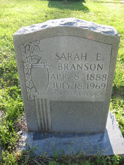
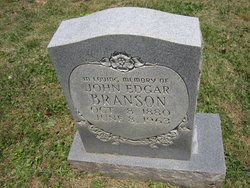
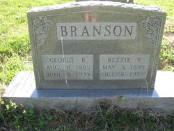
Sarah Etta Branson
| Birth | : | 8 Apr 1888 Virginia, USA |
| Death | : | 18 Jul 1969 Mount Airy, Surry County, North Carolina, USA |
| Burial | : | Pisgah United Methodist Church Cemetery, De Kalb, Gilmer County, USA |
| Coordinate | : | 38.9425160, -80.9219560 |
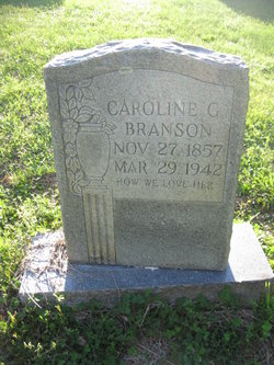
| Description | : | Daughter of Augustus and Caroline (Gwyn) Branson. |
frequently asked questions (FAQ):
-
Where is Sarah Etta Branson's memorial?
Sarah Etta Branson's memorial is located at: Pisgah United Methodist Church Cemetery, De Kalb, Gilmer County, USA.
-
When did Sarah Etta Branson death?
Sarah Etta Branson death on 18 Jul 1969 in Mount Airy, Surry County, North Carolina, USA
-
Where are the coordinates of the Sarah Etta Branson's memorial?
Latitude: 38.9425160
Longitude: -80.9219560
Family Members:
Parent
Siblings

Flowers:


Nearby Cemetories:
1. Pisgah United Methodist Church Cemetery
De Kalb, Gilmer County, USA
Coordinate: 38.9425160, -80.9219560
2. Riddle Cemetery
Gilmer County, USA
Coordinate: 38.9547005, -80.9049988
3. Bell Cemetery
Gilmer County, USA
Coordinate: 38.9281006, -80.8933029
4. Three Poplar Cemetery
Glenville, Gilmer County, USA
Coordinate: 38.9628600, -80.9445500
5. Job's Temple Cemetery
Glenville, Gilmer County, USA
Coordinate: 38.9322220, -80.9618810
6. Holbert Cemetery
Gilmer County, USA
Coordinate: 38.9686012, -80.8944016
7. Woodford Cemetery
Gilmer County, USA
Coordinate: 38.9482994, -80.8778000
8. Meadow Lane Cemetery
Glenville, Gilmer County, USA
Coordinate: 38.9491997, -80.8775024
9. Barton Cemetery
Gilmer County, USA
Coordinate: 38.9449997, -80.8760986
10. Wilson Cemetery
Lucerne, Gilmer County, USA
Coordinate: 38.9744900, -80.9013700
11. Maxwell-Collins Cemetery
Hardman, Gilmer County, USA
Coordinate: 38.9043220, -80.9195185
12. Keister-Upper Beall Cemetery
Glenville, Gilmer County, USA
Coordinate: 38.9209800, -80.8788600
13. Good Shepherd Catholic Cemetery
Tanner, Gilmer County, USA
Coordinate: 38.9811830, -80.9447050
14. Tanner Baptist Church Cemetery
Gilmer County, USA
Coordinate: 38.9814310, -80.9480630
15. Cather Cemetery - Leading Creek
De Kalb, Gilmer County, USA
Coordinate: 38.9632780, -80.8707920
16. Riddle Cemetery
Hardman, Gilmer County, USA
Coordinate: 38.8961111, -80.9333333
17. Cox Cemetery
Normantown, Gilmer County, USA
Coordinate: 38.8953300, -80.9170500
18. Woodford Farm Cemetery
Lucerne, Gilmer County, USA
Coordinate: 38.9819600, -80.8880900
19. Shiloh Church Cemetery
Glenville, Gilmer County, USA
Coordinate: 38.9002200, -80.8920300
20. Tater Knob
Gilmer County, USA
Coordinate: 38.8988304, -80.8848038
21. Chestnut Grove Baptist Church Cemetery
Gilmer County, USA
Coordinate: 38.9340420, -80.9885860
22. Stalnaker Cemetery
Glenville, Gilmer County, USA
Coordinate: 38.9441986, -80.8514023
23. Brown Cemetery
Gilmer County, USA
Coordinate: 38.8869070, -80.9272360
24. Kelley Cemetery Crooked Run
Cedarville, Gilmer County, USA
Coordinate: 38.9042000, -80.8634200