
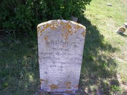
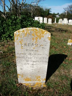
Sarah Gould Hammond
| Birth | : | 27 May 1826 Chatham, Barnstable County, Massachusetts, USA |
| Death | : | 13 Feb 1867 Chatham, Barnstable County, Massachusetts, USA |
| Burial | : | Old Saint Josephs Cemetery, Morganza, St. Mary's County, USA |
| Coordinate | : | 38.3746986, -76.6932983 |
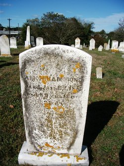
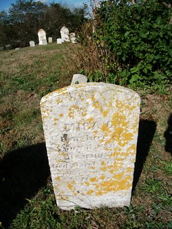
| Inscription | : | wife of Amon |
| Description | : | *Massachusetts, Marriages, 1841-1915 groom's name: Amond Hammond groom's birth date: 1819 groom's age: 28 bride's name: Sarah Gould bride's birth date: 1824 bride's age: 23 marriage date: 11 Oct 1847 marriage place: Chatham, Barnstable, Massachusetts, United States groom's father's name: Calvin Hammond groom's mother's name: Deborah Hammond bride's father's name: Richard Gould bride's mother's name: Sarah Gould indexing project (batch) number: I09901-7 system origin: Massachusetts-EASy source film number: 778360 additional information courtesy of Randall Jensen (#47426837) |
frequently asked questions (FAQ):
-
Where is Sarah Gould Hammond's memorial?
Sarah Gould Hammond's memorial is located at: Old Saint Josephs Cemetery, Morganza, St. Mary's County, USA.
-
When did Sarah Gould Hammond death?
Sarah Gould Hammond death on 13 Feb 1867 in Chatham, Barnstable County, Massachusetts, USA
-
Where are the coordinates of the Sarah Gould Hammond's memorial?
Latitude: 38.3746986
Longitude: -76.6932983
Family Members:
Spouse
Children
Flowers:


Nearby Cemetories:
1. Old Saint Josephs Cemetery
Morganza, St. Mary's County, USA
Coordinate: 38.3746986, -76.6932983
2. Saint Josephs Parish Cemetery
Morganza, St. Mary's County, USA
Coordinate: 38.3767014, -76.6971970
3. Stauffer Mennonite Cemetery
Loveville, St. Mary's County, USA
Coordinate: 38.3504040, -76.6874632
4. Galilee United Methodist Cemetery
Oakville, St. Mary's County, USA
Coordinate: 38.3918991, -76.6650009
5. Saint Marys Queen of Peace Cemetery
Helen, St. Mary's County, USA
Coordinate: 38.3746986, -76.7332993
6. Summerseat Cemetery
Laurel Grove, St. Mary's County, USA
Coordinate: 38.3979300, -76.6634000
7. Reeder Burial Ground
Laurel Grove, St. Mary's County, USA
Coordinate: 38.4065138, -76.6766289
8. Mount Zion United Methodist Cemetery
Laurel Grove, St. Mary's County, USA
Coordinate: 38.4131012, -76.6819000
9. Deep Falls Cemetery
Chaptico, St. Mary's County, USA
Coordinate: 38.3576600, -76.7573170
10. Our Lady of the Wayside Catholic Cemetery
Chaptico, St. Mary's County, USA
Coordinate: 38.3670707, -76.7771893
11. DeLaBrooke Manor Slave Cemetery
Mechanicsville, St. Mary's County, USA
Coordinate: 38.4369989, -76.6609750
12. Old Saint Aloysius Cemetery
Leonardtown, St. Mary's County, USA
Coordinate: 38.3210983, -76.6382980
13. Charles Memorial Gardens Pet Cemetery
Leonardtown, St. Mary's County, USA
Coordinate: 38.3082390, -76.6662064
14. Charles Memorial Gardens
Leonardtown, St. Mary's County, USA
Coordinate: 38.3084602, -76.6644516
15. Christ Church Cemetery
Chaptico, St. Mary's County, USA
Coordinate: 38.3657990, -76.7835999
16. Mechanicsville Methodist Episcopal South Cemetery
Mechanicsville, St. Mary's County, USA
Coordinate: 38.4428101, -76.7458420
17. First Saints Community Church Cemetery
Leonardtown, St. Mary's County, USA
Coordinate: 38.2997017, -76.6414032
18. Locke Family Cemetery
Mechanicsville, St. Mary's County, USA
Coordinate: 38.4528313, -76.7563019
19. Fisher Cemetery
Mechanicsville, St. Mary's County, USA
Coordinate: 38.4308090, -76.7896810
20. All Saints Episcopal Church Cemetery
Oakley, St. Mary's County, USA
Coordinate: 38.2882996, -76.7416992
21. Saint Marys County War Memorial
Leonardtown, St. Mary's County, USA
Coordinate: 38.2908516, -76.6359329
22. Saint Aloysius Gonzaga Catholic Cemetery
Leonardtown, St. Mary's County, USA
Coordinate: 38.2916985, -76.6327972
23. Ellenborough Cemetery
Leonardtown, St. Mary's County, USA
Coordinate: 38.2956505, -76.6238632
24. All Faith Episcopal Church Cemetery
Mechanicsville, St. Mary's County, USA
Coordinate: 38.4672012, -76.7305984