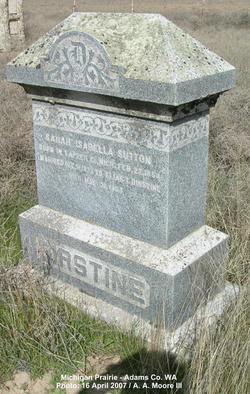
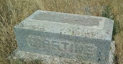
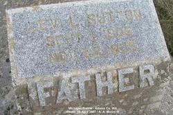
Sarah Isabella “Belle” Sutton Dirstine
| Birth | : | 22 Feb 1854 Lapeer County, Michigan, USA |
| Death | : | 31 May 1903 Lind, Adams County, Washington, USA |
| Burial | : | Oak Hill Cemetery, Hancock, Pottawattamie County, USA |
| Coordinate | : | 41.3908005, -95.3360977 |
| Description | : | Mrs. Belle Dirstine, an old and respected pioneer lady of this county, died at Lind last Tuesday morning of consumption, after two years of acute suffering. The lady was the wife of Elias Dirstine and a sister of Dr. L. L. Sutton of Hatton. Besides the husband she leaves three sons: Isaac Dirstine, who has had charge of Dirstine Bros.' drug store at Connell; John Dirstine, druggist and mayor of Lind, and Pearl Dirstine, besides numerous relatives and friends. The funeral occurred Monday from the residence at Lind; interment at Sutton cemetery, 12 miles south. Burial at Michigan Prairie Sarah Isabell Sutton Dirstine Feb.... Read More |
frequently asked questions (FAQ):
-
Where is Sarah Isabella “Belle” Sutton Dirstine's memorial?
Sarah Isabella “Belle” Sutton Dirstine's memorial is located at: Oak Hill Cemetery, Hancock, Pottawattamie County, USA.
-
When did Sarah Isabella “Belle” Sutton Dirstine death?
Sarah Isabella “Belle” Sutton Dirstine death on 31 May 1903 in Lind, Adams County, Washington, USA
-
Where are the coordinates of the Sarah Isabella “Belle” Sutton Dirstine's memorial?
Latitude: 41.3908005
Longitude: -95.3360977
Family Members:
Parent
Spouse
Siblings
Children
Flowers:
Nearby Cemetories:
1. Oak Hill Cemetery
Hancock, Pottawattamie County, USA
Coordinate: 41.3908005, -95.3360977
2. Newtown Cemetery
Avoca, Pottawattamie County, USA
Coordinate: 41.4583200, -95.3169400
3. Oaklawn Cemetery
Oakland, Pottawattamie County, USA
Coordinate: 41.3260994, -95.3818970
4. Lincoln Township Cemetery
Hancock, Pottawattamie County, USA
Coordinate: 41.3824997, -95.2313995
5. Graceland Cemetery
Avoca, Pottawattamie County, USA
Coordinate: 41.4935989, -95.3368988
6. Big Grove Cemetery
Pottawattamie County, USA
Coordinate: 41.3088420, -95.4322120
7. Saint Patricks Catholic Cemetery
Walnut, Pottawattamie County, USA
Coordinate: 41.4831000, -95.2310000
8. Silver Valley Cemetery
Hancock, Pottawattamie County, USA
Coordinate: 41.4042015, -95.4969025
9. Layton Township Cemetery
Walnut, Pottawattamie County, USA
Coordinate: 41.4755478, -95.2109756
10. Belknap Cemetery
Oakland, Pottawattamie County, USA
Coordinate: 41.2924995, -95.4424973
11. Jacobson Cemetery
Shelby County, USA
Coordinate: 41.5277700, -95.2988900
12. Olson Cemetery
Shelby County, USA
Coordinate: 41.5275002, -95.3806000
13. Whipple Cemetery
Pottawattamie County, USA
Coordinate: 41.2882996, -95.1983032
14. Shelby Cemetery
Shelby, Shelby County, USA
Coordinate: 41.5083313, -95.4511108
15. Heine Cemetery
Shelby, Shelby County, USA
Coordinate: 41.5277500, -95.4033000
16. Carson Cemetery
Carson, Pottawattamie County, USA
Coordinate: 41.2392006, -95.4044037
17. Lee Cemetery
Shelby, Shelby County, USA
Coordinate: 41.5555450, -95.2974981
18. Wheeler Grove Cemetery
Macedonia, Pottawattamie County, USA
Coordinate: 41.2131691, -95.3393631
19. Minden Township Cemetery
Minden, Pottawattamie County, USA
Coordinate: 41.4763908, -95.5444412
20. Bradway Farm Cemetery
Macedonia, Pottawattamie County, USA
Coordinate: 41.2083300, -95.3336500
21. Cuppys Grove Cemetery
Harlan, Shelby County, USA
Coordinate: 41.5643997, -95.2561035
22. Monroe United Methodist Church Cemetery
Monroe Township, Shelby County, USA
Coordinate: 41.5312000, -95.1735410
23. Jones - Williams Cemetery
Pottawattamie County, USA
Coordinate: 41.3761000, -95.5846000
24. Brighton Cemetery
Marne, Cass County, USA
Coordinate: 41.4622002, -95.0999985


