
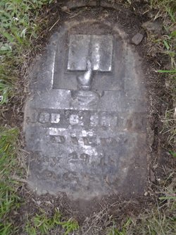
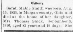
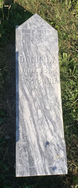
| Birth | : | Feb 1834 Iowa, USA |
| Death | : | 3 Sep 1916 Allodium Township, Graham County, Kansas, USA |
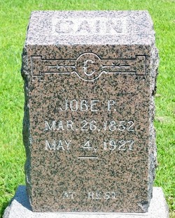
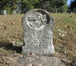
| Burial | : | Lucerne Cemetery, Lucerne, Sheridan County, USA |
| Coordinate | : | 39.4952087, -100.2127304 |
frequently asked questions (FAQ):
-
Where is Sarah Mable Smith Cain's memorial?
Sarah Mable Smith Cain's memorial is located at: Lucerne Cemetery, Lucerne, Sheridan County, USA.
-
When did Sarah Mable Smith Cain death?
Sarah Mable Smith Cain death on 3 Sep 1916 in Allodium Township, Graham County, Kansas, USA
-
Where are the coordinates of the Sarah Mable Smith Cain's memorial?
Latitude: 39.4952087
Longitude: -100.2127304
Family Members:
Parent
Spouse
Siblings
Children

Flowers:


Nearby Cemetories:
1. Lucerne Cemetery
Lucerne, Sheridan County, USA
Coordinate: 39.4952087, -100.2127304
2. Bow Creek Cemetery
Tasco, Sheridan County, USA
Coordinate: 39.4227982, -100.2564011
3. Allison Cemetery
Decatur County, USA
Coordinate: 39.5741997, -100.2480011
4. Adell Cemetery
Selden, Sheridan County, USA
Coordinate: 39.5384700, -100.3387300
5. Anderson Cemetery
Graham County, USA
Coordinate: 39.4077988, -100.0975037
6. Saint Joseph Cemetery
New Almelo, Norton County, USA
Coordinate: 39.5985985, -100.1159973
7. Studley Cemetery
Studley, Sheridan County, USA
Coordinate: 39.3568993, -100.1631012
8. South Star Cemetery
Graham County, USA
Coordinate: 39.4805984, -99.9935989
9. Baugher Cemetery
Studley, Sheridan County, USA
Coordinate: 39.3205600, -100.2560800
10. Morland Cemetery
Morland, Graham County, USA
Coordinate: 39.3431015, -100.0708008
11. Rock Creek Cemetery
Graham County, USA
Coordinate: 39.4075012, -99.9935989
12. Lenora South Cemetery
Lenora, Norton County, USA
Coordinate: 39.5956001, -100.0025024
13. Gettis Cemetery
Clayton, Norton County, USA
Coordinate: 39.6810989, -100.1327972
14. Jennings Cemetery
Jennings, Decatur County, USA
Coordinate: 39.6824989, -100.3050003
15. Lenora East Cemetery
Lenora, Norton County, USA
Coordinate: 39.6035995, -99.9935989
16. Calvary Cemetery
Leoville, Decatur County, USA
Coordinate: 39.5803200, -100.4613100
17. Dresden Cemetery
Dresden, Decatur County, USA
Coordinate: 39.6293907, -100.4231033
18. Immanuel Lutheran Cemetery
Hoxie, Sheridan County, USA
Coordinate: 39.4339600, -100.4791400
19. Hoxie Cemetery
Hoxie, Sheridan County, USA
Coordinate: 39.3736000, -100.4421997
20. Jackson Cemetery
Dresden, Decatur County, USA
Coordinate: 39.6727982, -100.4036026
21. Saint Frances Cemetery
Hoxie, Sheridan County, USA
Coordinate: 39.3541985, -100.4597015
22. Penokee Cemetery
Penokee, Graham County, USA
Coordinate: 39.3425293, -99.9727402
23. Mount Pleasant Community Cemetery
Studley, Sheridan County, USA
Coordinate: 39.2550011, -100.1635971
24. Fairview Cemetery
Hill City, Graham County, USA
Coordinate: 39.5257030, -99.8912650