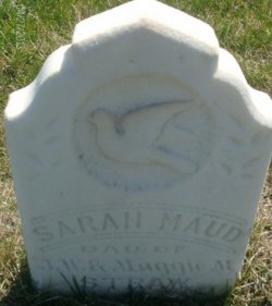
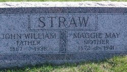
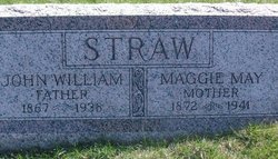
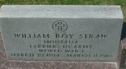
Sarah Maud Straw
| Birth | : | 21 Jun 1889 Rosebud County, Montana, USA |
| Death | : | 13 Aug 1889 Rosebud County, Montana, USA |
| Burial | : | Forsyth Cemetery, Forsyth, Rosebud County, USA |
| Coordinate | : | 46.2689018, -106.6528015 |
| Plot | : | 1st Addition Section G Lot 5 E1/2 Block 4 |
| Description | : | SOURCE: Death Certificate: ''''''''''''''''''''''''' Below information provided by: Jane Foster 3/17/2015 Sarah was first buried on her family's ranch and later moved to Forsyth Cemetery. |
frequently asked questions (FAQ):
-
Where is Sarah Maud Straw's memorial?
Sarah Maud Straw's memorial is located at: Forsyth Cemetery, Forsyth, Rosebud County, USA.
-
When did Sarah Maud Straw death?
Sarah Maud Straw death on 13 Aug 1889 in Rosebud County, Montana, USA
-
Where are the coordinates of the Sarah Maud Straw's memorial?
Latitude: 46.2689018
Longitude: -106.6528015
Family Members:
Parent
Siblings
Flowers:
Nearby Cemetories:
1. Forsyth Cemetery
Forsyth, Rosebud County, USA
Coordinate: 46.2689018, -106.6528015
2. Rosebud Cemetery
Rosebud, Rosebud County, USA
Coordinate: 46.2689018, -106.4381027
3. Howard Cemetery
Rosebud County, USA
Coordinate: 46.2621994, -106.9222031
4. Hathaway Cemetery
Rosebud County, USA
Coordinate: 46.2616997, -106.2185974
5. Colstrip Cemetery
Colstrip, Rosebud County, USA
Coordinate: 45.9096985, -106.6194000
6. Memorial Vale Cemetery
Hysham, Treasure County, USA
Coordinate: 46.2552986, -107.2307968
7. Bean Cemetery
Rosebud County, USA
Coordinate: 45.8535995, -106.4011002
8. Brown Cemetery
Colstrip, Rosebud County, USA
Coordinate: 45.8321991, -106.4180984
9. Lee Cemetery
Rosebud County, USA
Coordinate: 45.7792015, -106.5413971
10. Rancher Cemetery
Myers, Treasure County, USA
Coordinate: 46.2580986, -107.4197006
11. Fort Keogh Cemetery
Custer County, USA
Coordinate: 46.3800011, -105.8874969
12. Vanstel Cemetery
Rosebud County, USA
Coordinate: 46.7872009, -106.8942032
13. Calvary Cemetery
Miles City, Custer County, USA
Coordinate: 46.3816986, -105.8249969
14. Eastern Montana State Veterans Cemetery
Miles City, Custer County, USA
Coordinate: 46.3807564, -105.8246536
15. Old Calvary Cemetery
Miles City, Custer County, USA
Coordinate: 46.3807600, -105.8246500
16. Custer County Cemetery
Miles City, Custer County, USA
Coordinate: 46.3891983, -105.8264008
17. Pine Hills School Cemetery
Miles City, Custer County, USA
Coordinate: 46.4077988, -105.8167038
18. Rock Springs Cemetery
Rock Springs, Rosebud County, USA
Coordinate: 46.7847800, -106.1411500
19. Pine Crest Cemetery
Custer County, USA
Coordinate: 46.4564018, -105.7789001
20. Junction City Cemetery
Yellowstone County, USA
Coordinate: 46.1437320, -107.5493300
21. Lame Deer Cemetery
Lame Deer, Rosebud County, USA
Coordinate: 45.6264000, -106.6619034
22. Custer Cemetery
Custer, Yellowstone County, USA
Coordinate: 46.1270690, -107.5700030
23. Muddy Creek Cemetery
Muddy, Big Horn County, USA
Coordinate: 45.5741997, -106.7406006
24. Saint Labre Cemetery
Ashland, Rosebud County, USA
Coordinate: 45.6070930, -106.2836910


