
| Birth | : | 4 Apr 1875 Grundy County, Missouri, USA |
| Death | : | 7 Feb 1908 |
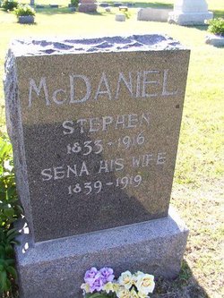
| Burial | : | Granada Cemetery, Granada, Nemaha County, USA |
| Coordinate | : | 39.7324982, -95.7988968 |
| Plot | : | Lot 147 |
frequently asked questions (FAQ):
-
Where is Sarah May “Sallie” McDaniel Ralston's memorial?
Sarah May “Sallie” McDaniel Ralston's memorial is located at: Granada Cemetery, Granada, Nemaha County, USA.
-
When did Sarah May “Sallie” McDaniel Ralston death?
Sarah May “Sallie” McDaniel Ralston death on 7 Feb 1908 in
-
Where are the coordinates of the Sarah May “Sallie” McDaniel Ralston's memorial?
Latitude: 39.7324982
Longitude: -95.7988968
Family Members:
Parent

Spouse

Siblings
Children
Flowers:


Nearby Cemetories:
1. Granada Cemetery
Granada, Nemaha County, USA
Coordinate: 39.7324982, -95.7988968
2. Capioma Cemetery
Capioma, Nemaha County, USA
Coordinate: 39.7805099, -95.8205719
3. Comet Cemetery
Powhattan Township, Brown County, USA
Coordinate: 39.7542600, -95.7340400
4. Saint Augustine Catholic Cemetery
Capioma Township, Nemaha County, USA
Coordinate: 39.7904282, -95.7897034
5. Barnes Cemetery
Goff, Nemaha County, USA
Coordinate: 39.6960983, -95.8824997
6. Woodlawn Cemetery
Woodlawn, Nemaha County, USA
Coordinate: 39.7905998, -95.8638992
7. South Powhattan Cemetery
Powhattan, Brown County, USA
Coordinate: 39.6608009, -95.7596970
8. Jonach Cemetery
Nemaha County, USA
Coordinate: 39.7925700, -95.8646600
9. Grasshopper Burial Ground
Powhattan Township, Brown County, USA
Coordinate: 39.7578020, -95.6949820
10. Tyler Cemetery
Fairview, Brown County, USA
Coordinate: 39.8119300, -95.7483200
11. Wetmore Cemetery
Wetmore, Nemaha County, USA
Coordinate: 39.6396800, -95.8108400
12. Wolfley Cemetery
Goff, Nemaha County, USA
Coordinate: 39.6454400, -95.8633900
13. Kennekuk Church Cemetery
Horton, Brown County, USA
Coordinate: 39.7074600, -95.6672300
14. Fairview Cemetery
Goff, Nemaha County, USA
Coordinate: 39.6831017, -95.9383011
15. Fairview City Cemetery
Fairview, Brown County, USA
Coordinate: 39.8464300, -95.7326900
16. Grant-Mjessepe Cemetery
Horton, Brown County, USA
Coordinate: 39.6663000, -95.6576000
17. Jessepe Indian Cemetery
Horton, Brown County, USA
Coordinate: 39.6715000, -95.6438000
18. Powhattan Cemetery
Powhattan, Brown County, USA
Coordinate: 39.7681007, -95.6288986
19. Netawaka Cemetery
Netawaka, Jackson County, USA
Coordinate: 39.6075300, -95.7223700
20. Pleasant Hill Cemetery
Fairview, Brown County, USA
Coordinate: 39.8411800, -95.6716400
21. Congregational Cemetery
Fairview, Brown County, USA
Coordinate: 39.8549995, -95.6949997
22. Old Fairview Cemetery
Fairview, Brown County, USA
Coordinate: 39.8550491, -95.6948700
23. Immanuel Lutheran Cemetery
Fairview, Brown County, USA
Coordinate: 39.8559700, -95.6858500
24. Saint Peters Cemetery
Mercier, Brown County, USA
Coordinate: 39.7247009, -95.6016998