
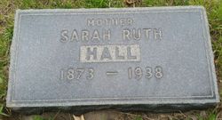
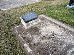
Sarah Ruth Doan Hall
| Birth | : | 24 Mar 1873 Stark County, Illinois, USA |
| Death | : | 6 Feb 1938 |
| Burial | : | Brampton Memorial Gardens, Brampton, Peel Regional Municipality, Canada |
| Coordinate | : | 43.6877200, -79.8098200 |
| Plot | : | Block 19 Lot S/W 5 TIER 17 Row 14 |
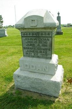
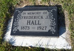
| Description | : | Daughter of Sarah Elizabeth Brassfield and John W. Doan. Married to Fred Hall c. Jan 1896. Died c. Feb 1910; buried in Durango, CO. |
frequently asked questions (FAQ):
-
Where is Sarah Ruth Doan Hall's memorial?
Sarah Ruth Doan Hall's memorial is located at: Brampton Memorial Gardens, Brampton, Peel Regional Municipality, Canada.
-
When did Sarah Ruth Doan Hall death?
Sarah Ruth Doan Hall death on 6 Feb 1938 in
-
Where are the coordinates of the Sarah Ruth Doan Hall's memorial?
Latitude: 43.6877200
Longitude: -79.8098200
Family Members:
Parent
Spouse
Siblings


Children
Flowers:


Nearby Cemetories:
1. Brampton Memorial Gardens
Brampton, Peel Regional Municipality, Canada
Coordinate: 43.6877200, -79.8098200
2. Brampton Cemetery
Brampton, Peel Regional Municipality, Canada
Coordinate: 43.6872680, -79.8086580
3. Eventide Cemetery
Brampton, Peel Regional Municipality, Canada
Coordinate: 43.7000500, -79.7825500
4. Alloa Methodist United Church Cemetery
Brampton, Peel Regional Municipality, Canada
Coordinate: 43.6957420, -79.8457570
5. Brampton Pioneer Cemetery
Brampton, Peel Regional Municipality, Canada
Coordinate: 43.6940300, -79.7706100
6. Huttonville Cemetery
Huttonville, Peel Regional Municipality, Canada
Coordinate: 43.6593323, -79.8191147
7. St. Elias Church and Cemetery
Brampton, Peel Regional Municipality, Canada
Coordinate: 43.6612500, -79.8456900
8. Brampton Cemetery
Brampton, Peel Regional Municipality, Canada
Coordinate: 43.6928400, -79.7546800
9. Snell Cemetery
Peel Regional Municipality, Canada
Coordinate: 43.7276810, -79.7931070
10. Page's Methodist Episcopal Church Cemetery
Brampton, Peel Regional Municipality, Canada
Coordinate: 43.6413100, -79.8188760
11. McNabb Cemetery
Halton Hills, Halton Regional Municipality, Canada
Coordinate: 43.6490000, -79.8559998
12. Saint Paul's Anglican Church Cemetery
Halton Hills, Halton Regional Municipality, Canada
Coordinate: 43.6442010, -79.8575000
13. Hillcrest Cemetery
Halton Hills, Halton Regional Municipality, Canada
Coordinate: 43.6432490, -79.8570010
14. Churchville Cemetery
Churchville, Peel Regional Municipality, Canada
Coordinate: 43.6390900, -79.7601800
15. Lundy Burying Ground
Brampton, Peel Regional Municipality, Canada
Coordinate: 43.7306800, -79.7496900
16. Mount Olivet Cemetery
Brampton, Peel Regional Municipality, Canada
Coordinate: 43.7304020, -79.7491950
17. Meadowvale Cemetery
Brampton, Peel Regional Municipality, Canada
Coordinate: 43.6415300, -79.7474000
18. Cheyne Cemetery
Brampton, Peel Regional Municipality, Canada
Coordinate: 43.6580520, -79.7219820
19. Dixon's Union Cemetery
Caledon, Peel Regional Municipality, Canada
Coordinate: 43.7607000, -79.8371700
20. Mount Zion Methodist Church Cemetery
Brampton, Peel Regional Municipality, Canada
Coordinate: 43.6103500, -79.8010600
21. Union Presbyterian Church Cemetery
Georgetown, Halton Regional Municipality, Canada
Coordinate: 43.6929340, -79.9177998
22. Greenwood Cemetery
Georgetown, Halton Regional Municipality, Canada
Coordinate: 43.6545830, -79.9119110
23. Glen Williams Cemetery
Halton Hills, Halton Regional Municipality, Canada
Coordinate: 43.6729600, -79.9220800
24. Derry West Cemetery
Mississauga, Peel Regional Municipality, Canada
Coordinate: 43.6456560, -79.7072320