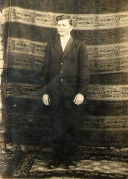
| Birth | : | 26 Oct 1868 Iowa, USA |
| Death | : | 11 Aug 1955 Roanoke, Roanoke City, Virginia, USA |
| Burial | : | Brompton Cemetery, Northallerton, Hambleton District, England |
| Coordinate | : | 54.3614100, -1.4140900 |
| Description | : | Sarah "Sadie" was the daughter of Catherine Schrock and William Enfield Sr. She married William Monroe Boitnott 11 Dec 1888 in Story County, Iowa. Sarah, William and two children, Doris R. and Earl, are buried in Brethren Cemetery. |
frequently asked questions (FAQ):
-
Where is Sarah “Sadie” Enfield Boitnott's memorial?
Sarah “Sadie” Enfield Boitnott's memorial is located at: Brompton Cemetery, Northallerton, Hambleton District, England.
-
When did Sarah “Sadie” Enfield Boitnott death?
Sarah “Sadie” Enfield Boitnott death on 11 Aug 1955 in Roanoke, Roanoke City, Virginia, USA
-
Where are the coordinates of the Sarah “Sadie” Enfield Boitnott's memorial?
Latitude: 54.3614100
Longitude: -1.4140900
Family Members:
Parent
Spouse
Siblings
Children
Flowers:
Nearby Cemetories:
1. Brompton Cemetery
Northallerton, Hambleton District, England
Coordinate: 54.3614100, -1.4140900
2. St. Thomas Churchyard
Brompton, Hambleton District, England
Coordinate: 54.3613700, -1.4263900
3. All Saints Churchyard
Northallerton, Hambleton District, England
Coordinate: 54.3420430, -1.4366340
4. Northallerton Cemetery
Northallerton, Hambleton District, England
Coordinate: 54.3410870, -1.4380120
5. St James Churchyard
Romanby, Hambleton District, England
Coordinate: 54.3331660, -1.4474010
6. St Lawrence Churchyard
Kirby Sigston, Hambleton District, England
Coordinate: 54.3458700, -1.3609600
7. All Saints Churchyard
Yafforth, Hambleton District, England
Coordinate: 54.3447400, -1.4720100
8. Danby Wiske Parish Churchyard
Danby Wiske, Hambleton District, England
Coordinate: 54.3793800, -1.4813060
9. All Saints Churchyard
Deighton, Hambleton District, England
Coordinate: 54.4099130, -1.4141500
10. St. Oswald Churchyard
East Harlsey, Hambleton District, England
Coordinate: 54.3914290, -1.3451990
11. St. Lawrence Churchyard
Hutton Bonville, Hambleton District, England
Coordinate: 54.3958000, -1.4830000
12. St Leonard Churchyard
Welbury, Hambleton District, England
Coordinate: 54.4138000, -1.3855600
13. Thornton-le-Beans Chapelyard
Thornton-le-Beans, Hambleton District, England
Coordinate: 54.3074250, -1.3934900
14. St. Helen's Churchyard
Ainderby Steeple, Hambleton District, England
Coordinate: 54.3232200, -1.4870680
15. St Michael and All Angels Churchyard
North Otterington, Hambleton District, England
Coordinate: 54.3017300, -1.4438700
16. Mount Grace Priory
East Harlsey, Hambleton District, England
Coordinate: 54.3799590, -1.3109160
17. Osmotherley Cemetery
Osmotherley, Hambleton District, England
Coordinate: 54.3684200, -1.3046700
18. St Peter Churchyard
Osmotherley, Hambleton District, England
Coordinate: 54.3681190, -1.3001490
19. St Mary the Virgin Churchyard
Leake, Hambleton District, England
Coordinate: 54.3094180, -1.3357310
20. St Oswald Churchyard
West Rounton, Hambleton District, England
Coordinate: 54.4243670, -1.3638680
21. St. Peter's Churchyard
Birkby, Hambleton District, England
Coordinate: 54.4157560, -1.4901840
22. St. Wilfrid Churchyard
Great Langton, Hambleton District, England
Coordinate: 54.3598870, -1.5367380
23. St. Mary's Churchyard
Over Silton, Hambleton District, England
Coordinate: 54.3319180, -1.3002410
24. St. Lawrence Churchyard
East Rounton, Hambleton District, England
Coordinate: 54.4241000, -1.3510700


