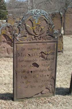
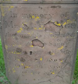
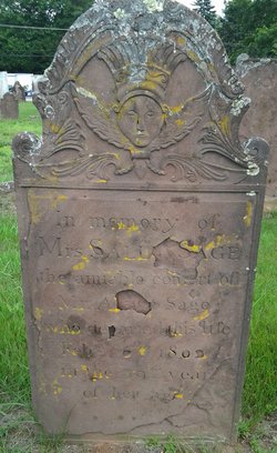
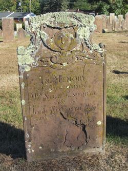
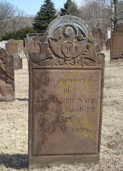
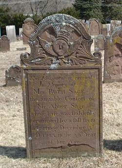
Sarah “Sally” Ellsworth Sage
| Birth | : | 21 Sep 1762 Middlesex County, Connecticut, USA |
| Death | : | 6 Feb 1802 Portland, Middlesex County, Connecticut, USA |
| Burial | : | Riverside Cemetery, Lincoln, Grafton County, USA |
| Coordinate | : | 44.0505900, -71.6856100 |
| Description | : | amiable consort of Mr. Abner Sage in the 39th year of her age |
frequently asked questions (FAQ):
-
Where is Sarah “Sally” Ellsworth Sage's memorial?
Sarah “Sally” Ellsworth Sage's memorial is located at: Riverside Cemetery, Lincoln, Grafton County, USA.
-
When did Sarah “Sally” Ellsworth Sage death?
Sarah “Sally” Ellsworth Sage death on 6 Feb 1802 in Portland, Middlesex County, Connecticut, USA
-
Where are the coordinates of the Sarah “Sally” Ellsworth Sage's memorial?
Latitude: 44.0505900
Longitude: -71.6856100
Family Members:
Parent
Spouse
Siblings
Children
Flowers:
Nearby Cemetories:
1. Riverside Cemetery
Lincoln, Grafton County, USA
Coordinate: 44.0505900, -71.6856100
2. Clark's Trading Post Animal Cemetery
Lincoln, Grafton County, USA
Coordinate: 44.0483740, -71.6862130
3. Hanson Farm Road Cemetery
Lincoln, Grafton County, USA
Coordinate: 44.0663890, -71.6869440
4. Jackman Cemetery
Grafton County, USA
Coordinate: 44.0322220, -71.6969440
5. Parker Cemetery
Woodstock, Grafton County, USA
Coordinate: 44.0193000, -71.6839700
6. Woodstock Cemetery
Woodstock, Grafton County, USA
Coordinate: 43.9827600, -71.6827500
7. Wildcat Cemetery
Thornton, Grafton County, USA
Coordinate: 43.9909710, -71.6391440
8. Easton Cemetery
Easton, Grafton County, USA
Coordinate: 44.1375000, -71.7805560
9. Kinsman Cemetery
Easton, Grafton County, USA
Coordinate: 44.1374900, -71.7808700
10. Brown Farmstead Cemetery
Benton, Grafton County, USA
Coordinate: 44.0778000, -71.8420830
11. Pine Grove Cemetery
Thornton, Grafton County, USA
Coordinate: 43.9060100, -71.6689000
12. East Cemetery
Benton, Grafton County, USA
Coordinate: 44.0985985, -71.8846970
13. West Thornton Cemetery
Thornton, Grafton County, USA
Coordinate: 43.8997200, -71.6805600
14. Willow Cemetery
Franconia, Grafton County, USA
Coordinate: 44.1968994, -71.7530975
15. Waterville Valley Cemetery
Waterville Valley, Grafton County, USA
Coordinate: 43.9634670, -71.5087000
16. Yeaton Cemetery
Thornton, Grafton County, USA
Coordinate: 43.8963800, -71.6794500
17. Blake Mountain Cemetery
Thornton, Grafton County, USA
Coordinate: 43.8963600, -71.6794200
18. High Street Cemetery
Glencliff, Grafton County, USA
Coordinate: 43.9851100, -71.8913900
19. West Cemetery
Benton, Grafton County, USA
Coordinate: 44.1033700, -71.9014000
20. Noyes Cemetery
Landaff, Grafton County, USA
Coordinate: 44.1830560, -71.8286110
21. Packard Graveyard
Thornton, Grafton County, USA
Coordinate: 43.8971540, -71.5845930
22. Mad River Cemetery
Thornton, Grafton County, USA
Coordinate: 43.8833670, -71.6077500
23. Avery Cemetery
Ellsworth, Grafton County, USA
Coordinate: 43.8805600, -71.7511200
24. Elmwood Cemetery
Franconia, Grafton County, USA
Coordinate: 44.2219009, -71.7474976

