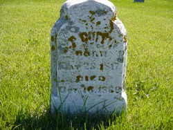
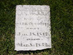
Sargent Parker Coffin
| Birth | : | 28 May 1817 Guilford County, North Carolina, USA |
| Death | : | 18 Oct 1866 Wayne County, Indiana, USA |
| Burial | : | Santa Cruz Memorial Park, Santa Cruz, Santa Cruz County, USA |
| Coordinate | : | 36.9904976, -122.0282974 |
| Description | : | After a very checkered past in North Carolina, Coffin moved to Indiana in the 1840s. There he redeemed himself during the Civil War by serving as a spy for the government of Gov. Oliver P. Morton. His southern upbringing and accent allowed him to infiltrate the Knights of the Golden Circle, a pro-Southern group of sympathizers operating in the state. His information allowed the government to keep the group in check and avoid their causing trouble within the state of Indiana during the war years. |
frequently asked questions (FAQ):
-
Where is Sargent Parker Coffin's memorial?
Sargent Parker Coffin's memorial is located at: Santa Cruz Memorial Park, Santa Cruz, Santa Cruz County, USA.
-
When did Sargent Parker Coffin death?
Sargent Parker Coffin death on 18 Oct 1866 in Wayne County, Indiana, USA
-
Where are the coordinates of the Sargent Parker Coffin's memorial?
Latitude: 36.9904976
Longitude: -122.0282974
Family Members:
Parent
Spouse
Siblings
Children
Flowers:
Nearby Cemetories:
1. Santa Cruz Memorial Park
Santa Cruz, Santa Cruz County, USA
Coordinate: 36.9904976, -122.0282974
2. Santa Cruz Mausoleum
Santa Cruz, Santa Cruz County, USA
Coordinate: 36.9901596, -122.0273068
3. Evergreen Cemetery
Santa Cruz, Santa Cruz County, USA
Coordinate: 36.9813805, -122.0350723
4. Mission Santa Cruz Cemetery
Santa Cruz, Santa Cruz County, USA
Coordinate: 36.9779390, -122.0294940
5. Calvary Episcopal Church Gravesite
Santa Cruz, Santa Cruz County, USA
Coordinate: 36.9721462, -122.0276762
6. Pine Knoll Pet Cemetery
Scotts Valley, Santa Cruz County, USA
Coordinate: 37.0149800, -122.0293500
7. Home of Peace Cemetery
Santa Cruz, Santa Cruz County, USA
Coordinate: 36.9746666, -122.0564041
8. Old Holy Cross Cemetery
Santa Cruz, Santa Cruz County, USA
Coordinate: 36.9820900, -121.9933243
9. Holy Cross Cemetery
Santa Cruz, Santa Cruz County, USA
Coordinate: 36.9826431, -121.9897537
10. Oakwood Memorial Park
Santa Cruz, Santa Cruz County, USA
Coordinate: 36.9904709, -121.9850159
11. Soquel Cemetery
Soquel, Santa Cruz County, USA
Coordinate: 36.9961624, -121.9562912
12. Beit Olam Cemetery
Soquel, Santa Cruz County, USA
Coordinate: 36.9967700, -121.9557300
13. Felton Cemetery
Felton, Santa Cruz County, USA
Coordinate: 37.0514526, -122.0795975
14. Land of Medicine Buddha Stupa
Soquel, Santa Cruz County, USA
Coordinate: 37.0125950, -121.9336400
15. Our Lady of Mount Carmel Cemetery
Aptos, Santa Cruz County, USA
Coordinate: 36.9806366, -121.9095993
16. Martin Family Burial Ground
Glenwood, Santa Cruz County, USA
Coordinate: 37.1083870, -121.9868690
17. Christ Lutheran Church Columbarium
Aptos, Santa Cruz County, USA
Coordinate: 36.9700550, -121.8704370
18. Day Valley Cemetery
Aptos, Santa Cruz County, USA
Coordinate: 36.9974050, -121.8503360
19. Boulder Creek IOOF Cemetery
Boulder Creek, Santa Cruz County, USA
Coordinate: 37.1216927, -122.1264038
20. Saint Josephs Monastery Cemetery
Aptos, Santa Cruz County, USA
Coordinate: 36.9947200, -121.8361700
21. Hebbard Cemetery
Los Gatos, Santa Clara County, USA
Coordinate: 37.1727340, -121.9925710
22. Rundell Cemetery
Los Gatos, Santa Clara County, USA
Coordinate: 37.1872545, -121.9954677
23. Watsonville Catholic Cemetery
Watsonville, Santa Cruz County, USA
Coordinate: 36.9278564, -121.7658463
24. Grateful Mountain Cemetery
Santa Cruz, Santa Cruz County, USA
Coordinate: 37.0965160, -122.2682150

