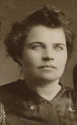
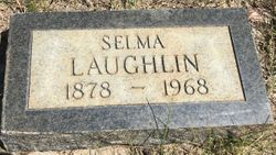
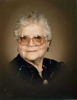
Selma Kanberg Laughlin
| Birth | : | 8 Nov 1878 Sweden |
| Death | : | 6 Sep 1968 Scobey, Daniels County, Montana, USA |
| Burial | : | Daniels County Cemetery, Scobey, Daniels County, USA |
| Coordinate | : | 48.7942009, -105.4421997 |
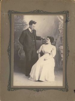
| Description | : | She was a daughter of Mr. and Mrs. Peter Kanberg. She came to the US with her parents in 1881. She married Henry Reider in 1899. he died in 1901. In 1905 she married George Laughlin in St. Paul, MN. They came to Montana in 1917. He died in 1929. She is survived by one daughter, Mrs. Florence Larson of Scobey; one stepdaughter, Mrs. Sarah Kerr of Stanleyville, Ontario, Canada; three sisters, Mrs. Myrtle Miller of Dutton, Mrs. Marie Drabbs of Hinsdale and Mrs. Emily Hohenadl of St. Paul, MN; 20 grandchildren, 46 great-grandchildren and 23 great great grandchildren. |
frequently asked questions (FAQ):
-
Where is Selma Kanberg Laughlin's memorial?
Selma Kanberg Laughlin's memorial is located at: Daniels County Cemetery, Scobey, Daniels County, USA.
-
When did Selma Kanberg Laughlin death?
Selma Kanberg Laughlin death on 6 Sep 1968 in Scobey, Daniels County, Montana, USA
-
Where are the coordinates of the Selma Kanberg Laughlin's memorial?
Latitude: 48.7942009
Longitude: -105.4421997
Family Members:
Spouse
Children
Flowers:
Nearby Cemetories:
1. Fairview Cemetery
Daniels County, USA
Coordinate: 48.6431007, -105.4972000
2. Saint Michaels Cemetery
Daniels County, USA
Coordinate: 48.9500008, -105.4244003
3. Orville Cemetery
Flaxville, Daniels County, USA
Coordinate: 48.7364006, -105.2016983
4. Flaxville Cemetery
Flaxville, Daniels County, USA
Coordinate: 48.8102989, -105.1697006
5. Whitetail Cemetery
Daniels County, USA
Coordinate: 48.8967018, -105.1477966
6. East Poplar Cemetery
Coronach, Assiniboia Census Division, Canada
Coordinate: 49.0649250, -105.3677700
7. West Fork Cemetery
Daniels County, USA
Coordinate: 48.6648000, -105.8567700
8. Buffalo Gap Cemetery
Buffalo Gap, Assiniboia Census Division, Canada
Coordinate: 49.0874100, -105.2777000
9. Coronach Cemetery
Coronach, Assiniboia Census Division, Canada
Coordinate: 49.1118600, -105.5017090
10. Pleasant Prairie Cemetery
Daniels County, USA
Coordinate: 48.5635986, -105.0871964
11. Mount Pleasant Cemetery
Coronach, Assiniboia Census Division, Canada
Coordinate: 49.1239380, -105.4126170
12. Valleyview Cemetery
Redstone, Sheridan County, USA
Coordinate: 48.8133011, -104.9356003
13. Saint John Lutheran Cemetery
Coronach, Assiniboia Census Division, Canada
Coordinate: 49.1308190, -105.6129560
14. Old Redstone Cemetery
Sheridan County, USA
Coordinate: 48.8306007, -104.9060974
15. Big Beaver Union Cemetery
Big Beaver, Weyburn Census Division, Canada
Coordinate: 49.0889460, -105.0563550
16. Berg Cemetery
Willow Bunch, Assiniboia Census Division, Canada
Coordinate: 49.1673810, -105.6112070
17. Faith Lutheran Cemetery
Sheridan County, USA
Coordinate: 48.6217003, -104.9039001
18. Archer Cemetery
Sheridan County, USA
Coordinate: 48.7811012, -104.8153000
19. Poplar Valley Cemetery
Rockglen, Assiniboia Census Division, Canada
Coordinate: 49.1012550, -105.8785270
20. Fife Lake Municipal Cemetery
Fife Lake, Assiniboia Census Division, Canada
Coordinate: 49.1742300, -105.7352760
21. Marshall Cemetery
Big Beaver, Weyburn Census Division, Canada
Coordinate: 49.0269260, -104.8803420
22. Highland Cemetery
Outlook, Sheridan County, USA
Coordinate: 48.8732986, -104.7755966
23. Christ the King Roman Catholic Cemetery
Fife Lake, Assiniboia Census Division, Canada
Coordinate: 49.2036630, -105.7281090
24. Volt Cemetery
Volt, Roosevelt County, USA
Coordinate: 48.3775000, -105.7160500


