

Sgt Doyt Lee Watson
| Birth | : | 30 Apr 1920 Salisbury, Rowan County, North Carolina, USA |
| Death | : | 23 Nov 1942 France |
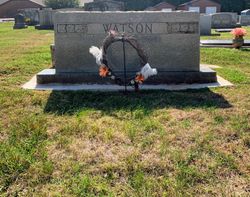
| Burial | : | Salem Lutheran Church Cemetery, Salisbury, Rowan County, USA |
| Coordinate | : | 35.6871986, -80.5721970 |
| Description | : | Watson was a waist gunner on B-17F #41-24503, nicknamed "Pandora's Box", assigned to the 8th Air Force, 91st Bombardment Group, 324th Bombardment Squadron. They were part of a ten plane formation on a mission to bomb the U-boat base at St Nazaire France. They came under attack from sixteen German FW 190 fighters when crossing the coast, and the attacks continued as they neared the target. Because of heavy damage, the pilot turned his plane towards the sea, accompanied by three other B-17s. They had two engines out so his plane couldn't keep up with the others or maintain altitude.... Read More |
frequently asked questions (FAQ):
-
Where is Sgt Doyt Lee Watson's memorial?
Sgt Doyt Lee Watson's memorial is located at: Salem Lutheran Church Cemetery, Salisbury, Rowan County, USA.
-
When did Sgt Doyt Lee Watson death?
Sgt Doyt Lee Watson death on 23 Nov 1942 in France
-
Where are the coordinates of the Sgt Doyt Lee Watson's memorial?
Latitude: 35.6871986
Longitude: -80.5721970
Family Members:
Parent

Siblings
Flowers:


Nearby Cemetories:
1. Salem Lutheran Church Cemetery
Salisbury, Rowan County, USA
Coordinate: 35.6871986, -80.5721970
2. Sherrills Ford Road Church Cemetery
Salisbury, Rowan County, USA
Coordinate: 35.6884308, -80.5954590
3. Saint Matthew's Episcopal Church Cemetery
Salisbury, Rowan County, USA
Coordinate: 35.7058983, -80.5554962
4. Saint Marks Lutheran Church Cemetery
Salisbury, Rowan County, USA
Coordinate: 35.6541670, -80.5822220
5. Enon Baptist Church Cemetery
Salisbury, Rowan County, USA
Coordinate: 35.7082291, -80.5275421
6. Millers Chapel A.M.E. Zion Church Cemetery
Salisbury, Rowan County, USA
Coordinate: 35.6383470, -80.5717460
7. Gloria Dei Lutheran Church Columbarium
Salisbury, Rowan County, USA
Coordinate: 35.6938358, -80.5110054
8. Owen Family Cemetery
Salisbury, Rowan County, USA
Coordinate: 35.6652985, -80.5159988
9. The Arbor United Methodist Church Cemetery
Salisbury, Rowan County, USA
Coordinate: 35.7356700, -80.5509200
10. Mount Zion Baptist Church
Mount Ulla, Rowan County, USA
Coordinate: 35.6712060, -80.6366480
11. Sacred Heart Roman Catholic Cemetery
Salisbury, Rowan County, USA
Coordinate: 35.7077500, -80.5074440
12. Ebenezer Methodist Church Cemetery
Mount Ulla, Rowan County, USA
Coordinate: 35.6930200, -80.6425900
13. Cedar Grove AME Zion Church Cemetery
Rowan County, USA
Coordinate: 35.7240520, -80.6270450
14. Oakwood Cemetery
Salisbury, Rowan County, USA
Coordinate: 35.6789040, -80.4985750
15. Thyatira Presbyterian Church Cemetery
Mill Bridge, Rowan County, USA
Coordinate: 35.6506310, -80.6371002
16. Salisbury National Cemetery Annex
Salisbury, Rowan County, USA
Coordinate: 35.6879710, -80.4912790
17. Oakdale Union Hill Cemetery
Salisbury, Rowan County, USA
Coordinate: 35.6763130, -80.4905630
18. Franklin Presbyterian Church Cemetery
Franklin, Rowan County, USA
Coordinate: 35.7246880, -80.5032580
19. Lebanon Lutheran Church Cemetery
Cleveland, Rowan County, USA
Coordinate: 35.7402300, -80.6266800
20. Rowan Memorial Park Cemetery
Salisbury, Rowan County, USA
Coordinate: 35.7178001, -80.4955978
21. Second Creek AME Zion - New Birth of Christ Church
Franklin Township, Rowan County, USA
Coordinate: 35.7461100, -80.5252800
22. Grace Lutheran Church Cemetery
China Grove, Rowan County, USA
Coordinate: 35.6180000, -80.5866900
23. Wilhelm Cemetery
Salisbury, Rowan County, USA
Coordinate: 35.6169900, -80.5855170
24. Bethel Lutheran Church Cemetery
Franklin, Rowan County, USA
Coordinate: 35.7212500, -80.4909410