Sgt Robert Lee Laucamp
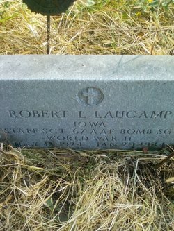
| Birth | : | 18 Jul 1924 Cedar County, Iowa, USA |
| Death | : | 29 Jan 1944 Germany |
| Burial | : | Napier Cemetery, Hohenwald, Lewis County, USA |
| Coordinate | : | 35.4403000, -87.4788971 |
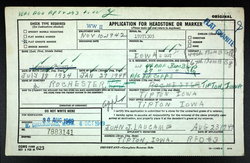
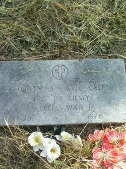
| Description | : | Muscatine Journal and News Tribune Monday February 14, 1944 page 3 Sgt. R. Laucamp, of near Tipton, Missing in War Tipton-Mr. and Mrs. John J. Laucamp of near Tipton received word from the secretary of war that their son, Staff Sgt. Robert L. Laucamp, has been reported missing in action since January 29 in Germany. Sgt. Laucamp is in the air corps. He was here on furlough last fall and attended memorial services for his friend, Lee Sterner, of Tipton, who was lost in a bombing mission over the Pacific. Muscatine Journal and News Tribune Thurs. March 2, 1944 page 14 Staff Sgt. Robert... Read More |
frequently asked questions (FAQ):
-
Where is Sgt Robert Lee Laucamp's memorial?
Sgt Robert Lee Laucamp's memorial is located at: Napier Cemetery, Hohenwald, Lewis County, USA.
-
When did Sgt Robert Lee Laucamp death?
Sgt Robert Lee Laucamp death on 29 Jan 1944 in Germany
-
Where are the coordinates of the Sgt Robert Lee Laucamp's memorial?
Latitude: 35.4403000
Longitude: -87.4788971
Family Members:
Parent
Siblings
Flowers:
Nearby Cemetories:
1. Napier Cemetery
Hohenwald, Lewis County, USA
Coordinate: 35.4403000, -87.4788971
2. Napier Cemetery
Lewis County, USA
Coordinate: 35.4367000, -87.4783000
3. Newtown Cemetery
Lewis County, USA
Coordinate: 35.4399986, -87.4906006
4. Pollock Cemetery
Lewis County, USA
Coordinate: 35.4672012, -87.5006027
5. Bailey Cemetery
Lewis County, USA
Coordinate: 35.4193993, -87.5152969
6. Collier Cemetery
Lewis County, USA
Coordinate: 35.4606018, -87.5171967
7. Dirtdobber Cemetery
Lewis County, USA
Coordinate: 35.4296989, -87.5327988
8. Laurel Hill Cemetery
Lawrence County, USA
Coordinate: 35.3939018, -87.5156021
9. Pope Cemetery
Lewis County, USA
Coordinate: 35.4646988, -87.5417023
10. Voorhies Cemetery
Lewis County, USA
Coordinate: 35.4413986, -87.5496979
11. Vinson Family Cemetery
Lawrenceburg, Lawrence County, USA
Coordinate: 35.3859000, -87.4542400
12. Davis Cemetery
Lewis County, USA
Coordinate: 35.4564018, -87.5483017
13. Himes Cemetery
Lewis County, USA
Coordinate: 35.4925003, -87.4443970
14. Brock Cemetery
Lawrence County, USA
Coordinate: 35.3892000, -87.4414000
15. Garland Cemetery
Lawrenceburg, Lawrence County, USA
Coordinate: 35.3763657, -87.4737473
16. Poore Cemetery
Lewis County, USA
Coordinate: 35.4874992, -87.5430984
17. Grinders Creek Cemetery
Lewis County, USA
Coordinate: 35.5099983, -87.4963989
18. Pioneer Cemetery
Hohenwald, Lewis County, USA
Coordinate: 35.5107994, -87.4606018
19. Brush Creek Cemetery
Lawrence County, USA
Coordinate: 35.3950005, -87.5531006
20. Grinders Creek Cemetery
Lewis County, USA
Coordinate: 35.4944000, -87.5438995
21. Payton Cemetery
Lewis County, USA
Coordinate: 35.4067001, -87.5653000
22. Henryville Cemetery
Henryville, Lawrence County, USA
Coordinate: 35.3955994, -87.3996964
23. Wright Cemetery
Lewis County, USA
Coordinate: 35.5208015, -87.4803009
24. Freedom Holy Temple Cemetery
Hohenwald, Lewis County, USA
Coordinate: 35.5015340, -87.5482810


