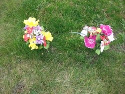
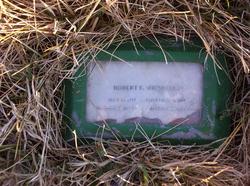
Sharlene A. Miller Shenefelt
| Birth | : | 21 Apr 1937 Nebraska, USA |
| Death | : | 24 Jun 2010 Eureka, Lincoln County, Montana, USA |
| Burial | : | Zion Methodist Church Cemetery, Rudolph, Haywood County, USA |
| Coordinate | : | 35.7033005, -89.2442017 |
| Description | : | EUREKA – Sharlene A. Shenefelt, 73, of Eureka, died Thursday, June 24, 2010, at Mountain View Manor in Eureka from natural causes. She was born April 21, 1937 in Omaha, Neb., to Benjamin and Latha Golden Miller. Survivors include her children Bill Lewis and wife Tina of Eureka, Deedee Voyles and husband Jim of Eureka, John Lewis of Shelby, Dale Shenefelt of Kalispell, Darrel Shenefelt and wife Roni of Kalispell, Rob Shenefelt and wife Tammy of Seattle, Steve Shenefelt and wife Kelly of Kalispell; 16 grandchildren and 12 great-grandchildren. Graveside services will be at 11 a.m. Wednesday, June 30, at Tobacco Valley... Read More |
frequently asked questions (FAQ):
-
Where is Sharlene A. Miller Shenefelt's memorial?
Sharlene A. Miller Shenefelt's memorial is located at: Zion Methodist Church Cemetery, Rudolph, Haywood County, USA.
-
When did Sharlene A. Miller Shenefelt death?
Sharlene A. Miller Shenefelt death on 24 Jun 2010 in Eureka, Lincoln County, Montana, USA
-
Where are the coordinates of the Sharlene A. Miller Shenefelt's memorial?
Latitude: 35.7033005
Longitude: -89.2442017
Family Members:
Spouse
Flowers:
Nearby Cemetories:
1. Zion Methodist Church Cemetery
Rudolph, Haywood County, USA
Coordinate: 35.7033005, -89.2442017
2. Zion United Methodist Church Cemetery
Brownsville, Haywood County, USA
Coordinate: 35.7033320, -89.2443350
3. Lower Salem Missionary Baptist Church Cemetery
Rudolph, Haywood County, USA
Coordinate: 35.7257390, -89.2638560
4. Hickory Grove Church Cemetery
Christmasville, Haywood County, USA
Coordinate: 35.6827150, -89.2934500
5. John Taylor Cemetery
Belle Eagle, Haywood County, USA
Coordinate: 35.6612000, -89.2124000
6. Hess Memorial Gardens
Belle Eagle, Haywood County, USA
Coordinate: 35.6522330, -89.2280190
7. Tabernacle Cemetery
Allens, Haywood County, USA
Coordinate: 35.6543990, -89.2074960
8. Johnson Family Cemetery
Johnsons Grove, Crockett County, USA
Coordinate: 35.7554260, -89.2085790
9. Taylor Cemetery
Allens, Haywood County, USA
Coordinate: 35.6527300, -89.2025980
10. Jennings Cemetery
Alamo, Crockett County, USA
Coordinate: 35.7684510, -89.2401620
11. Frank Varner Cemetery
Johnsons Grove, Crockett County, USA
Coordinate: 35.7638070, -89.2057050
12. Castellaw Cemetery
Johnsons Grove, Crockett County, USA
Coordinate: 35.7597900, -89.1964710
13. Wortham Chapel Cemetery
Haywood County, USA
Coordinate: 35.7155991, -89.1600037
14. Branch Cemetery
Frog Jump, Crockett County, USA
Coordinate: 35.7727540, -89.2383390
15. Moody Cemetery
Frog Jump, Crockett County, USA
Coordinate: 35.7716110, -89.2607500
16. Hughes Cemetery
Johnsons Grove, Crockett County, USA
Coordinate: 35.7708960, -89.2150330
17. White Cemetery
Johnsons Grove, Crockett County, USA
Coordinate: 35.7740020, -89.2676850
18. Buford Family Cemetery
Alamo, Crockett County, USA
Coordinate: 35.7612160, -89.1850940
19. Allen Church Cemetery
Allens, Haywood County, USA
Coordinate: 35.6423100, -89.1899890
20. Chapel Hill Missionary Baptist Church Cemetery
Shaw, Haywood County, USA
Coordinate: 35.7219570, -89.3363660
21. Lea Family Cemetery
Shaw, Haywood County, USA
Coordinate: 35.7128660, -89.3398910
22. Liberty Cemetery
Johnsons Grove, Crockett County, USA
Coordinate: 35.7635540, -89.1823900
23. Poston-Wyse Cemetery
Johnsons Grove, Crockett County, USA
Coordinate: 35.7769700, -89.2775020
24. Robertson Cemetery
Johnsons Grove, Crockett County, USA
Coordinate: 35.7578011, -89.1735992


