| Birth | : | 8 Dec 1930 Lexington, Dawson County, Nebraska, USA |
| Death | : | 22 Aug 2021 Lexington, Dawson County, Nebraska, USA |
| Burial | : | Hillside Cemetery, Dawson County, USA |
| Coordinate | : | 40.8946991, -99.7869034 |
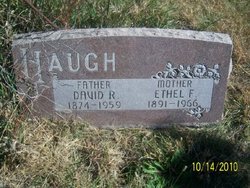
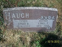
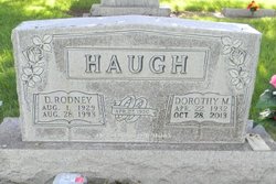
| Description | : | Shirley Mae Heine, 90 of Cozad, passed away Sunday, August 22, 2021 in Lexington. Shirley Mae (Haugh) Heine was born in Lexington, Nebraska on December 8, 1930 to David Rodney Haugh and Ethel Frances (Derby) Haugh. She grew up on the family farm 12 miles northwest of Lexington and attended rural school District #16 through 8th grade. She graduated from Cozad High with the class of 1948. Upon graduation, she received her Nebraska Teaching Certificate. Shirley gave her life to Christ and was baptized at the age of 12 at the Christian Church in Cozad, Nebraska. It was... Read More |
frequently asked questions (FAQ):
-
Where is Shirley Mae Haugh Heine's memorial?
Shirley Mae Haugh Heine's memorial is located at: Hillside Cemetery, Dawson County, USA.
-
When did Shirley Mae Haugh Heine death?
Shirley Mae Haugh Heine death on 22 Aug 2021 in Lexington, Dawson County, Nebraska, USA
-
Where are the coordinates of the Shirley Mae Haugh Heine's memorial?
Latitude: 40.8946991
Longitude: -99.7869034
Family Members:
Parent
Spouse
Siblings
Flowers:
Nearby Cemetories:
1. Hillside Cemetery
Dawson County, USA
Coordinate: 40.8946991, -99.7869034
2. Hewitt Cemetery
Lexington, Dawson County, USA
Coordinate: 40.8588982, -99.7769012
3. Buffalo Grove Presbyterian Church Cemetery
Buffalo, Dawson County, USA
Coordinate: 40.8721000, -99.8270000
4. Saint Johns Lutheran Cemetery
Lexington, Dawson County, USA
Coordinate: 40.9019012, -99.8458023
5. Grace Cemetery
Cozad, Dawson County, USA
Coordinate: 40.8602982, -99.8644028
6. Rose Hill Cemetery
Dawson County, USA
Coordinate: 40.9888992, -99.8442001
7. Cottonwood Cemetery
Dawson County, USA
Coordinate: 40.9322014, -99.9197006
8. Mount Hope Cemetery
Dawson County, USA
Coordinate: 40.8293991, -99.6733017
9. Greenwood Cemetery
Lexington, Dawson County, USA
Coordinate: 40.7956467, -99.7286682
10. Rhinehart Cemetery
Cozad, Dawson County, USA
Coordinate: 40.9599000, -99.9105000
11. Buffalo First Lutheran Cemetery Old
Buffalo, Dawson County, USA
Coordinate: 41.0100000, -99.8152000
12. First United Methodist Church Columbarium
Lexington, Dawson County, USA
Coordinate: 40.7810000, -99.7397000
13. Buffalo First Lutheran Cemetery New
Buffalo, Dawson County, USA
Coordinate: 41.0127000, -99.8150000
14. Cozad Cemetery
Cozad, Dawson County, USA
Coordinate: 40.8605995, -99.9475021
15. Saint Anns Cemetery
Lexington, Dawson County, USA
Coordinate: 40.7789001, -99.7114029
16. Evergreen Cemetery
Lexington, Dawson County, USA
Coordinate: 40.7639008, -99.6791992
17. Saint Patricks Cemetery
Eddyville, Dawson County, USA
Coordinate: 40.9747009, -99.6093979
18. Walnut Grove Cemetery
Cozad, Dawson County, USA
Coordinate: 40.9763985, -99.9944000
19. Jewell Cemetery
Sumner, Dawson County, USA
Coordinate: 40.9599991, -99.5646973
20. Block Cemetery
Cozad, Dawson County, USA
Coordinate: 40.9753000, -100.0085000
21. Viola Cemetery
Oconto, Custer County, USA
Coordinate: 41.0697980, -99.7036750
22. Christ Lutheran Cemetery
Oconto, Custer County, USA
Coordinate: 41.0759000, -99.8560000
23. Fairview Cemetery
Dawson County, USA
Coordinate: 40.7719002, -99.9955978
24. Willow Island Cemetery
Cozad, Dawson County, USA
Coordinate: 40.9016991, -100.0755997


