Shirley Stout Pond
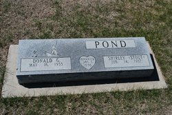
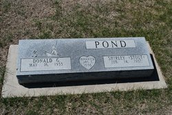
| Birth | : | 14 Feb 1937 Oxford, Harlan County, Nebraska, USA |
| Death | : | 15 Jun 2013 Cambridge, Furnas County, Nebraska, USA |
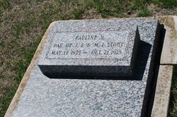
| Burial | : | Oxford Cemetery, Oxford, Harlan County, USA |
| Coordinate | : | 40.2580986, -99.6121979 |
| Inscription | : | MARRIED JAN 7, 1956 |
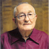
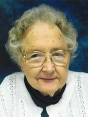
| Description | : | Shirley Pond, age 76, of Holbrook, died at the Cambridge Memorial Hospital in Cambridge on June 15, 2013. She was born Shirley Ann Valentine Stout on February 14, 1937 to Joseph and Mable (Fritzen) Stout at Oxford, Nebraska. Shirley attended and graduated from Oxford High School in 1955. On January 8, 1956 she was united in marriage to Donald G. Pond. The couple lived in McCook, Nebraska from 1959 till 1974. During this time Don and Shirley worked as house parents for SWATS group home caring for 18 men from 18 to 56 years of age. ... Read More |
frequently asked questions (FAQ):
-
Where is Shirley Stout Pond's memorial?
Shirley Stout Pond's memorial is located at: Oxford Cemetery, Oxford, Harlan County, USA.
-
When did Shirley Stout Pond death?
Shirley Stout Pond death on 15 Jun 2013 in Cambridge, Furnas County, Nebraska, USA
-
Where are the coordinates of the Shirley Stout Pond's memorial?
Latitude: 40.2580986
Longitude: -99.6121979
Family Members:
Parent
Spouse
Siblings
Flowers:
Nearby Cemetories:
1. Oxford Cemetery
Oxford, Harlan County, USA
Coordinate: 40.2580986, -99.6121979
2. Spring Grove Cemetery
Mascot, Harlan County, USA
Coordinate: 40.2775002, -99.5582962
3. Kellner Cemetery
Oxford, Furnas County, USA
Coordinate: 40.3215000, -99.6311000
4. Carter Cemetery
Orleans, Harlan County, USA
Coordinate: 40.2058000, -99.5143500
5. Sasse Cemetery
Orleans, Harlan County, USA
Coordinate: 40.1764900, -99.5545200
6. Homfeld Family Cemetery
Orleans, Harlan County, USA
Coordinate: 40.1658300, -99.5372300
7. Stamford Cemetery
Stamford, Harlan County, USA
Coordinate: 40.1469002, -99.5931015
8. Lennemann Cemetery
Orleans, Harlan County, USA
Coordinate: 40.1757800, -99.4988700
9. Highland Union Cemetery
Gosper County, USA
Coordinate: 40.3513990, -99.7172360
10. Edison Cemetery
Edison, Furnas County, USA
Coordinate: 40.2919006, -99.7902985
11. Union Cemetery
Beaver City, Furnas County, USA
Coordinate: 40.1469002, -99.7247009
12. Stump Cemetery
Furnas County, USA
Coordinate: 40.3478012, -99.7621994
13. Deaver Cemetery
Precept, Furnas County, USA
Coordinate: 40.1030998, -99.6489029
14. Zion Cemetery
Gosper County, USA
Coordinate: 40.4085999, -99.7005997
15. Shaw Cemetery
Phelps County, USA
Coordinate: 40.4303017, -99.5781021
16. Calvary Cemetery
Orleans, Harlan County, USA
Coordinate: 40.1377983, -99.4421997
17. Orleans Cemetery
Orleans, Harlan County, USA
Coordinate: 40.1330000, -99.4436700
18. Pleasant Hill Cemetery
Stamford, Harlan County, USA
Coordinate: 40.0730200, -99.6293800
19. Hoyt Cemetery
Orleans, Harlan County, USA
Coordinate: 40.1330190, -99.4316340
20. Industry Cemetery
Atlanta, Phelps County, USA
Coordinate: 40.4071999, -99.4419022
21. German Lutheran Cemetery
Harlan County, USA
Coordinate: 40.0461006, -99.5532990
22. Garfield Cemetery
Furnas County, USA
Coordinate: 40.2491989, -99.8992004
23. Mount Hope Cemetery
Beaver City, Furnas County, USA
Coordinate: 40.1333008, -99.8518982
24. Arapahoe Cemetery
Arapahoe, Furnas County, USA
Coordinate: 40.3239600, -99.8985500

