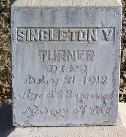
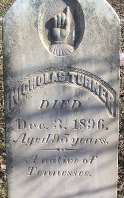
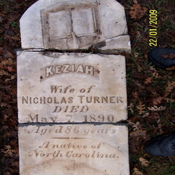
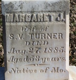
Singleton Vaughn Turner
| Birth | : | Dec 1829 Lafayette County, Missouri, USA |
| Death | : | 21 Jul 1913 Raymond, Madera County, California, USA |
| Burial | : | Collis Cemetery, Little Switzerland, Mitchell County, USA |
| Coordinate | : | 35.8628006, -82.1117020 |
| Description | : | According to Michael Elaine Salisbury: "His middle name is given in the California Voters Registers of 1888 and 1890. Normally I wouldn't put a lot of faith in the 1900 Census, but in this case all six members of his family that are listed are spot on with their months and years of birth. He was 83 when he died in July 1913. Doing the math fits with a birth of December 1829. (Fun fact: I've heard that he farmed and kept an orchard on the Yosemite Valley floor to provide for the increasing numbers of travellers there.)" |
frequently asked questions (FAQ):
-
Where is Singleton Vaughn Turner's memorial?
Singleton Vaughn Turner's memorial is located at: Collis Cemetery, Little Switzerland, Mitchell County, USA.
-
When did Singleton Vaughn Turner death?
Singleton Vaughn Turner death on 21 Jul 1913 in Raymond, Madera County, California, USA
-
Where are the coordinates of the Singleton Vaughn Turner's memorial?
Latitude: 35.8628006
Longitude: -82.1117020
Family Members:
Parent
Spouse
Siblings
Children
Nearby Cemetories:
1. Collis Cemetery
Little Switzerland, Mitchell County, USA
Coordinate: 35.8628006, -82.1117020
2. Burnett Cemetery
Little Switzerland, Mitchell County, USA
Coordinate: 35.8560982, -82.1035995
3. Boyd Cemetery
Mitchell County, USA
Coordinate: 35.8444260, -82.1151260
4. Church of the Resurrection Memory Garden
Little Switzerland, Mitchell County, USA
Coordinate: 35.8508333, -82.0905556
5. Buchanan Burial Ground
Little Switzerland, Mitchell County, USA
Coordinate: 35.8496080, -82.0910990
6. Stafford Cemetery
Mitchell County, USA
Coordinate: 35.8950005, -82.1207962
7. Fairview Baptist Church Cemetery
Celo, Yancey County, USA
Coordinate: 35.8549900, -82.1547700
8. McHone Cemetery
Mitchell County, USA
Coordinate: 35.8974991, -82.0892029
9. Liberty Hill Baptist Church Cemetery
Spruce Pine, Mitchell County, USA
Coordinate: 35.9007600, -82.1272000
10. Silvers Cemetery
Mitchell County, USA
Coordinate: 35.9042015, -82.1121979
11. Hollifield Cemetery
McDowell County, USA
Coordinate: 35.8280983, -82.0777969
12. Greenlee Memorial Cemetery
Grassy Creek, Mitchell County, USA
Coordinate: 35.8831700, -82.0596700
13. Cox Cemetery
Mitchell County, USA
Coordinate: 35.9039001, -82.1402969
14. Grassy Creek Baptist Church Cemetery
Grassy Creek, Mitchell County, USA
Coordinate: 35.8813700, -82.0542130
15. Ballew Cemetery
Yancey County, USA
Coordinate: 35.8344002, -82.1635971
16. Spruce Pine Memorial Cemetery
Spruce Pine, Mitchell County, USA
Coordinate: 35.9035988, -82.0730972
17. James Fox Cemetery
Celo, Yancey County, USA
Coordinate: 35.8643700, -82.1759100
18. Grassy Creek Memorial Cemetery
Grassy Creek, Mitchell County, USA
Coordinate: 35.8648220, -82.0451030
19. Tolley Cemetery
Spruce Pine, Mitchell County, USA
Coordinate: 35.9113998, -82.0824966
20. Berry Chapel Baptist Cemetery
Spruce Pine, Mitchell County, USA
Coordinate: 35.9065422, -82.0622739
21. Latter Day Saints Church Cemetery
McDowell County, USA
Coordinate: 35.8119910, -82.0704180
22. Liberty Chapel Church Cemetery
Celo, Yancey County, USA
Coordinate: 35.8553100, -82.1866700
23. Bailey Cemetery
Penland, Mitchell County, USA
Coordinate: 35.9247017, -82.1050034
24. Bracher Cemetery
Yancey County, USA
Coordinate: 35.8074989, -82.1489029

