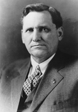
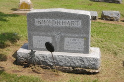
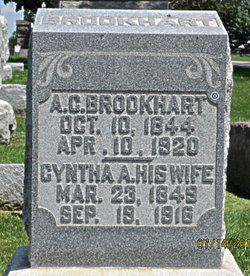
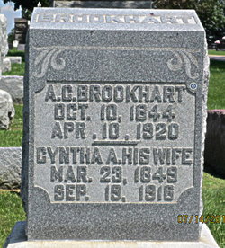
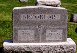
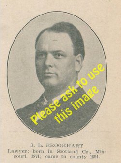
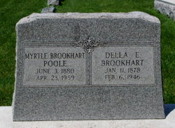
Smith Wildman Brookhart Famous memorial
| Birth | : | 2 Feb 1869 Arbela, Scotland County, Missouri, USA |
| Death | : | 15 Nov 1944 Whipple, Yavapai County, Arizona, USA |
| Burial | : | El Carmelo Cemetery, Pacific Grove, Monterey County, USA |
| Coordinate | : | 36.6325836, -121.9319763 |
| Description | : | US Senator. He was educated at Southern Iowa Normal School with an emphasis in scientific courses. For five years he taught school while also reading the law. He was admitted to the bar in 1892 and began practice in Washington Co, Iowa, serving six years as county attorney. He served in the U.S. Army during the Spanish American War and World War I, where he reached the rank of lieutenant colonel and was renowned for his marksmanship with a rifle. He was twice elected to represent Iowa in the United States Senate, in 1922 and in 1926.... Read More |
frequently asked questions (FAQ):
-
Where is Smith Wildman Brookhart Famous memorial's memorial?
Smith Wildman Brookhart Famous memorial's memorial is located at: El Carmelo Cemetery, Pacific Grove, Monterey County, USA.
-
When did Smith Wildman Brookhart Famous memorial death?
Smith Wildman Brookhart Famous memorial death on 15 Nov 1944 in Whipple, Yavapai County, Arizona, USA
-
Where are the coordinates of the Smith Wildman Brookhart Famous memorial's memorial?
Latitude: 36.6325836
Longitude: -121.9319763
Family Members:
Parent
Spouse
Siblings
Children
Flowers:
Nearby Cemetories:
1. El Carmelo Cemetery
Pacific Grove, Monterey County, USA
Coordinate: 36.6325836, -121.9319763
2. Saint Mary's Episcopal Church Leslie Garden
Pacific Grove, Monterey County, USA
Coordinate: 36.6211200, -121.9145800
3. Steinbeck Estate Burial Site
Pacific Grove, Monterey County, USA
Coordinate: 36.6197319, -121.9080276
4. Presidio of Monterey Cemetery
Monterey, Monterey County, USA
Coordinate: 36.6058006, -121.9151306
5. Alexis Nino Burial Site
Monterey, Monterey County, USA
Coordinate: 36.6055565, -121.8955307
6. Mission San Carlos Cemetery
Monterey, Monterey County, USA
Coordinate: 36.5956078, -121.8904190
7. San Carlos Cemetery
Monterey, Monterey County, USA
Coordinate: 36.5951881, -121.8871460
8. Monterey City Cemetery
Monterey, Monterey County, USA
Coordinate: 36.5954475, -121.8845215
9. City of Carmel Memorials
Carmel-by-the-Sea, Monterey County, USA
Coordinate: 36.5552979, -121.9203339
10. Mission Memorial Park
Seaside, Monterey County, USA
Coordinate: 36.6191635, -121.8217926
11. Carmel Mission Cemetery
Carmel-by-the-Sea, Monterey County, USA
Coordinate: 36.5430603, -121.9199600
12. California Central Coast Veterans Cemetery
Seaside, Monterey County, USA
Coordinate: 36.6371900, -121.7963600
13. Carmelite Monastery Cemetery
Monterey, Monterey County, USA
Coordinate: 36.5231400, -121.9232635
14. Saint Dunstans Episcopal Church Columbarium
Carmel Valley, Monterey County, USA
Coordinate: 36.5197330, -121.8059160
15. Whitcher Cemetery
East Garrison, Monterey County, USA
Coordinate: 36.6501730, -121.7305270
16. Church of the Good Shepherd Cemetery
Salinas, Monterey County, USA
Coordinate: 36.5413990, -121.7260410
17. Castroville Public Cemetery
Moss Landing, Monterey County, USA
Coordinate: 36.7930145, -121.7851410
18. Calvary Catholic Cemetery
Salinas, Monterey County, USA
Coordinate: 36.6880341, -121.6818085
19. Saint Pauls Episcopal Church Columbarium
Salinas, Monterey County, USA
Coordinate: 36.6588430, -121.6558850
20. Stephen Norriss Gravesite
Monterey County, USA
Coordinate: 36.8214110, -121.7601080
21. Garden of Memories
Salinas, Monterey County, USA
Coordinate: 36.6565247, -121.6384125
22. Santa Rita Chapel and Cemetery
Salinas, Monterey County, USA
Coordinate: 36.7281303, -121.6565475
23. Saint Georges Episcopal Church Columbarium
Salinas, Monterey County, USA
Coordinate: 36.7062580, -121.6440980
24. Yamato Cemetery
Salinas, Monterey County, USA
Coordinate: 36.6552811, -121.6307297

