
| Birth | : | 27 May 1920 Buffalo Gap, Custer County, South Dakota, USA |
| Death | : | 5 Sep 2014 Hot Springs, Fall River County, South Dakota, USA |
| Burial | : | Black Hills National Cemetery, Sturgis, Meade County, USA |
| Coordinate | : | 44.3689003, -103.4753036 |
| Plot | : | Col_A,Row_G,Site_149 |
| Inscription | : | S SGT WOMEN'S ARMY CORPS WORLD WAR II |
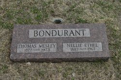
| Description | : | Helen Marie Brandt, age 94, of Hot Springs, SD, passed away September 5, 2014, at the VA Medical Center in Hot Springs. Helen was born May 27, 1920, in Buffalo Gap, SD, to Thomas W. and Nellie E. (Streeter) Bondurant. She served in the U.S. Army from September 1, 1943, until her honorable discharge on November 2, 1945. Helen is survived by her husband of Hot Springs;2 sons and 1 daughter,1 sister, eight grandchildren and five great grandchildren. Arrangements are pending. Contact http://www.mccolleyschapels.com/fh/home/home.cfm?fh_id=13288 For survivors |
frequently asked questions (FAQ):
-
Where is SSGT Helen Marie Bondurant Brandt's memorial?
SSGT Helen Marie Bondurant Brandt's memorial is located at: Black Hills National Cemetery, Sturgis, Meade County, USA.
-
When did SSGT Helen Marie Bondurant Brandt death?
SSGT Helen Marie Bondurant Brandt death on 5 Sep 2014 in Hot Springs, Fall River County, South Dakota, USA
-
Where are the coordinates of the SSGT Helen Marie Bondurant Brandt's memorial?
Latitude: 44.3689003
Longitude: -103.4753036
Family Members:
Parent

Spouse

Siblings

Flowers:


Nearby Cemetories:
1. Black Hills National Cemetery
Sturgis, Meade County, USA
Coordinate: 44.3689003, -103.4753036
2. Curley Grimes Memorial Cemetery
Sturgis, Meade County, USA
Coordinate: 44.3764500, -103.4691300
3. Fort Meade National Cemetery
Sturgis, Meade County, USA
Coordinate: 44.4021988, -103.4757996
4. Bear Butte Cemetery
Sturgis, Meade County, USA
Coordinate: 44.4111595, -103.4947968
5. Saint Aloysius Cemetery
Sturgis, Meade County, USA
Coordinate: 44.4141340, -103.5193420
6. Pleasant Valley Cemetery
Tilford, Meade County, USA
Coordinate: 44.3192500, -103.3531160
7. Galena Cemetery
Galena, Lawrence County, USA
Coordinate: 44.3349220, -103.6438410
8. Crook City Cemetery
Crook City, Lawrence County, USA
Coordinate: 44.4432100, -103.6241500
9. Piedmont Cemetery
Piedmont, Meade County, USA
Coordinate: 44.2425780, -103.3871730
10. Oak Ridge Cemetery
Deadwood, Lawrence County, USA
Coordinate: 44.3891983, -103.6766968
11. Whitewood Cemetery
Whitewood, Lawrence County, USA
Coordinate: 44.4617820, -103.6330030
12. Roubaix Cemetery
Roubaix, Lawrence County, USA
Coordinate: 44.2789380, -103.6656600
13. Mount Moriah Cemetery
Deadwood, Lawrence County, USA
Coordinate: 44.3760986, -103.7253036
14. Saint Ambrose Cemetery
Deadwood, Lawrence County, USA
Coordinate: 44.3821983, -103.7266998
15. Nemo Cemetery
Nemo, Lawrence County, USA
Coordinate: 44.1872800, -103.5066410
16. Anderson Cemetery
Lawrence County, USA
Coordinate: 44.4747009, -103.6896973
17. South Lead Cemetery
Lead, Lawrence County, USA
Coordinate: 44.3478510, -103.7606260
18. Little Dane Cemetery
Saint Onge, Lawrence County, USA
Coordinate: 44.5252500, -103.6705540
19. Mountain Meadow Cemetery
Lawrence County, USA
Coordinate: 44.2038994, -103.6557999
20. West Lead Cemetery
Lead, Lawrence County, USA
Coordinate: 44.3484001, -103.7779999
21. Gate of Heaven Cemetery
Saint Onge, Lawrence County, USA
Coordinate: 44.5353000, -103.7237000
22. Terry Cemetery
Terry, Lawrence County, USA
Coordinate: 44.3344290, -103.8165110
23. Vale Cemetery
Vale, Butte County, USA
Coordinate: 44.6138992, -103.4052963
24. Holy Cross Cemetery
Englewood, Lawrence County, USA
Coordinate: 44.2818985, -103.8047028