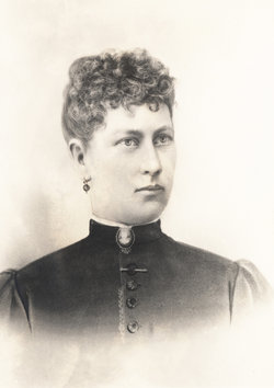
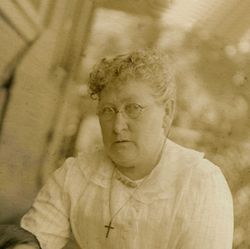
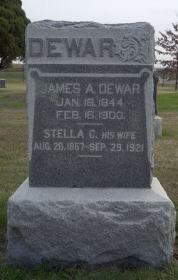
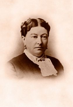
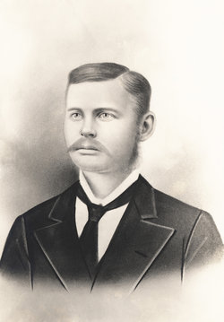
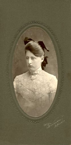
Stella Cora Conley Dewar
| Birth | : | 20 Aug 1857 Madison, Dane County, Wisconsin, USA |
| Death | : | 29 Sep 1921 Stockton, San Joaquin County, California, USA |
| Burial | : | Cochran Cemetery, Onoto, Pocahontas County, USA |
| Coordinate | : | 38.2721080, -80.1267030 |
| Plot | : | Section: SS Lot: 134 Space: 2 |
| Description | : | Stella died while she was a patient at the California State Hospital, the state's first insane asylum. Why she left Kansas and went to California and was shortly thereafter committed to the State Hospital remains a family mystery. |
frequently asked questions (FAQ):
-
Where is Stella Cora Conley Dewar's memorial?
Stella Cora Conley Dewar's memorial is located at: Cochran Cemetery, Onoto, Pocahontas County, USA.
-
When did Stella Cora Conley Dewar death?
Stella Cora Conley Dewar death on 29 Sep 1921 in Stockton, San Joaquin County, California, USA
-
Where are the coordinates of the Stella Cora Conley Dewar's memorial?
Latitude: 38.2721080
Longitude: -80.1267030
Family Members:
Parent
Spouse
Siblings
Children
Flowers:
Nearby Cemetories:
1. Cochran Cemetery
Onoto, Pocahontas County, USA
Coordinate: 38.2721080, -80.1267030
2. Gay Cemetery
Edray, Pocahontas County, USA
Coordinate: 38.2768660, -80.0963400
3. Beverage Cemetery
Onoto, Pocahontas County, USA
Coordinate: 38.2447180, -80.1375780
4. Whites Chapel United Methodist Church Cemetery
Woodrow, Pocahontas County, USA
Coordinate: 38.2797630, -80.1633310
5. Sharp Family Cemetery
Marlinton, Pocahontas County, USA
Coordinate: 38.2456440, -80.1060940
6. Gay Cemetery
Marlinton, Pocahontas County, USA
Coordinate: 38.2892685, -80.0795517
7. Mount Pleasant Cemetery
Marlinton, Pocahontas County, USA
Coordinate: 38.2816750, -80.0747760
8. Campbelltown Gay Cemetery
Campbelltown, Pocahontas County, USA
Coordinate: 38.2401580, -80.0912230
9. Brownsburg Cemetery
Marlinton, Pocahontas County, USA
Coordinate: 38.2599800, -80.0737610
10. McKenney Family Cemetery
Marlinton, Pocahontas County, USA
Coordinate: 38.2401200, -80.0864541
11. Wilfong Cemetery
Marlinton, Pocahontas County, USA
Coordinate: 38.2515920, -80.0629000
12. Marlin's Bottom Confederate Cemetery
Marlinton, Pocahontas County, USA
Coordinate: 38.2210200, -80.1004210
13. Alta Price Cemetery
Marlinton, Pocahontas County, USA
Coordinate: 38.2169770, -80.0909510
14. McLaughlin Cemetery
Marlinton, Pocahontas County, USA
Coordinate: 38.2167390, -80.0865550
15. Kee Cemetery
Buckeye, Pocahontas County, USA
Coordinate: 38.2058720, -80.1231310
16. Mountain View Cemetery
Marlinton, Pocahontas County, USA
Coordinate: 38.2141991, -80.0800018
17. William Sharp, Jr. Cemetery
Pocahontas County, USA
Coordinate: 38.2925960, -80.0429690
18. William Folks Burial Site
Monterville, Randolph County, USA
Coordinate: 38.3100000, -80.0500000
19. Fairview Cemetery
Marlinton, Pocahontas County, USA
Coordinate: 38.2816280, -80.0259560
20. Buckeye Cemetery
Buckeye, Pocahontas County, USA
Coordinate: 38.1823840, -80.1342550
21. Hannah Cemetery
Pocahontas County, USA
Coordinate: 38.3636017, -80.1200027
22. Gibson Cemetery
Slaty Fork, Pocahontas County, USA
Coordinate: 38.3678017, -80.1128006
23. Isaac Bender Gravesite
Cleveland, Webster County, USA
Coordinate: 38.3310000, -80.2249000
24. Corso Cemetery
Pocahontas County, USA
Coordinate: 38.3129712, -80.0063618

