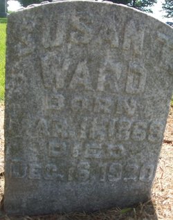
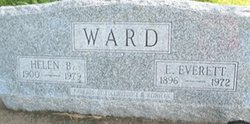
Susan Sanger Ward
| Birth | : | 11 Mar 1869 Springdale, Cedar County, Iowa, USA |
| Death | : | 16 Dec 1920 West Liberty, Muscatine County, Iowa, USA |
| Burial | : | Springdale Cemetery, Springdale, Cedar County, USA |
| Coordinate | : | 41.6786003, -91.2581024 |
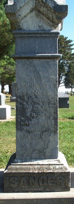
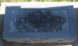
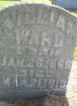
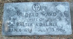
| Description | : | The Muscatine (Iowa) Journal and News Tribune Wednesday, 22 December 1920, page 9 IN MEMORIAM West Liberty, Ia., Dec. 22. – Susan T. Sanger was born near Springdale, Cedar county, on March 11, 1859, and passed away December 16, 1920. On February 8, 1893, she was united in marriage to William Ward of Marshfield, Wis. Mr. and Mrs. Ward resided in Wisconsin about two years and then came to Cedar county. Three children were born, all of whom survive – Mildred, Everett and Russell. Mr. Ward was killed in a railroad wreck in March, 1910. Shortly... Read More |
frequently asked questions (FAQ):
-
Where is Susan Sanger Ward's memorial?
Susan Sanger Ward's memorial is located at: Springdale Cemetery, Springdale, Cedar County, USA.
-
When did Susan Sanger Ward death?
Susan Sanger Ward death on 16 Dec 1920 in West Liberty, Muscatine County, Iowa, USA
-
Where are the coordinates of the Susan Sanger Ward's memorial?
Latitude: 41.6786003
Longitude: -91.2581024
Family Members:
Parent
Spouse
Siblings
Children
Flowers:
Nearby Cemetories:
1. Springdale Cemetery
Springdale, Cedar County, USA
Coordinate: 41.6786003, -91.2581024
2. North Liberty Cemetery
Springdale, Cedar County, USA
Coordinate: 41.6852989, -91.2292023
3. Pee Dee Cemetery
Cedar County, USA
Coordinate: 41.6699982, -91.2142029
4. Hickory Grove Cemetery
Cedar County, USA
Coordinate: 41.6637000, -91.3073000
5. Chamness Burial Plot
Springdale, Cedar County, USA
Coordinate: 41.6597351, -91.3182108
6. Saint Joseph Cemetery
Cedar Valley, Cedar County, USA
Coordinate: 41.7295000, -91.2667000
7. Burnett Burial Site
Rochester, Cedar County, USA
Coordinate: 41.6680782, -91.1834911
8. Saint Bernadette Catholic Church
West Branch, Cedar County, USA
Coordinate: 41.6755750, -91.3396070
9. Honey Grove Cemetery
Cedar County, USA
Coordinate: 41.7158012, -91.3266983
10. Friends Village Cemetery
West Branch, Cedar County, USA
Coordinate: 41.6732000, -91.3470000
11. West Branch Cemetery
West Branch, Cedar County, USA
Coordinate: 41.6765000, -91.3515000
12. Herbert Hoover National Historic Site
West Branch, Cedar County, USA
Coordinate: 41.6681500, -91.3519900
13. Howard Cemetery
Plato, Cedar County, USA
Coordinate: 41.7486303, -91.2918299
14. Dunfee Burial Site
Rochester, Cedar County, USA
Coordinate: 41.6266900, -91.1834904
15. Downey Cemetery
Downey, Cedar County, USA
Coordinate: 41.6119003, -91.3182983
16. Mount Zion Church Cemetery
Cedar County, USA
Coordinate: 41.7343000, -91.1790000
17. West Bethel Cemetery
Cedar County, USA
Coordinate: 41.6502991, -91.1556015
18. United Brethren Cemetery
Cedar County, USA
Coordinate: 41.7445000, -91.3285000
19. North Prairie Cemetery
West Liberty, Muscatine County, USA
Coordinate: 41.5924988, -91.2694016
20. Goodale Cemetery
Tipton, Cedar County, USA
Coordinate: 41.7219380, -91.1567400
21. Woodbridge Cemetery
Buchanan, Cedar County, USA
Coordinate: 41.7644005, -91.2294006
22. Rochester Cemetery
Rochester, Cedar County, USA
Coordinate: 41.6656200, -91.1395800
23. Kizer-Burns Cemetery
Tipton, Cedar County, USA
Coordinate: 41.7559130, -91.1854800
24. Oasis Cemetery
Oasis, Johnson County, USA
Coordinate: 41.7005997, -91.3858032

