Syntha Ann Stark Dykes
| Birth | : | 11 Jan 1858 Appanoose County, Iowa, USA |
| Death | : | 15 May 1939 Appanoose County, Iowa, USA |
| Burial | : | Wortham Chapel Cemetery, Haywood County, USA |
| Coordinate | : | 35.7155991, -89.1600037 |
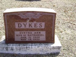
| Inscription | : | DYKES SYNTHA ANN WIFE OF NATHANIEL Jan 11, 1858 May 15, 1939 |
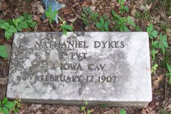
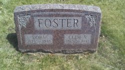
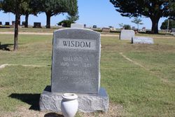
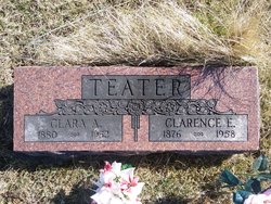
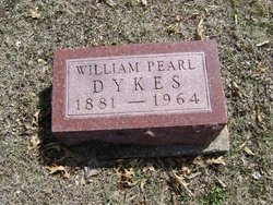
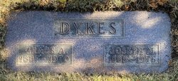
| Description | : | Syntha Ann Stark was born in Appanoose County, Iowa on Jan. 11, 1858. She was a daughter of William Nelson and Nancy Jane [Baker] Stark. They were early settlers of this county, from Indiana. She had three sisters and one brother - Emaline, Mary, Angeletta and Caleb Stark. Syntha married Nathaniel Dykes 31 Oct 1874 in Appanoose County. They had eleven children. Nathaniel died in 1907 leaving Syntha a widow for 32 years. Their children: Mary Eldora "Dora" Dykes Foster 1876 – 1948 Martha "Anna" Dykes Wisdom 1877 – 1954 Clara Alice Dykes Teater 1880 – 1952 William Pearl Dykes 1881 – 1964 Laura Myrtle Dykes... Read More |
frequently asked questions (FAQ):
-
Where is Syntha Ann Stark Dykes's memorial?
Syntha Ann Stark Dykes's memorial is located at: Wortham Chapel Cemetery, Haywood County, USA.
-
When did Syntha Ann Stark Dykes death?
Syntha Ann Stark Dykes death on 15 May 1939 in Appanoose County, Iowa, USA
-
Where are the coordinates of the Syntha Ann Stark Dykes's memorial?
Latitude: 35.7155991
Longitude: -89.1600037
Family Members:
Parent
Spouse
Siblings
Children
Nearby Cemetories:
1. Wortham Chapel Cemetery
Haywood County, USA
Coordinate: 35.7155991, -89.1600037
2. Bridger Family Cemetery
Crossroads, Crockett County, USA
Coordinate: 35.7364450, -89.1329660
3. Cross Road Cemetery
Crossroads, Crockett County, USA
Coordinate: 35.7434010, -89.1326790
4. Robertson Cemetery
Johnsons Grove, Crockett County, USA
Coordinate: 35.7578011, -89.1735992
5. Jones Crossing Cemetery
Jones, Haywood County, USA
Coordinate: 35.6745180, -89.1373870
6. Edwards Cemetery
Johnsons Grove, Crockett County, USA
Coordinate: 35.7627700, -89.1724300
7. Antioch Jones M.B. Church Cemetery
Haywood County, USA
Coordinate: 35.6677950, -89.1472410
8. Buford Family Cemetery
Alamo, Crockett County, USA
Coordinate: 35.7612160, -89.1850940
9. Lowery Cemetery
Bells, Crockett County, USA
Coordinate: 35.7217880, -89.0978970
10. Liberty Cemetery
Johnsons Grove, Crockett County, USA
Coordinate: 35.7635540, -89.1823900
11. Norville Cemetery
Alamo, Crockett County, USA
Coordinate: 35.7618900, -89.1326900
12. Old Liberty Cemetery
Johnsons Grove, Crockett County, USA
Coordinate: 35.7645470, -89.1824440
13. Castellaw Cemetery
Johnsons Grove, Crockett County, USA
Coordinate: 35.7597900, -89.1964710
14. Bell Family Cemetery
Bells, Crockett County, USA
Coordinate: 35.7057505, -89.0954900
15. Oak View Memorial Park
Crossroads, Crockett County, USA
Coordinate: 35.7524670, -89.1108350
16. Kail Cemetery
Alamo, Crockett County, USA
Coordinate: 35.7708070, -89.1552290
17. Johnson Family Cemetery
Johnsons Grove, Crockett County, USA
Coordinate: 35.7554260, -89.2085790
18. Belleview Cemetery
Bells, Crockett County, USA
Coordinate: 35.7192070, -89.0897780
19. Prescott Cemetery
Alamo, Crockett County, USA
Coordinate: 35.7749120, -89.1589760
20. Frank Varner Cemetery
Johnsons Grove, Crockett County, USA
Coordinate: 35.7638070, -89.2057050
21. Brantley Cemetery
Allens, Haywood County, USA
Coordinate: 35.6517990, -89.1641550
22. Harris Grove Cemetery
Alamo, Crockett County, USA
Coordinate: 35.7780850, -89.1434760
23. Simmons Cemetery
Bells, Crockett County, USA
Coordinate: 35.7172580, -89.0805900
24. Holly Grove Church Cemetery
Holly Grove, Haywood County, USA
Coordinate: 35.6552048, -89.1298065

