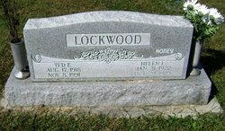
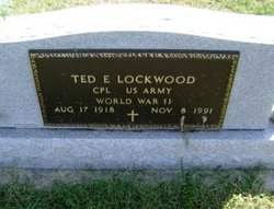
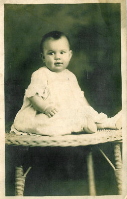
Ted E Lockwood
| Birth | : | 17 Aug 1918 |
| Death | : | 8 Nov 1991 |
| Burial | : | Cress Cemetery, Pleasant Valley, Preston County, USA |
| Coordinate | : | 39.6032830, -79.7111870 |
| Description | : | EVANSVILLE, Ind. - Ted E. Lockwood, 73, formerly of Tipton, died at 4:36 a.m. 1 Friday, Nov. 8,1991, at St. Mary's Hospital in Evansville after a three-year illness. He was born Aug. 17, 1918, in Hamilton County, the son of Edgar H. and Pauline (Small) Lockwood. Aug. 25, 1942, he married Helen Good, who survives. A World War II veteran, he retired from Indiana Employment Security Division, Evansville, after 32 years of service. This accomplishment led Gov. Robert Orr to name him Distinguished Hoosier. He was a member of Veterans of Foreign Wars Post 1114 and of the Funkhouser Post of the American Legion, both in... Read More |
frequently asked questions (FAQ):
-
Where is Ted E Lockwood's memorial?
Ted E Lockwood's memorial is located at: Cress Cemetery, Pleasant Valley, Preston County, USA.
-
When did Ted E Lockwood death?
Ted E Lockwood death on 8 Nov 1991 in
-
Where are the coordinates of the Ted E Lockwood's memorial?
Latitude: 39.6032830
Longitude: -79.7111870
Family Members:
Spouse
Flowers:
Nearby Cemetories:
1. Cress Cemetery
Pleasant Valley, Preston County, USA
Coordinate: 39.6032830, -79.7111870
2. Jenkins Cemetery
Mount Nebo, Preston County, USA
Coordinate: 39.5925610, -79.7216120
3. Everly Cemetery
Mount Nebo, Preston County, USA
Coordinate: 39.5846641, -79.7148391
4. Protzman Cemetery
Preston County, USA
Coordinate: 39.5699680, -79.6782590
5. Fairview Cemetery
Pisgah, Preston County, USA
Coordinate: 39.6474991, -79.7378006
6. Walls Cemetery
Pisgah, Preston County, USA
Coordinate: 39.6361550, -79.7612190
7. Pleasant Grove Cemetery
Herring, Preston County, USA
Coordinate: 39.5438309, -79.7385101
8. Beech Run Cemetery
Preston County, USA
Coordinate: 39.5452995, -79.6641998
9. Everly Cemetery
Laurel Run, Preston County, USA
Coordinate: 39.6725722, -79.7048876
10. Ringer Cemetery
Bruceton Mills, Preston County, USA
Coordinate: 39.6175680, -79.6206020
11. Wesley Chapel Cemetery
Pleasantdale, Preston County, USA
Coordinate: 39.5260600, -79.7239100
12. Centenary Cemetery
Cuzzart, Preston County, USA
Coordinate: 39.6000920, -79.6036560
13. Sugar Valley Cemetery
Bruceton Mills, Preston County, USA
Coordinate: 39.6665993, -79.6404037
14. Bruceton Mills Cemetery
Bruceton Mills, Preston County, USA
Coordinate: 39.6666100, -79.6402150
15. Masontown Cemetery
Masontown, Preston County, USA
Coordinate: 39.5492220, -79.7985150
16. Pleasantdale Cemetery
Pleasantdale, Preston County, USA
Coordinate: 39.5179330, -79.6810740
17. Pell Cemetery
Kingwood, Preston County, USA
Coordinate: 39.5179330, -79.6810740
18. Shay and Elliott Cemetery
Pleasantdale, Preston County, USA
Coordinate: 39.5142731, -79.6711174
19. Brandonville Cemetery
Brandonville, Preston County, USA
Coordinate: 39.6667400, -79.6193100
20. Mountain Grove Church of the Brethren Cemetery
Laurel Run, Preston County, USA
Coordinate: 39.7003564, -79.6989387
21. White Family Cemetery
Pleasantdale, Preston County, USA
Coordinate: 39.5057450, -79.6908330
22. Lenox Memorial Cemetery
Lenox, Preston County, USA
Coordinate: 39.5597000, -79.5927963
23. Shaw Cemetery
Albright, Preston County, USA
Coordinate: 39.5221760, -79.6277860
24. Saint Peters Lutheran Cemetery
Clifton Mills, Preston County, USA
Coordinate: 39.7035860, -79.6691010


