
| Birth | : | 14 Jun 1920 Plymouth, Washington County, North Carolina, USA |
| Death | : | 17 Jul 2010 Plymouth, Washington County, North Carolina, USA |
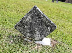
| Burial | : | Old South Burying Ground, Bolton, Worcester County, USA |
| Coordinate | : | 42.4231000, -71.6096500 |
| Description | : | Mrs. Thelma Browning Moore Roberson, 90, of Plymouth died Saturday, July 17, 2010, at Plumblee Nursing Center, Plymouth. Born June 14, 1920 in Washington County she was the daughter of the late John T. Browning, Jr. and Naomi Jackson Browning and was preceded in death by her husbands, A. Clinton Moore and Carl Roberson; sister, Hilda B. Hardison; brothers, Elmer Browning and Roscoe Browning. Thelma worked with Branch Bank & Trust Company as a teller and later with Brownings Department Store as a sales clerk and was a member of First Baptist Church. Her family includes her daughter, Naomi M. Carraway... Read More |
frequently asked questions (FAQ):
-
Where is Thelma Browning Moore Roberson's memorial?
Thelma Browning Moore Roberson's memorial is located at: Old South Burying Ground, Bolton, Worcester County, USA.
-
When did Thelma Browning Moore Roberson death?
Thelma Browning Moore Roberson death on 17 Jul 2010 in Plymouth, Washington County, North Carolina, USA
-
Where are the coordinates of the Thelma Browning Moore Roberson's memorial?
Latitude: 42.4231000
Longitude: -71.6096500
Family Members:
Parent

Spouse
Siblings
Flowers:


Nearby Cemetories:
1. Old South Burying Ground
Bolton, Worcester County, USA
Coordinate: 42.4231000, -71.6096500
2. Friends Burial Ground
Bolton, Worcester County, USA
Coordinate: 42.4133620, -71.6176710
3. Pan Burying Ground
Bolton, Worcester County, USA
Coordinate: 42.4305992, -71.5894012
4. Old Fry Burying Ground
Bolton, Worcester County, USA
Coordinate: 42.4077300, -71.6209900
5. North Cemetery
Berlin, Worcester County, USA
Coordinate: 42.4037000, -71.6225100
6. West Burying Ground
Bolton, Worcester County, USA
Coordinate: 42.4488983, -71.6300964
7. Smallpox Cemetery
Bolton, Worcester County, USA
Coordinate: 42.4511700, -71.5832800
8. Eastwood Cemetery
Lancaster, Worcester County, USA
Coordinate: 42.4417000, -71.6528015
9. Old Common Burial Ground
Lancaster, Worcester County, USA
Coordinate: 42.4426700, -71.6645300
10. Old Burying Ground
Berlin, Worcester County, USA
Coordinate: 42.3811646, -71.6375351
11. Saint Michael Cemetery
Hudson, Middlesex County, USA
Coordinate: 42.4025002, -71.5477982
12. Main Street Cemetery
Hudson, Middlesex County, USA
Coordinate: 42.3932991, -71.5541992
13. Old Settlers Burial Yard
Lancaster, Worcester County, USA
Coordinate: 42.4488754, -71.6742706
14. Forestvale Cemetery
Hudson, Middlesex County, USA
Coordinate: 42.3792100, -71.5646700
15. Middle Cemetery
Lancaster, Worcester County, USA
Coordinate: 42.4491997, -71.6757965
16. Woodlawn Cemetery
Clinton, Worcester County, USA
Coordinate: 42.4185982, -71.6889038
17. South Berlin Cemetery
Berlin, Worcester County, USA
Coordinate: 42.3652992, -71.6292038
18. Robin Hill Cemetery
Marlborough, Middlesex County, USA
Coordinate: 42.3638992, -71.5943985
19. Saint Benedict Center Cemetery
Harvard, Worcester County, USA
Coordinate: 42.4827900, -71.6231900
20. Saint John's Cemetery
Lancaster, Worcester County, USA
Coordinate: 42.4328003, -71.6977997
21. North Village Cemetery
Lancaster, Worcester County, USA
Coordinate: 42.4724998, -71.6778030
22. Bellevue Cemetery
Harvard, Worcester County, USA
Coordinate: 42.4958000, -71.6055984
23. Reservoir Pines Cemetery
Clinton, Worcester County, USA
Coordinate: 42.4084900, -71.7109700
24. Thayer Cemetery
Lancaster, Worcester County, USA
Coordinate: 42.4578500, -71.7024400