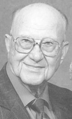
| Birth | : | 20 Nov 1918 Lewiston, Pawnee County, Nebraska, USA |
| Death | : | 13 Dec 2002 Pawnee County, Nebraska, USA |
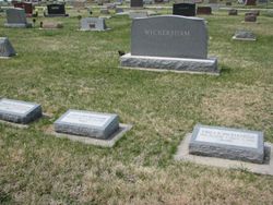
| Burial | : | Mount Pleasant Cemetery, Burchard, Pawnee County, USA |
| Coordinate | : | 40.1822014, -96.4049988 |
| Description | : | Daughter of George J. & Edith E. (Hoffman) Hiller. Married Oct. 2, 1937 to Leonard Jacob "Jake" Martin. Mother of Gayle and Bonnie. She died at her home on their farm near Lewiston, Nebraska. |
frequently asked questions (FAQ):
-
Where is Thelma Edith Hiller Martin's memorial?
Thelma Edith Hiller Martin's memorial is located at: Mount Pleasant Cemetery, Burchard, Pawnee County, USA.
-
When did Thelma Edith Hiller Martin death?
Thelma Edith Hiller Martin death on 13 Dec 2002 in Pawnee County, Nebraska, USA
-
Where are the coordinates of the Thelma Edith Hiller Martin's memorial?
Latitude: 40.1822014
Longitude: -96.4049988
Family Members:
Parent
Spouse
Siblings
Flowers:
Nearby Cemetories:
1. Sacred Heart Cemetery
Burchard, Pawnee County, USA
Coordinate: 40.1460991, -96.3683014
2. Burchard Cemetery
Burchard, Pawnee County, USA
Coordinate: 40.1383018, -96.3538971
3. Pleasant Hill Cemetery
Gage County, USA
Coordinate: 40.1462250, -96.4676820
4. Lewiston Cemetery
Lewiston, Pawnee County, USA
Coordinate: 40.2477989, -96.3882980
5. Virginia Cemetery
Virginia, Gage County, USA
Coordinate: 40.2186012, -96.5117035
6. Rinne Cemetery
Pawnee County, USA
Coordinate: 40.2472000, -96.2742004
7. Salems Cemetery
Steinauer, Pawnee County, USA
Coordinate: 40.2166000, -96.2555000
8. Liberty Cemetery
Liberty, Gage County, USA
Coordinate: 40.0772018, -96.4982986
9. Filley Cemetery
Filley, Gage County, USA
Coordinate: 40.2761002, -96.5306015
10. Kinney Cemetery
Gage County, USA
Coordinate: 40.1102100, -96.5588800
11. West Branch Cemetery
Pawnee County, USA
Coordinate: 40.0787940, -96.2797160
12. Saint Anthonys Cemetery
Steinauer, Pawnee County, USA
Coordinate: 40.2075005, -96.2189026
13. Crab Orchard Cemetery
Crab Orchard, Johnson County, USA
Coordinate: 40.3274994, -96.4366989
14. Saint Pauls United Church of Christ Cemetery
Tecumseh, Johnson County, USA
Coordinate: 40.2996000, -96.2742000
15. Tanner Cemetery
Pawnee County, USA
Coordinate: 40.0238991, -96.4143982
16. Stark Cemetery
Holmesville, Gage County, USA
Coordinate: 40.2122002, -96.6147003
17. Mission Creek Cemetery
Pawnee County, USA
Coordinate: 40.0149994, -96.4263992
18. Barneston Cemetery
Barneston, Gage County, USA
Coordinate: 40.0661011, -96.5755997
19. Saint Josephs Cemetery
Barneston, Gage County, USA
Coordinate: 40.0653000, -96.5757980
20. Brethren Cemetery
Holmesville, Gage County, USA
Coordinate: 40.2125015, -96.6331024
21. Evangelical Lutheran Cemetery
Liberty, Gage County, USA
Coordinate: 40.0083300, -96.4825100
22. Saint Peters Lutheran Church Cemetery
Steinauer, Pawnee County, USA
Coordinate: 40.2555000, -96.1801000
23. Vesta Cemetery
Johnson County, USA
Coordinate: 40.3630981, -96.3414001
24. Beranek Cemetery
Table Rock, Pawnee County, USA
Coordinate: 40.2042007, -96.1607971


