

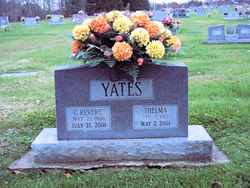
Thelma Maxine Jordan Yates
| Birth | : | 4 Feb 1912 Milton, Cabell County, West Virginia, USA |
| Death | : | 2 May 2001 Huntington, Cabell County, West Virginia, USA |
| Burial | : | Forsyth Cemetery, Forsyth, Rosebud County, USA |
| Coordinate | : | 46.2689018, -106.6528015 |
| Plot | : | Section I, Lot 43, Space B |
| Inscription | : | Y A T E S C. REVERE THELMA JULY 22, 1909 FEB. 4, 1912 JULY 27, 2001 MAY 2, 2001 |
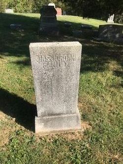
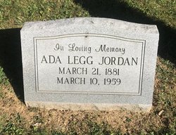
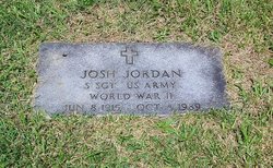
| Description | : | THELMA YATES, 89, of Milton, wife of Creath Revere Yates, died Wednesday in Cabell Huntington Hospital. She was a seamstress for Huntington Mfg. Survivors include one daughter, Mary McClure of Barboursville; and one sister, Ella Alberts of Nashville, Tenn. Heck Funeral Home, Milton, is in charge of arrangements, which are incomplete. The Herald-Dispatch, May 4, 2001 Daughter of James Jordan & Ada Legg. |
frequently asked questions (FAQ):
-
Where is Thelma Maxine Jordan Yates's memorial?
Thelma Maxine Jordan Yates's memorial is located at: Forsyth Cemetery, Forsyth, Rosebud County, USA.
-
When did Thelma Maxine Jordan Yates death?
Thelma Maxine Jordan Yates death on 2 May 2001 in Huntington, Cabell County, West Virginia, USA
-
Where are the coordinates of the Thelma Maxine Jordan Yates's memorial?
Latitude: 46.2689018
Longitude: -106.6528015
Family Members:
Parent
Spouse
Siblings

Flowers:


Nearby Cemetories:
1. Forsyth Cemetery
Forsyth, Rosebud County, USA
Coordinate: 46.2689018, -106.6528015
2. Rosebud Cemetery
Rosebud, Rosebud County, USA
Coordinate: 46.2689018, -106.4381027
3. Howard Cemetery
Rosebud County, USA
Coordinate: 46.2621994, -106.9222031
4. Hathaway Cemetery
Rosebud County, USA
Coordinate: 46.2616997, -106.2185974
5. Colstrip Cemetery
Colstrip, Rosebud County, USA
Coordinate: 45.9096985, -106.6194000
6. Memorial Vale Cemetery
Hysham, Treasure County, USA
Coordinate: 46.2552986, -107.2307968
7. Bean Cemetery
Rosebud County, USA
Coordinate: 45.8535995, -106.4011002
8. Brown Cemetery
Colstrip, Rosebud County, USA
Coordinate: 45.8321991, -106.4180984
9. Lee Cemetery
Rosebud County, USA
Coordinate: 45.7792015, -106.5413971
10. Rancher Cemetery
Myers, Treasure County, USA
Coordinate: 46.2580986, -107.4197006
11. Fort Keogh Cemetery
Custer County, USA
Coordinate: 46.3800011, -105.8874969
12. Vanstel Cemetery
Rosebud County, USA
Coordinate: 46.7872009, -106.8942032
13. Calvary Cemetery
Miles City, Custer County, USA
Coordinate: 46.3816986, -105.8249969
14. Eastern Montana State Veterans Cemetery
Miles City, Custer County, USA
Coordinate: 46.3807564, -105.8246536
15. Old Calvary Cemetery
Miles City, Custer County, USA
Coordinate: 46.3807600, -105.8246500
16. Custer County Cemetery
Miles City, Custer County, USA
Coordinate: 46.3891983, -105.8264008
17. Pine Hills School Cemetery
Miles City, Custer County, USA
Coordinate: 46.4077988, -105.8167038
18. Rock Springs Cemetery
Rock Springs, Rosebud County, USA
Coordinate: 46.7847800, -106.1411500
19. Pine Crest Cemetery
Custer County, USA
Coordinate: 46.4564018, -105.7789001
20. Junction City Cemetery
Yellowstone County, USA
Coordinate: 46.1437320, -107.5493300
21. Lame Deer Cemetery
Lame Deer, Rosebud County, USA
Coordinate: 45.6264000, -106.6619034
22. Custer Cemetery
Custer, Yellowstone County, USA
Coordinate: 46.1270690, -107.5700030
23. Muddy Creek Cemetery
Muddy, Big Horn County, USA
Coordinate: 45.5741997, -106.7406006
24. Saint Labre Cemetery
Ashland, Rosebud County, USA
Coordinate: 45.6070930, -106.2836910