| Birth | : | 23 Apr 1923 Cedar Rapids, Boone County, Nebraska, USA |
| Death | : | 4 Sep 2009 Spalding, Greeley County, Nebraska, USA |
| Burial | : | Lawrenceburg Cemetery, Lawrenceburg, Anderson County, USA |
| Coordinate | : | 38.0232000, -84.8901000 |
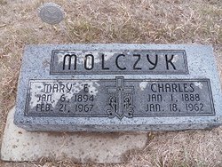
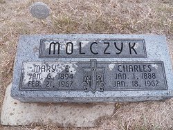
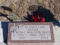
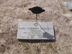
| Description | : | Son of Charles & Mary (Banack) Molczyk. Married to Rita Caroline Ray on 11-18-1944 at St. Michael's Catholic Church at Spalding, NE. WW II - US Army - Awarded the Purple Heart Medal for wounds received. ****************************************** Thanks to contributor #48796369 Theodore "Ted" Esadore Molczyk, 86, of Spalding died Friday, Sept. 4, 2009, at Friendship Villa in Spalding. Services will be at 10:30 a.m. Tuesday at St. Michael's Catholic Church in Spalding. The Rev. Don Burhman will officiate. Burial will be in St. Michael's Catholic Cemetery. Mr. Molczyk was born April 23, 1923 in Cedar Rapids, to Charles and Mary (Banack) Molczyk. Survivors of his immediate family include two... Read More |
frequently asked questions (FAQ):
-
Where is Theodore Esadore “Ted” Molczyk's memorial?
Theodore Esadore “Ted” Molczyk's memorial is located at: Lawrenceburg Cemetery, Lawrenceburg, Anderson County, USA.
-
When did Theodore Esadore “Ted” Molczyk death?
Theodore Esadore “Ted” Molczyk death on 4 Sep 2009 in Spalding, Greeley County, Nebraska, USA
-
Where are the coordinates of the Theodore Esadore “Ted” Molczyk's memorial?
Latitude: 38.0232000
Longitude: -84.8901000
Family Members:
Parent
Spouse
Siblings
Children
Flowers:
Nearby Cemetories:
1. Lawrenceburg Cemetery
Lawrenceburg, Anderson County, USA
Coordinate: 38.0232000, -84.8901000
2. Woodlawn Hills Cemetery
Lawrenceburg, Anderson County, USA
Coordinate: 38.0133018, -84.8861008
3. Bell-Carpenter Family Cemetery
Lawrenceburg, Anderson County, USA
Coordinate: 38.0150220, -84.8992860
4. Bond-Frazier
Lawrenceburg, Anderson County, USA
Coordinate: 38.0280770, -84.8718318
5. Salt River Baptist Church Cemetery
Lawrenceburg, Anderson County, USA
Coordinate: 38.0068020, -84.8895590
6. Taylor Family Cemetery
Lawrenceburg, Anderson County, USA
Coordinate: 38.0309670, -84.9106370
7. Cole Family Cemetery
Alton, Anderson County, USA
Coordinate: 38.0380930, -84.9062600
8. Wallace Graveyard
Lawrenceburg, Anderson County, USA
Coordinate: 38.0430890, -84.8901990
9. Sand Spring Cemetery
Lawrenceburg, Anderson County, USA
Coordinate: 38.0011040, -84.8775830
10. Penney-Allen-Frazier-Mountjoy Cemetery
Lawrenceburg, Anderson County, USA
Coordinate: 38.0149300, -84.9284210
11. McBrayer Cemetery
Alton Station, Anderson County, USA
Coordinate: 38.0267770, -84.9298060
12. Frazier Cemetery
Lawrenceburg, Anderson County, USA
Coordinate: 38.0432428, -84.8585518
13. Coke Cemetery
McBrayer, Anderson County, USA
Coordinate: 37.9803330, -84.8848670
14. Freedom Baptist Church Cemetery
Lawrenceburg, Anderson County, USA
Coordinate: 38.0252670, -84.9502880
15. Littlepage Cemetery
Lawrenceburg, Anderson County, USA
Coordinate: 38.0385227, -84.9597354
16. Hebron Cemetery
Lawrenceburg, Anderson County, USA
Coordinate: 37.9634330, -84.8754080
17. Hollis Cemetery
Alton, Anderson County, USA
Coordinate: 38.0775580, -84.9260320
18. Herndon-Roach Cemetery
Alton, Anderson County, USA
Coordinate: 38.0624170, -84.9510830
19. Fox Creek Cemetery
Lawrenceburg, Anderson County, USA
Coordinate: 37.9902150, -84.9648580
20. Fox Creek Christian Church Graveyard
Fox Creek, Anderson County, USA
Coordinate: 37.9895730, -84.9672170
21. Paxton Family Cemetery
Anderson County, USA
Coordinate: 37.9617660, -84.9328260
22. Munday Cemetery
Anderson City, Anderson County, USA
Coordinate: 38.0331527, -84.9803454
23. Young Cemetery
Birdie, Anderson County, USA
Coordinate: 38.0331327, -84.9803654
24. Bear Wallow Cemetery
Anderson County, USA
Coordinate: 38.0649796, -84.9644775

