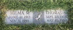
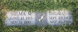
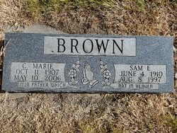
Thomas Albert Brown Sr.
| Birth | : | 23 Sep 1908 Fortescue, Holt County, Missouri, USA |
| Death | : | 10 May 1980 |
| Burial | : | Greenwood Cemetery, Chadron, Dawes County, USA |
| Coordinate | : | 42.8272018, -103.0239029 |
| Plot | : | Blk 9, Lot 121, Space 3 |
| Description | : | Age 71years Buried May 13, 1980 |
frequently asked questions (FAQ):
-
Where is Thomas Albert Brown Sr.'s memorial?
Thomas Albert Brown Sr.'s memorial is located at: Greenwood Cemetery, Chadron, Dawes County, USA.
-
When did Thomas Albert Brown Sr. death?
Thomas Albert Brown Sr. death on 10 May 1980 in
-
Where are the coordinates of the Thomas Albert Brown Sr.'s memorial?
Latitude: 42.8272018
Longitude: -103.0239029
Family Members:
Parent
Spouse
Siblings
Flowers:
Nearby Cemetories:
1. Greenwood Cemetery
Chadron, Dawes County, USA
Coordinate: 42.8272018, -103.0239029
2. Calvary Cemetery
Chadron, Dawes County, USA
Coordinate: 42.8224983, -103.0085983
3. Grace Episcopal Cemetery
Chadron, Dawes County, USA
Coordinate: 42.8267000, -102.9996000
4. Shisler Cemetery
Dawes County, USA
Coordinate: 42.7930984, -103.0875015
5. Highland Cemetery
Dawes County, USA
Coordinate: 42.8163986, -102.9302979
6. Evergreen Cemetery
Chadron, Dawes County, USA
Coordinate: 42.6646710, -103.0608510
7. Whitney Cemetery
Whitney, Dawes County, USA
Coordinate: 42.7705994, -103.2564011
8. Bethel Cemetery
Dawes County, USA
Coordinate: 42.6850014, -103.1841965
9. Beaver Valley Cemetery
Sheridan County, USA
Coordinate: 42.8880997, -102.7517014
10. Highland Cemetery
Hay Springs, Sheridan County, USA
Coordinate: 42.7145500, -102.7727500
11. Antelope Cemetery
Hay Springs, Sheridan County, USA
Coordinate: 42.7144970, -102.7727290
12. Highland Center Cemetery
Dawes County, USA
Coordinate: 42.6100006, -103.1258011
13. Antelope Springs Cemetery
Chadron, Dawes County, USA
Coordinate: 42.6185000, -102.8706100
14. Wanda Highway Gravesite
Chadron, Dawes County, USA
Coordinate: 42.6535800, -103.2655800
15. Bomar Cemetery
Hay Springs, Sheridan County, USA
Coordinate: 42.8062000, -102.6459600
16. Our Lady of Lourdes Catholic Cemetery
Slim Butte, Oglala Lakota County, USA
Coordinate: 43.0619800, -102.8166200
17. Slim Buttes Cemetery
Pine Ridge, Oglala Lakota County, USA
Coordinate: 43.0621700, -102.8168100
18. St. Mary's Cemetery
Hay Springs, Sheridan County, USA
Coordinate: 42.6721992, -102.7035980
19. Hay Springs Cemetery
Hay Springs, Sheridan County, USA
Coordinate: 42.6702995, -102.7033005
20. Crawford Cemetery
Crawford, Dawes County, USA
Coordinate: 42.7181015, -103.4052963
21. Pleasant Hill Cemetery
Chadron, Dawes County, USA
Coordinate: 42.5547300, -102.8429000
22. Saint Matthews Episcopal Cemetery
Slim Butte, Oglala Lakota County, USA
Coordinate: 43.0780530, -102.7873140
23. Abold Family Cemetery
Rushville, Sheridan County, USA
Coordinate: 42.8863500, -102.6158000
24. Harvey Cemetery
Crawford, Dawes County, USA
Coordinate: 42.6455994, -103.3625031

