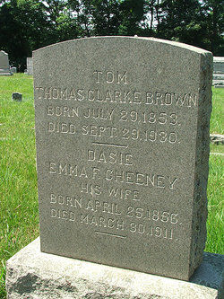
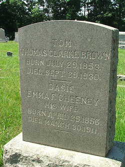
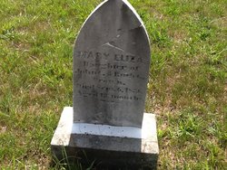
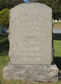
Thomas Clarke “Tom” Brown
| Birth | : | 29 Jul 1853 East Greenwich, Kent County, Rhode Island, USA |
| Death | : | 29 Sep 1930 Warwick, Kent County, Rhode Island, USA |
| Burial | : | Mansfield Cemetery, Sherwood, Calumet County, USA |
| Coordinate | : | 44.1463300, -88.2814600 |
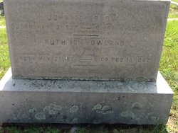
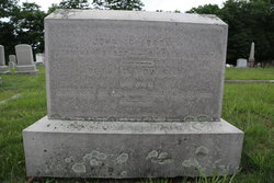
| Description | : | Parents: John Clark Brown & Ruth (Howland) |
frequently asked questions (FAQ):
-
Where is Thomas Clarke “Tom” Brown's memorial?
Thomas Clarke “Tom” Brown's memorial is located at: Mansfield Cemetery, Sherwood, Calumet County, USA.
-
When did Thomas Clarke “Tom” Brown death?
Thomas Clarke “Tom” Brown death on 29 Sep 1930 in Warwick, Kent County, Rhode Island, USA
-
Where are the coordinates of the Thomas Clarke “Tom” Brown's memorial?
Latitude: 44.1463300
Longitude: -88.2814600
Family Members:
Parent
Spouse
Siblings
Children
Flowers:
Nearby Cemetories:
1. Mansfield Cemetery
Sherwood, Calumet County, USA
Coordinate: 44.1463300, -88.2814600
2. Saint Anthony Catholic Cemetery
Harrison, Calumet County, USA
Coordinate: 44.1342100, -88.2906400
3. Sacred Heart Cemetery
Sherwood, Calumet County, USA
Coordinate: 44.1618996, -88.2639008
4. Stacey Children Cemetery
Sherwood, Calumet County, USA
Coordinate: 44.1674900, -88.2936000
5. High Cliff Cemetery
Sherwood, Calumet County, USA
Coordinate: 44.1707993, -88.2910995
6. Dorn Cemetery
Harrison, Calumet County, USA
Coordinate: 44.1211000, -88.3117000
7. Forrest Run Pet Cemetery
Sherwood, Calumet County, USA
Coordinate: 44.1800400, -88.2953100
8. Saint John Catholic Cemetery
Saint John, Calumet County, USA
Coordinate: 44.1674300, -88.2038000
9. Saint Marys Cemetery
Stockbridge, Calumet County, USA
Coordinate: 44.0842018, -88.3024979
10. Indian Cemetery
Stockbridge, Calumet County, USA
Coordinate: 44.0821991, -88.3013992
11. Saint Peters Cemetery
Hilbert, Calumet County, USA
Coordinate: 44.1333008, -88.1832962
12. Portland Cemetery
Brant, Calumet County, USA
Coordinate: 44.0746994, -88.2241974
13. Saint John Evangelical Lutheran Cemetery
Dundas, Calumet County, USA
Coordinate: 44.2206300, -88.2280690
14. Saint Marys Cemetery
Hilbert, Calumet County, USA
Coordinate: 44.1321983, -88.1647034
15. Saint Luke Lutheran Church Cemetery
Chilton, Calumet County, USA
Coordinate: 44.0874000, -88.1934100
16. Lakeside Cemetery
Stockbridge, Calumet County, USA
Coordinate: 44.0491982, -88.3127975
17. Holy Angels Cemetery
Appleton, Outagamie County, USA
Coordinate: 44.2440000, -88.3318000
18. Sweet Family Cemetery
Stockbridge, Calumet County, USA
Coordinate: 44.0369490, -88.2994370
19. Holy Name Cemetery
Kimberly, Outagamie County, USA
Coordinate: 44.2586100, -88.3380600
20. St. Mary's Cemetery
Kaukauna, Outagamie County, USA
Coordinate: 44.2671100, -88.2884900
21. Saint Paul Cemetery
Combined Locks, Outagamie County, USA
Coordinate: 44.2676000, -88.2922000
22. Forest Home Cemetery
Forest Junction, Calumet County, USA
Coordinate: 44.2275009, -88.1541977
23. Stockbridge Cemetery
Kaukauna, Outagamie County, USA
Coordinate: 44.2684746, -88.2818051
24. Union Cemetery
Kaukauna, Outagamie County, USA
Coordinate: 44.2689018, -88.2919006

