
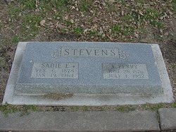

Thomas Perry Stevens
| Birth | : | 28 Jun 1876 Vinland, Douglas County, Kansas, USA |
| Death | : | 1 Jul 1952 Greeley, Weld County, Colorado, USA |
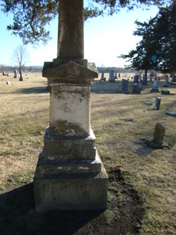
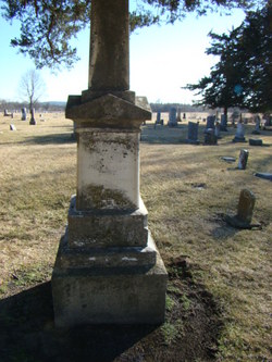
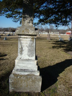
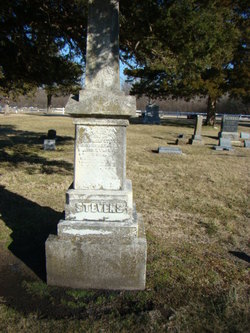
| Burial | : | Vinland Cemetery, Vinland, Douglas County, USA |
| Coordinate | : | 38.8485985, -95.1763992 |
| Description | : | Thomas Perry Stevens, dairy farmer and breeder of Jersey cattle, was born in Vinland, Kansas, June 28, 1876. His father, John Stevens, who was born near Berger, Norway, December 28, 1823, died in Vinland, July 4, 1899. A farmer, he served three years in the Civil War as a member of the 2nd Kansas Cavalry. Mary Jones, wife of John Stevens, was born in Pulaski County, Kentucky, August 13, 1843, and died at Vinland, April 9, 1900. Thomas Perry Stevens attended public school at Vinland until 1892, at which time he began the operation of a dairy farm. He has... Read More |
frequently asked questions (FAQ):
-
Where is Thomas Perry Stevens's memorial?
Thomas Perry Stevens's memorial is located at: Vinland Cemetery, Vinland, Douglas County, USA.
-
When did Thomas Perry Stevens death?
Thomas Perry Stevens death on 1 Jul 1952 in Greeley, Weld County, Colorado, USA
-
Where are the coordinates of the Thomas Perry Stevens's memorial?
Latitude: 38.8485985
Longitude: -95.1763992
Family Members:
Parent
Spouse

Siblings
Children
Flowers:


Nearby Cemetories:
1. Stony Point Cemetery
Vinland, Douglas County, USA
Coordinate: 38.8249512, -95.2107391
2. Dow Cemetery
Vinland, Douglas County, USA
Coordinate: 38.8186620, -95.2143000
3. Brumbaugh Cemetery
Douglas County, USA
Coordinate: 38.8319200, -95.2330100
4. Breeze Family Cemetery
Pleasant Grove, Douglas County, USA
Coordinate: 38.8472800, -95.2480400
5. Blue Mound Cemetery
Lawrence, Douglas County, USA
Coordinate: 38.9046600, -95.1865400
6. Ulrich Cemetery
Pleasant Grove, Douglas County, USA
Coordinate: 38.8395740, -95.2531810
7. Clearfield Cemetery
Clearfield, Douglas County, USA
Coordinate: 38.8260002, -95.0930023
8. County Poor Farm Cemetery
Douglas County, USA
Coordinate: 38.9119400, -95.2214600
9. Richland Cemetery
Lawrence, Douglas County, USA
Coordinate: 38.8768997, -95.2630997
10. Kennedy Cemetery
Douglas County, USA
Coordinate: 38.9112900, -95.2269200
11. Marshall Cemetery
Douglas County, USA
Coordinate: 38.9040800, -95.2446700
12. Deay Cemetery
Eudora, Douglas County, USA
Coordinate: 38.8546486, -95.0749435
13. Oakwood Cemetery
Baldwin City, Douglas County, USA
Coordinate: 38.7694016, -95.1825027
14. Pleasant Hill Cemetery
Pleasant Grove, Douglas County, USA
Coordinate: 38.8535995, -95.2794037
15. Prairie City Cemetery
Baldwin City, Douglas County, USA
Coordinate: 38.7689018, -95.2050018
16. Mount Calvary Cemetery
Baldwin City, Douglas County, USA
Coordinate: 38.7687988, -95.2049713
17. Miller Family Cemetery
Baldwin City, Douglas County, USA
Coordinate: 38.7688751, -95.2146683
18. Baldwin City Cemetery
Baldwin City, Douglas County, USA
Coordinate: 38.7612953, -95.1862869
19. Cemetery Beni Israel
Eudora, Douglas County, USA
Coordinate: 38.9280128, -95.1122208
20. Dutton Cemetery
Douglas County, USA
Coordinate: 38.8989800, -95.2790600
21. Black Jack Cemetery
Douglas County, USA
Coordinate: 38.7660400, -95.1159400
22. Franklin Cemetery
Douglas County, USA
Coordinate: 38.9437523, -95.1869431
23. Haskell Cemetery
Lawrence, Douglas County, USA
Coordinate: 38.9353790, -95.2284241
24. Saint Johns Catholic Cemetery
Douglas County, USA
Coordinate: 38.9437900, -95.1919600