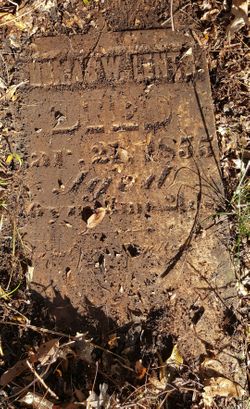
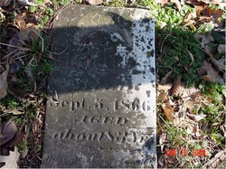
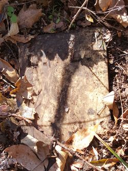
Thomas Washington Lents
| Birth | : | 31 Dec 1814 Rowan County, North Carolina, USA |
| Death | : | 21 Mar 1855 Ray County, Missouri, USA |
| Burial | : | Gardnerville Cemetery, Gardnerville, Douglas County, USA |
| Coordinate | : | 38.9463997, -119.7592010 |
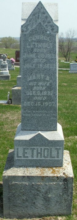
| Description | : | Aged: 40 Years, 3 Months, 21 Days Son of Jacob and Mary Lents Husband of Lucinda Schooler Lents Father to Nathan Lentz, Mary Letholt, Josephus Lents, Thomas Lents, Amy Bush, Rebecca Brown, Hiram Lentz, Alfred Lents, Phillip Lents, James Lentz, and Andrew Lentz. Brother of Amanda Lents. |
frequently asked questions (FAQ):
-
Where is Thomas Washington Lents's memorial?
Thomas Washington Lents's memorial is located at: Gardnerville Cemetery, Gardnerville, Douglas County, USA.
-
When did Thomas Washington Lents death?
Thomas Washington Lents death on 21 Mar 1855 in Ray County, Missouri, USA
-
Where are the coordinates of the Thomas Washington Lents's memorial?
Latitude: 38.9463997
Longitude: -119.7592010
Family Members:
Parent
Spouse
Children
Flowers:
Nearby Cemetories:
1. Gardnerville Cemetery
Gardnerville, Douglas County, USA
Coordinate: 38.9463997, -119.7592010
2. Eastside Memorial Park
Minden, Douglas County, USA
Coordinate: 38.9623985, -119.7320023
3. Captain George Donner Cemetery
Kingsbury, Douglas County, USA
Coordinate: 38.9542007, -119.8394012
4. Mottsville Cemetery
Douglas County, USA
Coordinate: 38.9319000, -119.8383026
5. Clara Holbrook Frank Family Cemetery
Gardnerville, Douglas County, USA
Coordinate: 38.8904900, -119.6936600
6. Washoe Cemetery
Gardnerville, Douglas County, USA
Coordinate: 38.8699900, -119.7455400
7. Knott Family Graveyard
Genoa, Douglas County, USA
Coordinate: 39.0069900, -119.8452400
8. Genoa Cemetery
Genoa, Douglas County, USA
Coordinate: 39.0116997, -119.8431015
9. Happy Hunting Grounds Cemetery
Gardnerville, Douglas County, USA
Coordinate: 38.8657000, -119.6524000
10. Fredericksburg Cemetery
Frederickburg, Alpine County, USA
Coordinate: 38.8275986, -119.7866974
11. Jacks Valley Cemetery
Douglas County, USA
Coordinate: 39.0840751, -119.8468480
12. Happy Homestead Cemetery
South Lake Tahoe, El Dorado County, USA
Coordinate: 38.9371986, -119.9681015
13. Johnson-Springmeyer Cemetery
South Lake Tahoe, El Dorado County, USA
Coordinate: 38.9376580, -119.9681600
14. Ormsby Poor Farm Cemetery
Carson City, Carson City, USA
Coordinate: 39.1172066, -119.7700043
15. Stewart Cemetery
Carson City, Carson City, USA
Coordinate: 39.1175800, -119.7701000
16. Old Stewart Indian Cemetery
Stewart, Carson City, USA
Coordinate: 39.1178900, -119.7546700
17. Al Tahoe Cemetery
South Lake Tahoe, El Dorado County, USA
Coordinate: 38.9411011, -119.9875565
18. Old Woodfords Cemetery
Alpine County, USA
Coordinate: 38.7762710, -119.8255320
19. Woodfords Washoe Indian Cemetery
Woodfords, Alpine County, USA
Coordinate: 38.7688570, -119.8190720
20. Saint Johns in the Wilderness Episcopal Columbariu
Glenbrook, Douglas County, USA
Coordinate: 39.0722520, -119.9422930
21. Glenbrook Cemetery
Glenbrook, Douglas County, USA
Coordinate: 39.0891100, -119.9352500
22. Dixon Family Cemetery
Carson City, USA
Coordinate: 39.1483269, -119.7432404
23. Nevada State Prison Burial Ground
Carson City, Carson City, USA
Coordinate: 39.1581900, -119.7378200
24. Carson Pioneer Cemetery
Carson City, Carson City, USA
Coordinate: 39.1612396, -119.7792969


