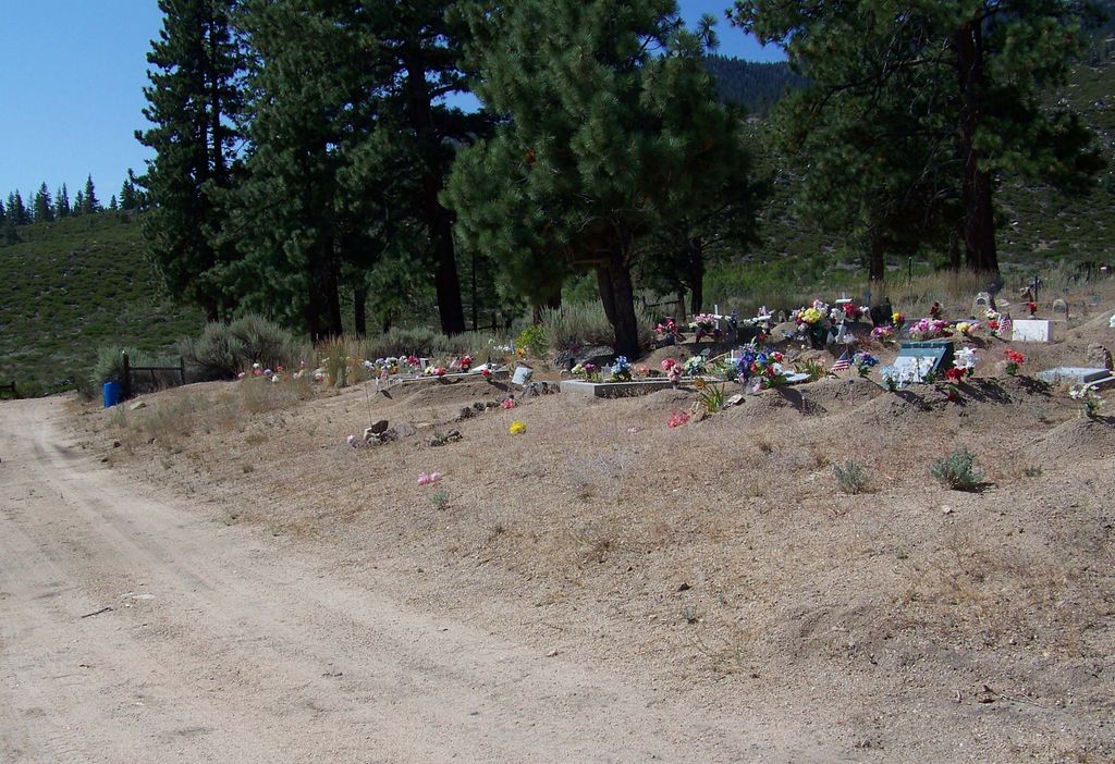
| Memorials | : | 0 |
| Location | : | Woodfords, Alpine County, USA |
| Coordinate | : | 38.7688570, -119.8190720 |
| Description | : | The cemetery is located at the north end of Indian Cemetery Road. The cemetery is reached by travelling 0.8 miles south on Alpine State Highway (California State Highway 89), then turning left (west) onto Monroe Ranch Road, travelling about 700 feet west on Monroe Ranch Road, and the turning left onto Indian Cemetery Road. Some sources refer to this cemetery as being in Dresslerville, Nevada, even though it is in Alpine County, California, rather than Douglas County, Nevada. The U.S. Geological Survey (USGS) Geographic Names Information System (GNIS) feature ID for the cemetery is 237317 (Washoe Cemetery). |
frequently asked questions (FAQ):
-
Where is Woodfords Washoe Indian Cemetery?
Woodfords Washoe Indian Cemetery is located at Indian Cemetery Road Woodfords, Alpine County ,California , 96120USA.
-
Woodfords Washoe Indian Cemetery cemetery's updated grave count on graveviews.com?
0 memorials
-
Where are the coordinates of the Woodfords Washoe Indian Cemetery?
Latitude: 38.7688570
Longitude: -119.8190720
Nearby Cemetories:
1. Old Woodfords Cemetery
Alpine County, USA
Coordinate: 38.7762710, -119.8255320
2. Fredericksburg Cemetery
Frederickburg, Alpine County, USA
Coordinate: 38.8275986, -119.7866974
3. Markleeville Cemetery
Markleeville, Alpine County, USA
Coordinate: 38.6923520, -119.7771870
4. Washoe Cemetery
Gardnerville, Douglas County, USA
Coordinate: 38.8699900, -119.7455400
5. Clara Holbrook Frank Family Cemetery
Gardnerville, Douglas County, USA
Coordinate: 38.8904900, -119.6936600
6. Silver Mountain Cemetery
Markleeville, Alpine County, USA
Coordinate: 38.6172050, -119.7522590
7. Happy Hunting Grounds Cemetery
Gardnerville, Douglas County, USA
Coordinate: 38.8657000, -119.6524000
8. Mottsville Cemetery
Douglas County, USA
Coordinate: 38.9319000, -119.8383026
9. Gardnerville Cemetery
Gardnerville, Douglas County, USA
Coordinate: 38.9463997, -119.7592010
10. Captain George Donner Cemetery
Kingsbury, Douglas County, USA
Coordinate: 38.9542007, -119.8394012
11. Happy Homestead Cemetery
South Lake Tahoe, El Dorado County, USA
Coordinate: 38.9371986, -119.9681015
12. Johnson-Springmeyer Cemetery
South Lake Tahoe, El Dorado County, USA
Coordinate: 38.9376580, -119.9681600
13. Eastside Memorial Park
Minden, Douglas County, USA
Coordinate: 38.9623985, -119.7320023
14. Al Tahoe Cemetery
South Lake Tahoe, El Dorado County, USA
Coordinate: 38.9411011, -119.9875565
15. Knott Family Graveyard
Genoa, Douglas County, USA
Coordinate: 39.0069900, -119.8452400
16. Genoa Cemetery
Genoa, Douglas County, USA
Coordinate: 39.0116997, -119.8431015
17. Tragedy Spring Cemetery
El Dorado County, USA
Coordinate: 38.6396300, -120.1485500
18. McMichael Family Cemetery
Douglas County, USA
Coordinate: 38.7380900, -119.4315700
19. Maidens Grave
Amador County, USA
Coordinate: 38.6316986, -120.1699982
20. Antelope Valley Cemetery
Coleville, Mono County, USA
Coordinate: 38.5782318, -119.5105515
21. Jacks Valley Cemetery
Douglas County, USA
Coordinate: 39.0840751, -119.8468480
22. Saint Johns in the Wilderness Episcopal Columbariu
Glenbrook, Douglas County, USA
Coordinate: 39.0722520, -119.9422930
23. William W Tyler’s Grave
El Dorado County, USA
Coordinate: 38.8822220, -120.2055560
24. Glenbrook Cemetery
Glenbrook, Douglas County, USA
Coordinate: 39.0891100, -119.9352500

