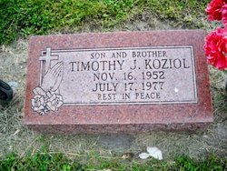
Timothy J. Koziol
| Birth | : | 16 Nov 1952 Genoa, Nance County, Nebraska, USA |
| Death | : | 17 Jul 1977 Genoa, Nance County, Nebraska, USA |
| Burial | : | Steneby Kyrkogård, Steneby, Bengtsfors kommun, Sweden |
| Coordinate | : | 58.9364561, 12.2059806 |
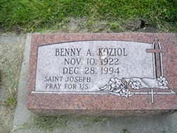
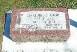
| Description | : | Son of Benedict A. & Geraldine S. (Rybinski) Koziol. Died as a result of a motorcycle accident, 2 miles south west of Genoa, NE. on Highway 22. |
frequently asked questions (FAQ):
-
Where is Timothy J. Koziol's memorial?
Timothy J. Koziol's memorial is located at: Steneby Kyrkogård, Steneby, Bengtsfors kommun, Sweden.
-
When did Timothy J. Koziol death?
Timothy J. Koziol death on 17 Jul 1977 in Genoa, Nance County, Nebraska, USA
-
Where are the coordinates of the Timothy J. Koziol's memorial?
Latitude: 58.9364561
Longitude: 12.2059806
Family Members:
Parent
Flowers:
Nearby Cemetories:
1. Steneby Kyrkogård
Steneby, Bengtsfors kommun, Sweden
Coordinate: 58.9364561, 12.2059806
2. Billingsfors kyrka
Billingsfors, Bengtsfors kommun, Sweden
Coordinate: 58.9869225, 12.2533739
3. Tisselskogs kyrkogård
Dals Langed, Bengtsfors kommun, Sweden
Coordinate: 58.9078407, 12.3963433
4. Dals-Eds Kyrkogård
Ed, Dals-Eds kommun, Sweden
Coordinate: 58.9058200, 11.9385800
5. Rölanda kyrka
Rolanda, Dals-Eds kommun, Sweden
Coordinate: 58.8419720, 11.9146110
6. Ånimskog Cemetery
Animskog, Åmåls kommun, Sweden
Coordinate: 58.8918531, 12.5419308
7. Järbo Kyrkogården
Högsäter, Färgelanda kommun, Sweden
Coordinate: 58.7282783, 12.1384410
8. Tösse Kyrkogården
Tosse, Åmåls kommun, Sweden
Coordinate: 58.9753250, 12.6210690
9. Holms Kyrkogård
Mellerud, Melleruds kommun, Sweden
Coordinate: 58.7098000, 12.4737389
10. Åmåls Kyrkogård
Amal, Åmåls kommun, Sweden
Coordinate: 59.0567690, 12.7004220
11. Järns kyrkogård
Mellerud, Melleruds kommun, Sweden
Coordinate: 58.6678520, 12.4978697
12. Holmegil Cemetery
Aremark kommune, Norway
Coordinate: 59.1427860, 11.7411870
13. Grinstads Church Cemetery
Grinstad, Melleruds kommun, Sweden
Coordinate: 58.6233200, 12.5111342
14. Klöveskogs kyrkogård
Mellerud, Melleruds kommun, Sweden
Coordinate: 58.6452412, 12.6157530
15. Naverstad Kyrkogård
Tanums kommun, Sweden
Coordinate: 58.7634830, 11.5671670
16. Sillerud Parish Church Cemetery
Sillerud, Årjängs kommun, Sweden
Coordinate: 59.3087917, 12.3109972
17. Bolstad Church Cemetery
Bolstad, Melleruds kommun, Sweden
Coordinate: 58.5759319, 12.4830382
18. Aremark kirkegård
Fossby, Aremark kommune, Norway
Coordinate: 59.2447300, 11.6818600
19. Kila kyrka
Saterskog, Säffle kommun, Sweden
Coordinate: 59.2043900, 12.8149100
20. By Kyrkogård
Säffle kommun, Sweden
Coordinate: 59.1128100, 12.9379700
21. Solli gravlund
Halden kommune, Norway
Coordinate: 59.0954910, 11.4430320
22. Idd kirke
Halden kommune, Norway
Coordinate: 59.0862840, 11.4346680
23. Asak kirkegård
Asak, Halden kommune, Norway
Coordinate: 59.1440900, 11.4541500
24. Slavekirkegården
Oslo, Oslo kommune, Norway
Coordinate: 59.1135500, 11.4002833


