
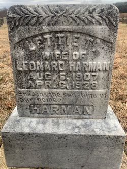
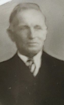
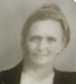
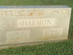
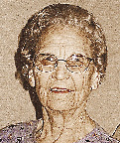
Triphana E “Lettie” Dickerson Harman
| Birth | : | 6 Aug 1907 Patrick County, Virginia, USA |
| Death | : | 6 Apr 1928 Floyd County, Virginia, USA |
| Burial | : | Harter Farm Cemetery, Floyd, Floyd County, USA |
| Coordinate | : | 36.8441730, -80.3374180 |
| Inscription | : | wife of Leonard Harman She was the sunshine of our home. |
frequently asked questions (FAQ):
-
Where is Triphana E “Lettie” Dickerson Harman's memorial?
Triphana E “Lettie” Dickerson Harman's memorial is located at: Harter Farm Cemetery, Floyd, Floyd County, USA.
-
When did Triphana E “Lettie” Dickerson Harman death?
Triphana E “Lettie” Dickerson Harman death on 6 Apr 1928 in Floyd County, Virginia, USA
-
Where are the coordinates of the Triphana E “Lettie” Dickerson Harman's memorial?
Latitude: 36.8441730
Longitude: -80.3374180
Family Members:
Parent
Spouse
Siblings


Nearby Cemetories:
1. Harter Farm Cemetery
Floyd, Floyd County, USA
Coordinate: 36.8441730, -80.3374180
2. Huff Cemetery at Fairview Church of the Brethren
Floyd, Floyd County, USA
Coordinate: 36.8410860, -80.3471160
3. Burgess Cemetery
Floyd, Floyd County, USA
Coordinate: 36.8528090, -80.3411270
4. East Hill Cemetery
Floyd, Floyd County, USA
Coordinate: 36.8562800, -80.3272450
5. Weddle-Whitlow-Wickham Cemetery
Shelors Mill, Floyd County, USA
Coordinate: 36.8503309, -80.3625396
6. Howell-Slusher Cemetery
Floyd, Floyd County, USA
Coordinate: 36.8653903, -80.3308104
7. O’Bryan - Cannaday Cemetery
Floyd, Floyd County, USA
Coordinate: 36.8563093, -80.3145326
8. Hancock Cemetery
Floyd County, USA
Coordinate: 36.8235590, -80.3549920
9. Bolen Cemetery
Floyd, Floyd County, USA
Coordinate: 36.8709370, -80.3468100
10. Agnew - Kitterman Cemetery
Floyd, Floyd County, USA
Coordinate: 36.8675980, -80.3171400
11. Howell - Carter Cemetery
Shelors Mill, Floyd County, USA
Coordinate: 36.8752509, -80.3457628
12. Epperly-Ballinger Cemetery
Floyd, Floyd County, USA
Coordinate: 36.8760030, -80.3349010
13. Howell-Via Cemetery
Floyd, Floyd County, USA
Coordinate: 36.8776040, -80.3533390
14. Howell Cemetery
Floyd County, USA
Coordinate: 36.8795445, -80.3459129
15. Joel Agnew Cemetery
Floyd, Floyd County, USA
Coordinate: 36.8649390, -80.2988530
16. Thomas Grove Cemetery
Floyd, Floyd County, USA
Coordinate: 36.8608892, -80.2866001
17. Smith Cemetery
Floyd, Floyd County, USA
Coordinate: 36.8872319, -80.3260720
18. Boyd-Clark-Howell Cemetery
Patrick County, USA
Coordinate: 36.8173770, -80.2861020
19. Pratt Cemetery
Shelors Mill, Floyd County, USA
Coordinate: 36.8231860, -80.3955960
20. Simmons Cemetery
Floyd, Floyd County, USA
Coordinate: 36.8616820, -80.3977326
21. Weddle Cemetery
Shelors Mill, Floyd County, USA
Coordinate: 36.8677010, -80.3989320
22. Keith - Sutphin - Weddle Cemetery
Floyd, Floyd County, USA
Coordinate: 36.8677635, -80.3988947
23. Agnew Cemetery
Floyd, Floyd County, USA
Coordinate: 36.8926340, -80.3012620
24. Col. Jacob Helms Cemetery
Floyd, Floyd County, USA
Coordinate: 36.9007300, -80.3558900