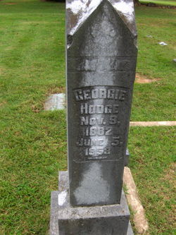
Vera Mae Hodge Moore
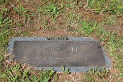
| Birth | : | 21 Feb 1914 Sulphur Springs Township, Rutherford County, North Carolina, USA |
| Death | : | 24 Jan 1984 Forest City, Rutherford County, North Carolina, USA |
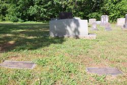
| Burial | : | St. Helen's Churchyard, Edlington, East Lindsey District, England |
| Coordinate | : | 53.2260200, -0.1536400 |
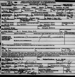
| Description | : | She married Johnny Linwood Maynard in 1935 in Newton, Catawba Co, NC. By 1940, their surname had changed to “Moore”. She is listed as “Vera Moore” on the 1940 census with him in Newton, Catawba Co, NC. She is named as “Vera Hodge Moore” per the informant of her husband’s information for his Rutherford Co, NC, death certificate in Jun 1977. Her surname “Moore” remained so at her death in Rutherford Co, NC, in 1984. |
frequently asked questions (FAQ):
-
Where is Vera Mae Hodge Moore's memorial?
Vera Mae Hodge Moore's memorial is located at: St. Helen's Churchyard, Edlington, East Lindsey District, England.
-
When did Vera Mae Hodge Moore death?
Vera Mae Hodge Moore death on 24 Jan 1984 in Forest City, Rutherford County, North Carolina, USA
-
Where are the coordinates of the Vera Mae Hodge Moore's memorial?
Latitude: 53.2260200
Longitude: -0.1536400
Family Members:
Parent
Spouse
Flowers:
Nearby Cemetories:
1. St. Helen's Churchyard
Edlington, East Lindsey District, England
Coordinate: 53.2260200, -0.1536400
2. St Margarets Churchyard
Langton, East Lindsey District, England
Coordinate: 53.2034275, -0.1490403
3. St. Margaret's Churchyard
Hemingby, East Lindsey District, England
Coordinate: 53.2524100, -0.1469300
4. St. Mary's Churchyard
Horncastle, East Lindsey District, England
Coordinate: 53.2068380, -0.1208750
5. St. Swithin's Churchyard
Baumber, East Lindsey District, England
Coordinate: 53.2530300, -0.1699400
6. Holy Trinity Churchyard
Horncastle, East Lindsey District, England
Coordinate: 53.2077100, -0.1103900
7. Horncastle Cemetery
Horncastle, East Lindsey District, England
Coordinate: 53.1995200, -0.1095800
8. St Peters Churchyard
Low Toynton, East Lindsey District, England
Coordinate: 53.2166100, -0.0914000
9. All Saints Churchyard
Horsington, East Lindsey District, England
Coordinate: 53.2023100, -0.2160600
10. All Saints Churchyard
Great Sturton, East Lindsey District, England
Coordinate: 53.2730000, -0.1789600
11. All Saints Churchyard
Gautby, East Lindsey District, England
Coordinate: 53.2359800, -0.2413800
12. St. Andrew's Churchyard
Fulletby, East Lindsey District, England
Coordinate: 53.2416800, -0.0560500
13. St. Margaret's Churchyard
Bucknall, East Lindsey District, England
Coordinate: 53.2039920, -0.2513250
14. St. Peter and St. Paul's Churchyard
Belchford, East Lindsey District, England
Coordinate: 53.2599830, -0.0616480
15. All Saints Churchyard
Greetham with Somersby, East Lindsey District, England
Coordinate: 53.2185110, -0.0418221
16. St. Benedict's Churchyard
Haltham, East Lindsey District, England
Coordinate: 53.1571600, -0.1378600
17. St. Stephen's Churchyard
Hatton, East Lindsey District, England
Coordinate: 53.2758321, -0.2357834
18. All Saints Churchyard
Goulceby, East Lindsey District, England
Coordinate: 53.2976400, -0.1229300
19. All Saints Old Churchyard
Goulceby, East Lindsey District, England
Coordinate: 53.2976700, -0.1228900
20. St. Peter's Churchyard
Asterby, East Lindsey District, England
Coordinate: 53.2975600, -0.1050000
21. All Saints Churchyard
Hameringham, East Lindsey District, England
Coordinate: 53.1865890, -0.0412020
22. St. Mary's Churchyard
Kirkby on Bain, East Lindsey District, England
Coordinate: 53.1442900, -0.1430300
23. St. Mary's Churchyard
Lusby with Winceby, East Lindsey District, England
Coordinate: 53.1962840, -0.0245500
24. St. Andrew's Churchyard
Ashby Puerorum, East Lindsey District, England
Coordinate: 53.2231670, -0.0123010

