
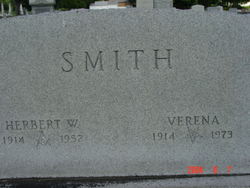
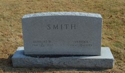
Verena Isabelle Durst Smith
| Birth | : | 3 Sep 1914 Clark County, Ohio, USA |
| Death | : | 1 May 1973 Xenia, Greene County, Ohio, USA |
| Burial | : | Mount Hope Cemetery, Gordon, Sheridan County, USA |
| Coordinate | : | 42.7113991, -102.2241974 |
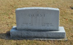
| Description | : | Verena Isabelle Durst Smith, age 58, of the Ohio Masonic Home, died at the Hospitality Home in Xenia, at 8 pm, May 1, 1973. She was the widow of Herbert W Smith, who preceded her in death in 1952. Verena was born Sept. 3, 1914 in Clark County, the daughter of John R Durst & Pearl Bowers. On May 22, 1933, she was married to Herbert Woodrow Smith in Richmond, Indiana. They were parents of two children who survive; daughter, Mrs. Roxie Anne Wallace and son, John W. Smith; and grandparents of five grandchildren. Verena... Read More |
frequently asked questions (FAQ):
-
Where is Verena Isabelle Durst Smith's memorial?
Verena Isabelle Durst Smith's memorial is located at: Mount Hope Cemetery, Gordon, Sheridan County, USA.
-
When did Verena Isabelle Durst Smith death?
Verena Isabelle Durst Smith death on 1 May 1973 in Xenia, Greene County, Ohio, USA
-
Where are the coordinates of the Verena Isabelle Durst Smith's memorial?
Latitude: 42.7113991
Longitude: -102.2241974
Family Members:
Parent

Spouse

Children
Flowers:


Nearby Cemetories:
1. Mount Hope Cemetery
Gordon, Sheridan County, USA
Coordinate: 42.7113991, -102.2241974
2. Gordon Cemetery
Gordon, Sheridan County, USA
Coordinate: 42.7858009, -102.2102966
3. Dane Cemetery
Cherry County, USA
Coordinate: 42.7924300, -102.0824700
4. Fair View Cemetery
Rushville, Sheridan County, USA
Coordinate: 42.7155991, -102.4325027
5. Lavaca Cemetery
Irwin, Cherry County, USA
Coordinate: 42.7332993, -102.0175018
6. Saint Marys Cemetery
Rushville, Sheridan County, USA
Coordinate: 42.7174988, -102.4436035
7. Amity Cemetery
Sheridan County, USA
Coordinate: 42.8036003, -102.4389038
8. Bethel Cemetery
Sheridan County, USA
Coordinate: 42.9011002, -102.3208008
9. Davis Cemetery
Rushville, Sheridan County, USA
Coordinate: 42.5421000, -102.4118800
10. Saint Aloysius Cemetery
Sheridan County, USA
Coordinate: 42.9015500, -102.4025500
11. Preble Cemetery
Sheridan County, USA
Coordinate: 42.6504000, -102.5765000
12. Holly Cemetery
Rushville, Sheridan County, USA
Coordinate: 42.8575120, -102.5370990
13. Novotny Cemetery
Hay Springs, Sheridan County, USA
Coordinate: 42.7742004, -102.5963974
14. Beguin Cemetery
Sheridan County, USA
Coordinate: 42.5107994, -102.4982986
15. Sacred Heart Cemetery
Hay Springs, Sheridan County, USA
Coordinate: 42.5213220, -102.5782690
16. Feather on Head Cemetery
Oglala Lakota County, USA
Coordinate: 43.0311012, -102.1611023
17. Bomar Cemetery
Hay Springs, Sheridan County, USA
Coordinate: 42.8062000, -102.6459600
18. Mari Sandoz Museum
Gordon, Sheridan County, USA
Coordinate: 42.3857010, -102.1575270
19. Abold Family Cemetery
Rushville, Sheridan County, USA
Coordinate: 42.8863500, -102.6158000
20. Wolf Creek Community Cemetery
Oglala Lakota County, USA
Coordinate: 43.0405750, -102.3966490
21. St. Mary's Cemetery
Hay Springs, Sheridan County, USA
Coordinate: 42.6721992, -102.7035980
22. Hay Springs Cemetery
Hay Springs, Sheridan County, USA
Coordinate: 42.6702995, -102.7033005
23. Spotted Bear Family Cemetery
Denby, Oglala Lakota County, USA
Coordinate: 43.0608200, -102.3376600
24. White Clay Cemetery
Rushville, Sheridan County, USA
Coordinate: 42.9732820, -102.5667230