Vernell Lowery Rainwater
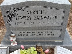
| Birth | : | 7 Sep 1937 Parkers Chapel, Union County, Arkansas, USA |
| Death | : | 2 Sep 2013 El Dorado, Union County, Arkansas, USA |
| Burial | : | Old Parkers Chapel Cemetery, Parkers Chapel, Union County, USA |
| Coordinate | : | 33.1470000, -92.7258300 |
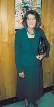
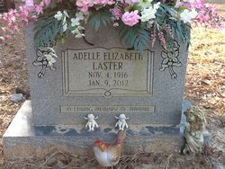
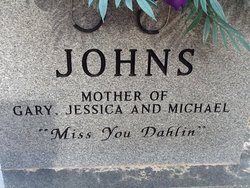
| Description | : | Vernell Rainwater 75 of El Dorado passed away September 2, 2013. She was born to Herman and Adell Lowery September 7, 1937 in El Dorado, Arkansas (Parkers Chapel Community). She was the manager at Chick-A-Dilly #1 for 27 years and retired April 2013. She was kind and generous person. Vernell was a wonderful daughter, mother, sister, grandmother, great-grandmother, aunt, sister-in-law, mother-in-law, and friend. She will always be remembered as a Momma, Nana, Momma Jr. BunBun, Sister, and Vern. Preceding her passing; her father, Herman Lowery; mother, Adell Hill Laster, step-father, James Laster, her sister, Dorothy Johns. brother-in-laws, G.W. Murray and Bill... Read More |
frequently asked questions (FAQ):
-
Where is Vernell Lowery Rainwater's memorial?
Vernell Lowery Rainwater's memorial is located at: Old Parkers Chapel Cemetery, Parkers Chapel, Union County, USA.
-
When did Vernell Lowery Rainwater death?
Vernell Lowery Rainwater death on 2 Sep 2013 in El Dorado, Union County, Arkansas, USA
-
Where are the coordinates of the Vernell Lowery Rainwater's memorial?
Latitude: 33.1470000
Longitude: -92.7258300
Family Members:
Parent
Siblings
Flowers:
Nearby Cemetories:
1. Old Parkers Chapel Cemetery
Parkers Chapel, Union County, USA
Coordinate: 33.1470000, -92.7258300
2. Shady Grove Cemetery
Parkers Chapel, Union County, USA
Coordinate: 33.1350000, -92.7093000
3. Meek-Traylor Cemetery
Parkers Chapel, Union County, USA
Coordinate: 33.1333677, -92.7002846
4. Parkers Chapel Church Cemetery
Parkers Chapel, Union County, USA
Coordinate: 33.1724500, -92.7217700
5. Galilee Cemetery
El Dorado, Union County, USA
Coordinate: 33.1716995, -92.6841965
6. Beulah Grove Cemetery
El Dorado, Union County, USA
Coordinate: 33.1954000, -92.7133000
7. Wesson Cemetery
Wesson, Union County, USA
Coordinate: 33.1074300, -92.7642700
8. Wyatt-Parnell Cemetery
El Dorado, Union County, USA
Coordinate: 33.1958008, -92.7442017
9. Cummings Cemetery
Junction City, Union County, USA
Coordinate: 33.0989000, -92.7037800
10. Rogers Family Cemetery
El Dorado, Union County, USA
Coordinate: 33.2010440, -92.7245660
11. Hammond Cemetery
El Dorado, Union County, USA
Coordinate: 33.1988983, -92.7071991
12. Beulah Grove Wesson Cemetery
Wesson, Union County, USA
Coordinate: 33.1063995, -92.7696991
13. Friendship Cemetery
El Dorado, Union County, USA
Coordinate: 33.1936000, -92.6818000
14. Stamps Cemetery
El Dorado, Union County, USA
Coordinate: 33.1490000, -92.6539000
15. Mount Calvary Cemetery
El Dorado, Union County, USA
Coordinate: 33.1900000, -92.6645000
16. Lott-Burgy Cemetery
El Dorado, Union County, USA
Coordinate: 33.1917000, -92.6649000
17. Saint Marks Cemetery
Union County, USA
Coordinate: 33.1006000, -92.6639000
18. Carroll Cemetery
Wesson, Union County, USA
Coordinate: 33.1724000, -92.8037000
19. Pleasant Hill Cemetery
Wesson, Union County, USA
Coordinate: 33.1025000, -92.7946000
20. Centre Point Cemetery
El Dorado, Union County, USA
Coordinate: 33.2198982, -92.7304993
21. Presbyterian Cemetery
El Dorado, Union County, USA
Coordinate: 33.2085991, -92.6631012
22. Harris Cemetery
El Dorado, Union County, USA
Coordinate: 33.1966600, -92.8031000
23. Smyrna Cemetery
El Dorado, Union County, USA
Coordinate: 33.1143990, -92.6342010
24. Warner Brown Cemetery
El Dorado, Union County, USA
Coordinate: 33.2108002, -92.6614990

