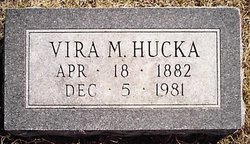
Vira Mabel Clark Hucka
| Birth | : | 18 Apr 1882 Yetter, Calhoun County, Iowa, USA |
| Death | : | 5 Dec 1981 Oskaloosa, Mahaska County, Iowa, USA |
| Burial | : | Immaculate Conception Cemetery, New Hartford, Litchfield County, USA |
| Coordinate | : | 41.8781586, -72.9824982 |
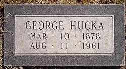
| Description | : | Mrs. Vira Hucka, 99, a former Rockwell City resident, died Saturday morning, December 5, 1981, at Pleasant Park Nursing Home in Oskaloosa. Funeral services were held at 1 p.m. Tuesday at the Morton Funeral Home in Rockwell City with burial in Cottonwood cemetery at Lake City. Mrs. Vira Hucka was born April 18, 1882, on a farm near Yetter, and attended a rural school there. In 1903 she married George Hucka at Yetter and they made their home there. They then moved to a farm near Lake City, and then to a farm near Lytton. When Mr. and Mrs. Hucka... Read More |
frequently asked questions (FAQ):
-
Where is Vira Mabel Clark Hucka's memorial?
Vira Mabel Clark Hucka's memorial is located at: Immaculate Conception Cemetery, New Hartford, Litchfield County, USA.
-
When did Vira Mabel Clark Hucka death?
Vira Mabel Clark Hucka death on 5 Dec 1981 in Oskaloosa, Mahaska County, Iowa, USA
-
Where are the coordinates of the Vira Mabel Clark Hucka's memorial?
Latitude: 41.8781586
Longitude: -72.9824982
Family Members:
Parent
Spouse
Siblings
Flowers:
Nearby Cemetories:
1. Immaculate Conception Cemetery
New Hartford, Litchfield County, USA
Coordinate: 41.8781586, -72.9824982
2. North Village Cemetery
New Hartford, Litchfield County, USA
Coordinate: 41.8789406, -72.9826508
3. Pine Meadow Cemetery
New Hartford, Litchfield County, USA
Coordinate: 41.8760490, -72.9681473
4. Saint John's Episcopal Church Memorial Garden
Pine Meadow, Litchfield County, USA
Coordinate: 41.8745850, -72.9681730
5. Pine Grove Cemetery
New Hartford, Litchfield County, USA
Coordinate: 41.8782997, -72.9621964
6. Town Hill Cemetery
New Hartford, Litchfield County, USA
Coordinate: 41.8521805, -72.9964066
7. Riverside Cemetery
Barkhamsted, Litchfield County, USA
Coordinate: 41.9096985, -72.9880981
8. Barkhamsted Center Cemetery
Barkhamsted, Litchfield County, USA
Coordinate: 41.9235992, -72.9655991
9. Old Nepaug Cemetery
Nepaug, Litchfield County, USA
Coordinate: 41.8300600, -72.9960200
10. New Nepaug Cemetery
New Hartford, Litchfield County, USA
Coordinate: 41.8290800, -72.9968300
11. Canton Center Cemetery
Canton, Hartford County, USA
Coordinate: 41.8550960, -72.9159270
12. Bakersville Cemetery
Bakersville, Litchfield County, USA
Coordinate: 41.8324699, -73.0293732
13. Dyer Cemetery
Canton, Hartford County, USA
Coordinate: 41.8338699, -72.9222260
14. New Saint Joseph Cemetery
Winsted, Litchfield County, USA
Coordinate: 41.9136009, -73.0547028
15. North Canton Cemetery
North Canton, Hartford County, USA
Coordinate: 41.8899994, -72.8938980
16. Forest View Cemetery
Winsted, Litchfield County, USA
Coordinate: 41.9171982, -73.0610962
17. Southwest Cemetery
Collinsville, Hartford County, USA
Coordinate: 41.8227997, -72.9227982
18. North Canton United Methodist Memorial Garden
Canton, Hartford County, USA
Coordinate: 41.8991030, -72.8913320
19. Trinity Episcopal Church Memorial Cemetery
Canton, Hartford County, USA
Coordinate: 41.8216060, -72.9234460
20. Winsted Old Burying Ground
Winsted, Litchfield County, USA
Coordinate: 41.9226700, -73.0607400
21. John Darbe Cemetery
Winsted, Litchfield County, USA
Coordinate: 41.9297170, -73.0561320
22. Calvary Cemetery
Canton, Hartford County, USA
Coordinate: 41.8153000, -72.9242020
23. Saint Josephs Old Catholic Cemetery
Winsted, Litchfield County, USA
Coordinate: 41.9253006, -73.0635529
24. Burrville Cemetery
Torrington, Litchfield County, USA
Coordinate: 41.8650360, -73.0848236

