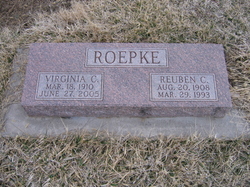
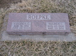
Virginia Clarinda Isaacson Roepke
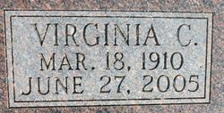
| Birth | : | 18 Mar 1910 Riley County, Kansas, USA |
| Death | : | 27 Jun 2005 Linn, Washington County, Kansas, USA |
| Burial | : | Center Cemetery, New Milford, Litchfield County, USA |
| Coordinate | : | 41.5817170, -73.4085040 |
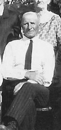
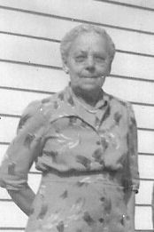
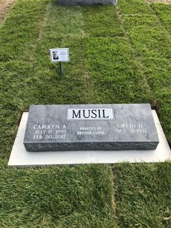
| Description | : | Virginia was born in the Rose Hill community, Riley County, to William and Hulda (Nelson) Isaacson. Virginia was united in marriage to Richard Musil , November 27, 1929. To this union was born one son, Orlin Dee. Richard passed away October 14, 1933. On March 11, 1936, she married Reuben C. Roepke at Manhattan, KS. She and Reuben farmed for 36 years in the Cottage Hill community before retiring and moving to Waterville, KS. She was a homemaker. Survivors include a son, Orlin and his wife Carol Musil; a daughter, Vicky and her husband John Nightingale; and... Read More |
frequently asked questions (FAQ):
-
Where is Virginia Clarinda Isaacson Roepke's memorial?
Virginia Clarinda Isaacson Roepke's memorial is located at: Center Cemetery, New Milford, Litchfield County, USA.
-
When did Virginia Clarinda Isaacson Roepke death?
Virginia Clarinda Isaacson Roepke death on 27 Jun 2005 in Linn, Washington County, Kansas, USA
-
Where are the coordinates of the Virginia Clarinda Isaacson Roepke's memorial?
Latitude: 41.5817170
Longitude: -73.4085040
Family Members:
Parent
Spouse
Siblings
Children
Flowers:
Nearby Cemetories:
1. Center Cemetery
New Milford, Litchfield County, USA
Coordinate: 41.5817170, -73.4085040
2. Saint Johns Episcopal Church Memorial Garden
New Milford, Litchfield County, USA
Coordinate: 41.5791230, -73.4106480
3. Saint Francis Xavier Cemetery
New Milford, Litchfield County, USA
Coordinate: 41.5715485, -73.4218826
4. Pickett District Cemetery
New Milford, Litchfield County, USA
Coordinate: 41.5672384, -73.4140704
5. Holy Cross Cemetery
New Milford, Litchfield County, USA
Coordinate: 41.5475006, -73.4169006
6. Quaker Cemetery
New Milford, Litchfield County, USA
Coordinate: 41.5374985, -73.4235992
7. Center Cemetery
Bridgewater, Litchfield County, USA
Coordinate: 41.5385400, -73.3677300
8. Long Mountain Cemetery
New Milford, Litchfield County, USA
Coordinate: 41.6338997, -73.4586029
9. Center Cemetery
Sherman, Fairfield County, USA
Coordinate: 41.5787582, -73.4965744
10. Northville Cemetery
New Milford, Litchfield County, USA
Coordinate: 41.6464005, -73.3846970
11. North Cemetery
Sherman, Fairfield County, USA
Coordinate: 41.5980000, -73.4957000
12. North Cemetery
Roxbury, Litchfield County, USA
Coordinate: 41.5659485, -73.3193207
13. Saint Patrick Cemetery
Roxbury, Litchfield County, USA
Coordinate: 41.5645676, -73.3193207
14. West Meetinghouse Cemetery
New Milford, Litchfield County, USA
Coordinate: 41.6497002, -73.4375000
15. Great Oak Cemetery
Roxbury, Litchfield County, USA
Coordinate: 41.5649000, -73.3142470
16. South Cemetery
Bridgewater, Litchfield County, USA
Coordinate: 41.5161018, -73.3664017
17. Roxbury Center Cemetery
Roxbury, Litchfield County, USA
Coordinate: 41.5624886, -73.3115082
18. Gaylordsville Cemetery
New Milford, Litchfield County, USA
Coordinate: 41.6319008, -73.4841995
19. Allen Cemetery
Sherman, Fairfield County, USA
Coordinate: 41.6117500, -73.5028300
20. Coburn Cemetery
Sherman, Fairfield County, USA
Coordinate: 41.5435982, -73.4974976
21. Briggs Cemetery
Sherman, Fairfield County, USA
Coordinate: 41.5649681, -73.5090942
22. Christ Church Columbarium
Roxbury, Litchfield County, USA
Coordinate: 41.5566400, -73.3095120
23. Seth Warner Gravesite
Roxbury, Litchfield County, USA
Coordinate: 41.5567970, -73.3089600
24. Gallow Hills Cemetery
New Milford, Litchfield County, USA
Coordinate: 41.5030823, -73.4178314

