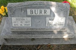
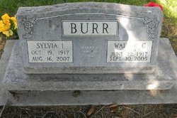
Walter “Dutch” Burr
| Birth | : | 22 Jun 1917 Turin, Monona County, Iowa, USA |
| Death | : | 30 Sep 2005 Cozad, Dawson County, Nebraska, USA |
| Burial | : | Wenonah Cemetery, Wenonah, Gloucester County, USA |
| Coordinate | : | 39.7893982, -75.1622009 |
| Plot | : | DIV. C, BLOCK 3, LOT 3, SPACE 3 |
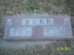
| Description | : | Son of Christian and Frieda (Beth) Burr. Moved with his family to the Eddyville area in 1920; graduated from Eddyville High School in 1937 Grew up in the farming business, farmed until 1970; started working for Co-op and later became manager of the Eddyville Co-op. Married: Nov. 12, 1939, to Erma McClintick in Eddyville. She died Feb. 18, 1953. Married: Sept. 10, 1966, to Sylvia Reier Keyser in Eddyville. Activities: was a neat and well-organized man; enjoyed hunting, fishing and horses; enjoyed spending time with children, even driving a school bus for many years, but he especially loved his grandchildren; also enjoyed gardening and dancing;... Read More |
frequently asked questions (FAQ):
-
Where is Walter “Dutch” Burr's memorial?
Walter “Dutch” Burr's memorial is located at: Wenonah Cemetery, Wenonah, Gloucester County, USA.
-
When did Walter “Dutch” Burr death?
Walter “Dutch” Burr death on 30 Sep 2005 in Cozad, Dawson County, Nebraska, USA
-
Where are the coordinates of the Walter “Dutch” Burr's memorial?
Latitude: 39.7893982
Longitude: -75.1622009
Family Members:
Parent
Spouse
Siblings
Children
Flowers:
Nearby Cemetories:
1. Wenonah Cemetery
Wenonah, Gloucester County, USA
Coordinate: 39.7893982, -75.1622009
2. Mantua Methodist Cemetery
Mantua, Gloucester County, USA
Coordinate: 39.7883160, -75.1663420
3. Mantua Union Graveyard
Mantua, Gloucester County, USA
Coordinate: 39.7902460, -75.1707610
4. Holy Trinity Memorial Garden
Wenonah, Gloucester County, USA
Coordinate: 39.7922200, -75.1514700
5. Jesse Chew Cemetery
Gloucester County, USA
Coordinate: 39.7736800, -75.1498250
6. Odd Fellows Cemetery
Jericho, Gloucester County, USA
Coordinate: 39.8077300, -75.1426600
7. Driver Cemetery
Barnsboro, Gloucester County, USA
Coordinate: 39.7631000, -75.1554900
8. Gates of Heaven Cemetery
Mount Royal, Gloucester County, USA
Coordinate: 39.7961006, -75.1967010
9. Mount Zion Methodist Church Cemetery
Barnsboro, Gloucester County, USA
Coordinate: 39.7547540, -75.1629530
10. Woodbury Memorial Park
West Deptford, Gloucester County, USA
Coordinate: 39.8266983, -75.1742020
11. Green Cemetery
Deptford, Gloucester County, USA
Coordinate: 39.8269005, -75.1430969
12. Lippincott Cemetery
Clarksboro, Gloucester County, USA
Coordinate: 39.8032460, -75.2138660
13. Alms House Cemetery
Gloucester County, USA
Coordinate: 39.8029980, -75.2142200
14. Saint Peters Cemetery
Mount Royal, Gloucester County, USA
Coordinate: 39.8090130, -75.2130090
15. Zion United Methodist Church Cemetery
Clarksboro, Gloucester County, USA
Coordinate: 39.8030891, -75.2191696
16. Brewer Cemetery
Deptford Township, Gloucester County, USA
Coordinate: 39.8249700, -75.1213100
17. Eglington Cemetery
Clarksboro, Gloucester County, USA
Coordinate: 39.7980690, -75.2257462
18. Bethel Methodist Church Cemetery
Hurffville, Gloucester County, USA
Coordinate: 39.7571983, -75.1110992
19. Wood Family Burial Ground
Woodbury, Gloucester County, USA
Coordinate: 39.8408240, -75.1508400
20. Friends Burial Ground
Woodbury, Gloucester County, USA
Coordinate: 39.8408600, -75.1508100
21. Bunker Hill Presbyterian Church Cemetery
Sewell, Gloucester County, USA
Coordinate: 39.7767514, -75.0931293
22. Old Deptford Strangers Burial Ground
Deptford, Gloucester County, USA
Coordinate: 39.8301090, -75.1133550
23. Cattell Burial Ground
Deptford, Gloucester County, USA
Coordinate: 39.8306465, -75.1140594
24. Hillcrest Memorial Park
Hurffville, Gloucester County, USA
Coordinate: 39.7491989, -75.1110992

