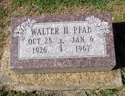
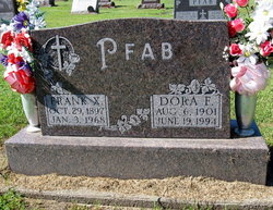
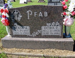
Walter Henry Pfab
| Birth | : | 28 Oct 1926 Bernard, Dubuque County, Iowa, USA |
| Death | : | 6 Jan 1967 East Dubuque, Jo Daviess County, Illinois, USA |
| Burial | : | St. Michael's Churchyard, Skelbrooke, Metropolitan Borough of Doncaster, England |
| Coordinate | : | 53.6029400, -1.2293000 |
| Description | : | Telegraph Herald Tuesday Sun. Jan. 8, 1967 Walter H. Pfab Services will be held at 11 a.m. Monday at Sacred Heart Church, Fillmore, Ia., for Walter H. Pfab, 40, of rural Bernard, Ia. Burial will be in Sacred Heart Cemetery, Fillmore. Mr. Pfab was killed early Friday when the car he was in was struck by a truck on Highway 20 just east of East Dubuque. Friends may call after 2 p.m. Sunday at the Hoffmann Mortuary. Mr. Pfab... Read More |
frequently asked questions (FAQ):
-
Where is Walter Henry Pfab's memorial?
Walter Henry Pfab's memorial is located at: St. Michael's Churchyard, Skelbrooke, Metropolitan Borough of Doncaster, England.
-
When did Walter Henry Pfab death?
Walter Henry Pfab death on 6 Jan 1967 in East Dubuque, Jo Daviess County, Illinois, USA
-
Where are the coordinates of the Walter Henry Pfab's memorial?
Latitude: 53.6029400
Longitude: -1.2293000
Family Members:
Parent
Siblings
Children
Flowers:
Nearby Cemetories:
1. St. Michael's Churchyard
Skelbrooke, Metropolitan Borough of Doncaster, England
Coordinate: 53.6029400, -1.2293000
2. Hampole Priory
Hampole, Metropolitan Borough of Doncaster, England
Coordinate: 53.5876700, -1.2373620
3. St. Helen's Churchyard
Burghwallis, Metropolitan Borough of Doncaster, England
Coordinate: 53.6020620, -1.1899730
4. St. Margaret's Churchyard
North Elmsall, Metropolitan Borough of Wakefield, England
Coordinate: 53.6091690, -1.2810510
5. Redhouse Lane Cemetery
Adwick le Street, Metropolitan Borough of Doncaster, England
Coordinate: 53.5762650, -1.1989510
6. Red House Cemetery
Brodsworth, Metropolitan Borough of Doncaster, England
Coordinate: 53.5761770, -1.1990350
7. St. Mary the Virgin Churchyard
South Elmsall, Metropolitan Borough of Wakefield, England
Coordinate: 53.5934950, -1.2861930
8. St. Mary Magdalene Churchyard
Campsall, Metropolitan Borough of Doncaster, England
Coordinate: 53.6203680, -1.1779620
9. Campsall New Cemetery
Campsall, Metropolitan Borough of Doncaster, England
Coordinate: 53.6239500, -1.1804250
10. Campsall Old Cemetery
Campsall, Metropolitan Borough of Doncaster, England
Coordinate: 53.6241000, -1.1801000
11. All Saints Churchyard
Owston, Metropolitan Borough of Doncaster, England
Coordinate: 53.5942161, -1.1691935
12. St. Laurence Churchyard
Adwick le Street, Metropolitan Borough of Doncaster, England
Coordinate: 53.5710200, -1.1846150
13. St Peter Churchyard
Kirk Smeaton, Selby District, England
Coordinate: 53.6436580, -1.2148560
14. Askern Cemetery
Askern, Metropolitan Borough of Doncaster, England
Coordinate: 53.6187830, -1.1637670
15. Windmill Balk Lane Cemetery
Adwick le Street, Metropolitan Borough of Doncaster, England
Coordinate: 53.5662610, -1.1913080
16. All Saints Churchyard
Hooton Pagnell, Metropolitan Borough of Doncaster, England
Coordinate: 53.5660840, -1.2683133
17. Saint Michael and All Angels Churchyard
Brodsworth, Metropolitan Borough of Doncaster, England
Coordinate: 53.5591500, -1.2365300
18. Moorthorpe Cemetery
Moorthorpe, Metropolitan Borough of Wakefield, England
Coordinate: 53.5938700, -1.3025110
19. Hooton Pagnell New Churchyard
Hooton Pagnell, Metropolitan Borough of Doncaster, England
Coordinate: 53.5625600, -1.2701200
20. St. Peter's Churchyard
Askern, Metropolitan Borough of Doncaster, England
Coordinate: 53.6169240, -1.1524250
21. St. Mary the Virgin Churchyard
Badsworth, Metropolitan Borough of Wakefield, England
Coordinate: 53.6291680, -1.3011070
22. St John the Evangelist Churchyard
Wentbridge, Metropolitan Borough of Wakefield, England
Coordinate: 53.6507600, -1.2591930
23. Carr Lane Cemetery
South Kirkby, Metropolitan Borough of Wakefield, England
Coordinate: 53.5993460, -1.3153480
24. All Saints Churchyard
South Kirkby, Metropolitan Borough of Wakefield, England
Coordinate: 53.5941350, -1.3170410


