
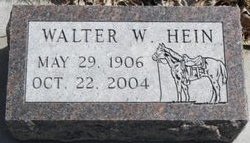
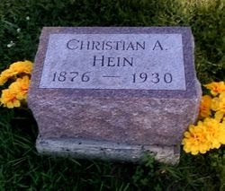
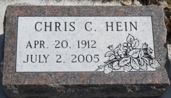
Walter Wilhelm Heinrick “Walt” Hein
| Birth | : | 29 May 1906 Artesian, Sanborn County, South Dakota, USA |
| Death | : | 22 Oct 2004 Forsyth, Rosebud County, Montana, USA |
| Burial | : | Forsyth Cemetery, Forsyth, Rosebud County, USA |
| Coordinate | : | 46.2689018, -106.6528015 |
| Description | : | Walter Hein, age 98, of Forsyth, passed away on October 22, 2004 at the Rosebud Health Care Center in Forsyth. Walt was born the son of Christian and Augusta (Kipplin) Hein on May 29, 1906 in Artesion, South Dakota. In 1912, at the age of 6, arriving on an immigrant train, with their farm machinery and livestock the family came out from South Dakota. Walt settled with his family on their homestead, north of Forsyth. Walt grew up and was educated in the Forsyth area. Through the 8th grade, he attended Mud Springs School, north of Forsyth, where he had... Read More |
frequently asked questions (FAQ):
-
Where is Walter Wilhelm Heinrick “Walt” Hein's memorial?
Walter Wilhelm Heinrick “Walt” Hein's memorial is located at: Forsyth Cemetery, Forsyth, Rosebud County, USA.
-
When did Walter Wilhelm Heinrick “Walt” Hein death?
Walter Wilhelm Heinrick “Walt” Hein death on 22 Oct 2004 in Forsyth, Rosebud County, Montana, USA
-
Where are the coordinates of the Walter Wilhelm Heinrick “Walt” Hein's memorial?
Latitude: 46.2689018
Longitude: -106.6528015
Family Members:
Parent
Spouse
Siblings

Children
Flowers:


Nearby Cemetories:
1. Forsyth Cemetery
Forsyth, Rosebud County, USA
Coordinate: 46.2689018, -106.6528015
2. Rosebud Cemetery
Rosebud, Rosebud County, USA
Coordinate: 46.2689018, -106.4381027
3. Howard Cemetery
Rosebud County, USA
Coordinate: 46.2621994, -106.9222031
4. Hathaway Cemetery
Rosebud County, USA
Coordinate: 46.2616997, -106.2185974
5. Colstrip Cemetery
Colstrip, Rosebud County, USA
Coordinate: 45.9096985, -106.6194000
6. Memorial Vale Cemetery
Hysham, Treasure County, USA
Coordinate: 46.2552986, -107.2307968
7. Bean Cemetery
Rosebud County, USA
Coordinate: 45.8535995, -106.4011002
8. Brown Cemetery
Colstrip, Rosebud County, USA
Coordinate: 45.8321991, -106.4180984
9. Lee Cemetery
Rosebud County, USA
Coordinate: 45.7792015, -106.5413971
10. Rancher Cemetery
Myers, Treasure County, USA
Coordinate: 46.2580986, -107.4197006
11. Fort Keogh Cemetery
Custer County, USA
Coordinate: 46.3800011, -105.8874969
12. Vanstel Cemetery
Rosebud County, USA
Coordinate: 46.7872009, -106.8942032
13. Calvary Cemetery
Miles City, Custer County, USA
Coordinate: 46.3816986, -105.8249969
14. Eastern Montana State Veterans Cemetery
Miles City, Custer County, USA
Coordinate: 46.3807564, -105.8246536
15. Old Calvary Cemetery
Miles City, Custer County, USA
Coordinate: 46.3807600, -105.8246500
16. Custer County Cemetery
Miles City, Custer County, USA
Coordinate: 46.3891983, -105.8264008
17. Pine Hills School Cemetery
Miles City, Custer County, USA
Coordinate: 46.4077988, -105.8167038
18. Rock Springs Cemetery
Rock Springs, Rosebud County, USA
Coordinate: 46.7847800, -106.1411500
19. Pine Crest Cemetery
Custer County, USA
Coordinate: 46.4564018, -105.7789001
20. Junction City Cemetery
Yellowstone County, USA
Coordinate: 46.1437320, -107.5493300
21. Lame Deer Cemetery
Lame Deer, Rosebud County, USA
Coordinate: 45.6264000, -106.6619034
22. Custer Cemetery
Custer, Yellowstone County, USA
Coordinate: 46.1270690, -107.5700030
23. Muddy Creek Cemetery
Muddy, Big Horn County, USA
Coordinate: 45.5741997, -106.7406006
24. Saint Labre Cemetery
Ashland, Rosebud County, USA
Coordinate: 45.6070930, -106.2836910