| Birth | : | 6 Dec 1908 Mansfield, Douglas County, Washington, USA |
| Death | : | 26 Oct 2000 Wenatchee, Chelan County, Washington, USA |
| Burial | : | Forest Lawn Cemetery, Orangeville, Dufferin County, Canada |
| Coordinate | : | 43.9349430, -80.0981640 |
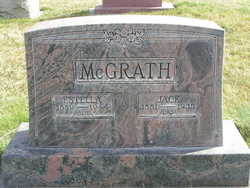
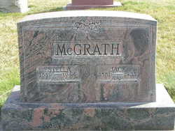
| Description | : | Note: Incorrect birth year on headstone. Records searched; birth records, SSDI and obituary state 1908. Pioneer North Central Washington resident, W. Verdelle "Mac" McGrath, died Thursday, Oct. 26, 2000, at Central Washington Hospital. Grandson of territorial pioneers, Michael and Anna Weir, Verdelle was born Dec. 6, 1908, at the McGrath ranch on Foster Creek near Mansfield. He was the eldest child of Jack and Estella Weir McGrath of Mansfield. As a youngster, Verdelle lived with his grandparents so he could attend the little red brick rural school north of Waterville. As his father was a popular musician and played at local dances, Verdelle... Read More |
frequently asked questions (FAQ):
-
Where is Wilbur Verdelle “Mac” McGrath's memorial?
Wilbur Verdelle “Mac” McGrath's memorial is located at: Forest Lawn Cemetery, Orangeville, Dufferin County, Canada.
-
When did Wilbur Verdelle “Mac” McGrath death?
Wilbur Verdelle “Mac” McGrath death on 26 Oct 2000 in Wenatchee, Chelan County, Washington, USA
-
Where are the coordinates of the Wilbur Verdelle “Mac” McGrath's memorial?
Latitude: 43.9349430
Longitude: -80.0981640
Family Members:
Parent
Spouse
Siblings
Children
Flowers:
Nearby Cemetories:
1. Forest Lawn Cemetery
Orangeville, Dufferin County, Canada
Coordinate: 43.9349430, -80.0981640
2. Mono College Presbyterian Cemetery
Orangeville, Dufferin County, Canada
Coordinate: 43.9494200, -80.1049200
3. Hughson Family Cemetery
Laurel, Dufferin County, Canada
Coordinate: 43.9281000, -80.1348000
4. Zion Wesleyan Methodist Cemetery
Mono, Dufferin County, Canada
Coordinate: 43.9548170, -80.1244380
5. Greenwood Cemetery
Orangeville, Dufferin County, Canada
Coordinate: 43.9121500, -80.1323500
6. Providence Methodist Cemetery
East Garafraxa, Dufferin County, Canada
Coordinate: 43.8900590, -80.1656360
7. Alton Cemetery
Alton, Peel Regional Municipality, Canada
Coordinate: 43.8581581, -80.0661240
8. Saint George's Cemetery
Peel Regional Municipality, Canada
Coordinate: 43.8698226, -80.0325520
9. Laurel Cemetery
Laurel, Dufferin County, Canada
Coordinate: 43.9579300, -80.2106700
10. Saint Francis Roman Catholic Cemetery
Mono, Dufferin County, Canada
Coordinate: 43.9504493, -79.9726131
11. Mono East Cemetery
Mono, Dufferin County, Canada
Coordinate: 43.9743990, -79.9778650
12. Burns Cemetery
Mono, Dufferin County, Canada
Coordinate: 44.0313290, -80.0733000
13. Caledon United Church Cemetery
Caledon, Peel Regional Municipality, Canada
Coordinate: 43.8648360, -80.0013450
14. Saint Johns Cemetery
Mono, Dufferin County, Canada
Coordinate: 43.9875630, -79.9789050
15. Relessey Cemetery
Relessey, Dufferin County, Canada
Coordinate: 44.0479400, -80.0269170
16. Granger Cemetery
Granger, Dufferin County, Canada
Coordinate: 44.0608800, -80.0944500
17. Waldemar Cemetery
Dufferin County, Canada
Coordinate: 43.8861500, -80.2820000
18. Huxley Cemetery
Hillsburgh, Wellington County, Canada
Coordinate: 43.7999660, -80.1600710
19. Adjala United Church Cemetery
Adjala, Simcoe County, Canada
Coordinate: 43.9883610, -79.9096160
20. Wesley Wesleyan Methodist Cemetery
Mono, Dufferin County, Canada
Coordinate: 44.0543854, -79.9774115
21. Hillsburgh Pioneer Cemetery
Hillsburgh, Wellington County, Canada
Coordinate: 43.7870610, -80.1400340
22. Bethel Presbyterian
East Garafraxa, Dufferin County, Canada
Coordinate: 43.8192000, -80.2348000
23. Price's Corners Cemetery
Prices Corner, Dufferin County, Canada
Coordinate: 43.8186570, -80.2351690
24. Saint Cornelius Roman Catholic Cemetery
Caledon, Peel Regional Municipality, Canada
Coordinate: 43.8354300, -79.9371900


