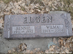
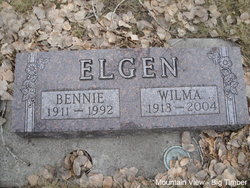
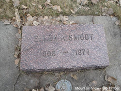
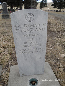
Wilhelmina “Wilma” Steensland Elgen
| Birth | : | 23 May 1913 Big Timber, Sweet Grass County, Montana, USA |
| Death | : | 3 Jan 2004 Big Timber, Sweet Grass County, Montana, USA |
| Burial | : | Rockland Cemetery, Belpre, Washington County, USA |
| Coordinate | : | 39.2813988, -81.6200027 |
| Plot | : | Section 6, Block 9, Lot 2, Grave 8 |
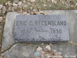
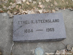
| Description | : | Wilma Elgen of Big Timber passed away Saturday, January 3, 2004 of natural causes at the Pioneer Medical Center in Big Timber. She was born May 23, 1913 a daughter of Eric and Ethel (Keith) Steensland. She graduated from the Sweet Grass County High School in 1932. Wilma married Bennie Elgen on October 26, 1936 in Livingston, Montana. Wilma worked for the County Superintendent of Schools for 22 years, retiring in 1973. But for three years spent on the West Coast during World War II, she spent her entire life in Big Timber. Wilma was preceded in death by her husband of 56... Read More |
frequently asked questions (FAQ):
-
Where is Wilhelmina “Wilma” Steensland Elgen's memorial?
Wilhelmina “Wilma” Steensland Elgen's memorial is located at: Rockland Cemetery, Belpre, Washington County, USA.
-
When did Wilhelmina “Wilma” Steensland Elgen death?
Wilhelmina “Wilma” Steensland Elgen death on 3 Jan 2004 in Big Timber, Sweet Grass County, Montana, USA
-
Where are the coordinates of the Wilhelmina “Wilma” Steensland Elgen's memorial?
Latitude: 39.2813988
Longitude: -81.6200027
Family Members:
Parent
Spouse
Siblings
Flowers:
Nearby Cemetories:
1. Rockland Cemetery
Belpre, Washington County, USA
Coordinate: 39.2813988, -81.6200027
2. Cedarville Cemetery
Washington County, USA
Coordinate: 39.2769012, -81.6081009
3. Blennerhassett Family Burial Grounds
Blennerhassett Island View Addition, Wood County, USA
Coordinate: 39.2716217, -81.6009064
4. River Hill Cemetery
Blennerhassett, Wood County, USA
Coordinate: 39.2636300, -81.6094400
5. Maddox Cemetery
Blennerhassett, Wood County, USA
Coordinate: 39.2608170, -81.6126500
6. Edelen Cemetery
Wood County, USA
Coordinate: 39.2714005, -81.6560974
7. Bethel Baptist Church Cemetery
Parkersburg, Wood County, USA
Coordinate: 39.2511700, -81.6239900
8. Corner Cemetery
Corner, Washington County, USA
Coordinate: 39.3022003, -81.6622009
9. Sunset Memory Gardens
Parkersburg, Wood County, USA
Coordinate: 39.2496986, -81.5911026
10. Tracewell Cemetery
Parkersburg, Wood County, USA
Coordinate: 39.2498000, -81.5870000
11. Posey Cemetery
Lubeck, Wood County, USA
Coordinate: 39.2437860, -81.5980020
12. Old Pest-House Cemetery
Parkersburg, Wood County, USA
Coordinate: 39.2581200, -81.5713960
13. Fairview Memory Garden
Dunham, Washington County, USA
Coordinate: 39.3103943, -81.6649399
14. Reed-Fairview Memory Gardens
Belpre Township, Washington County, USA
Coordinate: 39.3105010, -81.6653280
15. Lubeck Cemetery
Lubeck, Wood County, USA
Coordinate: 39.2368400, -81.6337400
16. Trinity Episcopal Church Columbarium
Parkersburg, Wood County, USA
Coordinate: 39.2665240, -81.5614570
17. Barnes Cemetery
Wood County, USA
Coordinate: 39.2500000, -81.6703033
18. Evergreen Memorial Gardens
Dunham, Washington County, USA
Coordinate: 39.3180970, -81.6645330
19. Riverview Cemetery
Parkersburg, Wood County, USA
Coordinate: 39.2735020, -81.5543890
20. DeSales Heights Convent
Parkersburg, Wood County, USA
Coordinate: 39.2763700, -81.5535050
21. Holliday Cemetery
Parkersburg, Wood County, USA
Coordinate: 39.2619019, -81.5560989
22. Saint Marys Cemetery
Little Hocking, Washington County, USA
Coordinate: 39.2731018, -81.6889038
23. Parkersburg Memorial Gardens
Parkersburg, Wood County, USA
Coordinate: 39.2798310, -81.5491430
24. Hollister Cemetery
Dunham, Washington County, USA
Coordinate: 39.3368700, -81.6179360

